Old Maps of Cabell County, West Virginia for Metal Detecting
Plan your next treasure hunt with 123 historic maps of Cabell County. Find old homesites, ghost towns, trails, and gathering spots that may be lost to time — perfect for identifying promising metal detecting locations.
- Locate forgotten sites: Uncover places like long-lost settlements, abandoned rail lines, or gathering spots.
- Plan better hunts: Use map overlays combined with LiDAR or satellite views to narrow in on historically rich areas.
- Made for detectorists: Thousands of hobbyists use these maps to discover relics, coins, and hidden history.
Use these historic maps to boost your research and find new opportunities beneath the surface of Cabell County.
Cabell County, WV maps
(123)- 1892 Map of Huntington, 1895 Print
 1892 Huntington1895 Print · USGSWest Virginia and Ohio meet along the river in the late nineteenth century, showing the rail-fueled growth of Huntington and Wayne. Local historians can trace the paths of the Chesapeake and Ohio Railroad past Barboursville and find early landmarks like Blue Sulphur Sp's and Davis Mill.
 - 1898 Map of Huntington
 1898 Huntington1898 Print · USGSNear the turn of the century, the Ohio River valley was transforming through the expansion of the Chesapeake and Ohio RR. Modern researchers can trace early nineteenth-century settlements from the bustling streets of Huntington to the inland hubs of Hamlin and Barboursville.3 unique versions available
 - 1901 Map of Guyandot, 1953 Print
 1901 Guyandot1953 Print · USGSThe Ohio River valley at the start of the twentieth century shows a bustling corridor of industry and river commerce. Genealogists and historians can trace the early footprints of Huntington and Ceredo alongside early rail routes like the Baltimore and Ohio RR.
 - 1901 Map of Ceredo, 1953 Print
 1901 Ceredo1953 Print · USGSThe tri-state convergence of West Virginia, Ohio, and Kentucky comes alive in this early 20th-century survey of the Ohio River valley. Genealogists and rail historians can trace the vital transport networks of Kenova and Ceredo, alongside family-named landmarks like Walker Br and Rice Run.2 unique versions available
 - 1902 Map of Guyandot
 1902 Guyandot1902 Print · USGSThe industrial hub of Huntington and the river town of Guyandot sit at the center of this early century border survey. Genealogists can trace family names and small settlements along Twelvepole Creek and Russell Creek, including Lavalette, Shoals, and Dickson.4 unique versions available
 - 1902 Map of Milton
 1902 Milton1902 Print · USGSTeays Valley and the western Virginia hill country are shown here at the turn of the century, as the railroad era transformed the region's commerce. Genealogists can trace early homesteads and landmarks like Howell Mill, Salt Rock, and the Ben Johnson Ford.3 unique versions available
 - 1902 Map of Midkiff, 1925 Print
 1902 Midkiff1925 Print · USGSLincoln and Cabell Counties at the turn of the century show a region transitioning through the arrival of the railroad and the growth of river-valley commerce. Family historians can trace early property sites and communities like Milton, Hamlin, and the historic Blue Sulphur Springs along the Mud River corridor.
 - 1903 Map of Kenova
 1903 Kenova1903 Print · USGSThe tri-state river junction at Ashland and Kenova was a bustling industrial hub after the turn of the century. Trace early rail lines and mining settlements like Coalton and Boghead, or locate family landmarks along the Little Sandy River and Means Tunnel.5 unique versions available
 - 1904 Map of Kenova
 1904 Kenova1904 Print · USGSThe tri-state confluence of the Ohio River and Big Sandy River hums with early industrial activity at the start of the century. Genealogists can trace rail-side settlements and remote homesteads along Blaine Creek and near Mt Savage or Webbville.
 - 1906 Map of Athalia, 1956 Print
 1906 Athalia1956 Print · USGSLawrence and Gallia counties in the early 1900s are captured here as a landscape of river ferries and ridge-top farm communities. You can trace early post offices at Willowwood, follow the Baltimore and Ohio RR, or locate old river crossings like the Crown City Ferry.
 - 1906 Map of Glenwood, 1958 Print
 1906 Glenwood1958 Print · USGSThe Ohio River valley was a bustling corridor of steam and rail at the start of the 1900s, anchoring the border between Mason County and Ohio. Researchers can trace riverside settlements like Mercers Bottom, find vanished post offices such as Thivener PO, and follow the Baltimore and Ohio RR through Apple Grove.
 - 1907 Map of Midkiff, 1964 Print
 1907 Midkiff1964 Print · USGSThe Guyandotte River valley is captured here in the early twentieth century, showing a network of small settlements and rail lines. Genealogists can trace family roots through labels like Laverne PO Brown City, Griffithsville, and Ranger.
 - 1908 Map of Athalia
 1908 Athalia1908 Print · USGSThe Ohio River borderlands in the early twentieth century were a network of ferry crossings and small river towns. Genealogists can trace family names and farmsteads near Athalia, Crown City, and the Baltimore and Ohio RR corridor.3 unique versions available
 - 1908 Map of Glenwood
 1908 Glenwood1908 Print · USGSThe Ohio River valley at the turn of the century shows a landscape of riverfront rail towns and high ridges before modern development. Genealogists can trace early post offices like Yellowtown Thivener PO and settlements at Mercers Bottom or Ben Lomond.3 unique versions available
 - 1909 Map of Wayne
 1909 Wayne1909 Print · USGSWayne County is shown in the first decade of the century, when the rail-and-river network dictated the rhythm of local life. Researchers can trace family roots through numerous post offices and rural settlements like Sidney PO, East Lynn, and Genoa along the Twelvepole Creek.2 unique versions available
 - 1909 Map of Midkiff
 1909 Midkiff1909 Print · USGSLincoln County at the turn of the century is defined by the winding Guyandot River and its accompanying rail line. Genealogists can trace early homesteads and post offices in communities like Griffithsville, Luzerne PO (Brown City), and Spurlockville.3 unique versions available
 - 1913 Map of Ceredo
 1913 Ceredo1913 Print · USGSThe confluence of the Ohio and Big Sandy rivers comes alive in this pre-war survey of the West Virginia-Ohio borderlands. Genealogists and rail historians can trace the early footprints of Kenova, Ceredo, and the winding path of Twelvepole Creek.4 unique versions available
 - 1931 Map of Wayne, 1956 Print
 1931 Wayne1956 Print · USGSThe West Virginia hills near the Kentucky border are shown here in the early 1930s, centered on the Wayne county seat. Researchers can find numerous country schools and small rail stops along the Norfolk and Western Ry, including Genoa, Radnor, and the Quaker PO.
 - 1931 Map of Milton, 1963 Print
 1931 Milton1963 Print · USGSWestern West Virginia at the height of the railroad era shows a landscape of river-valley towns and ridge-top communities. Trace the vanished world of rural education and commerce at Howell Mill, Skyhigh Sch, and the busy rail stop at Milton.
 - 1935 Map of Milton
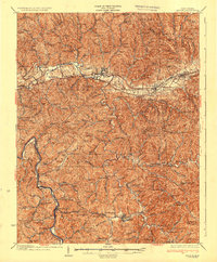 1935 Milton1935 Print · USGSCabell and Lincoln Counties appear here in the mid-1930s, defined by the winding river valleys and ridge-top communities of the Appalachian Plateau. Genealogists can trace early homesteads and social hubs through numerous sites like Howell Mill, Skyhigh Sch, and Bethesda Ch.3 unique versions available
 - 1941 Map of Wayne
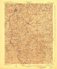 1941 Wayne1941 Print · USGSWayne County and the surrounding ridges are captured here in the early 1940s, showing a landscape defined by hollows and isolated schools. Genealogists can trace family connections through numerous landmarks like Bethesda Ch, Marshall Sch, and the Norfolk and Western RR line.
 - 1953 Map of Catlettsburg, 1955 Print
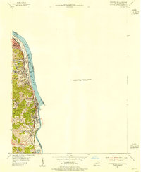 1953 Catlettsburg1955 Print · USGSThe industrial riverfront of northeastern Kentucky is captured here just after the war, where the Ohio and Big Sandy rivers converge. Researchers can trace the mid-century footprint of Catlettsburg and Ashland alongside landmarks like England Hill Sch and Lock No 29.
 - 1957 Map of Catlettsburg, 1958 Print
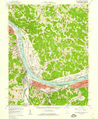 1957 Catlettsburg1958 Print · USGSThe tri-state river junction comes alive in the late fifties, showing the industrial heart of the OHIO RIVER valley. Genealogists and historians can trace family roots through the England Hill Sch, Williams Cem, and the historic streets of Kenova.2 unique versions available
 - 1957 Map of Huntington, 1959 Print
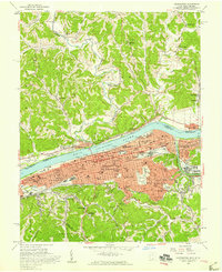 1957 Huntington1959 Print · USGSThe industrial and academic heart of the Tri-State area comes alive in this late 1950s survey of the Ohio River valley. Researchers can trace the sprawling grounds of Marshall College, locate family plots in Spring Hill Cemetery, or follow the busy tracks of the Baltimore and Ohio railroad.
 - 1957 Map of Winslow, 1959 Print
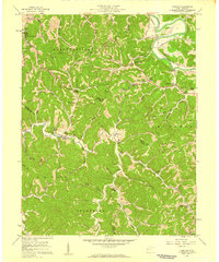 1957 Winslow1959 Print · USGSThe hills of Cabell and Wayne counties are captured here in the mid-fifties, showing a landscape of winding creek hollows and tight-knit rural communities. Researchers can locate family landmarks like the Baylous Cemetery, Davis Chapel, and the old McComas School.2 unique versions available
Showing maps 1-25 of 123
Top cities of Cabell County
- Huntington historical maps
- Barboursville historical maps
- Culloden historical maps
- Milton historical maps
Frequently asked questions
- What are the different types of historical maps available for Cabell County?
- What is the oldest map of Cabell County?
- Where can I purchase historical maps of Cabell County for my home or office?
- Where can I download high-res historical maps of Cabell County?
- Are there historical topographic maps available for Cabell County?
- Is there historical aerial imagery available for Cabell County?
- Where are historical maps of Cabell County sourced from?