Old Maps of Sarah, West Virginia for Hiking & Exploration
Hike through history with 14 historic maps of Sarah. Explore old trails, ghost towns, and forgotten backroads — perfect for outdoor adventurers and local explorers.
- Rediscover forgotten places: Map out old mining camps, roads, and footpaths that no longer exist on modern maps.
- Layer with modern tools: Combine with LiDAR or satellite views to plan hikes through historical terrain.
- Made for exploration: Popular among hikers, overlanders, and local history lovers.
Use these maps to find adventure and explore the hidden past of Sarah.
Sarah, WV maps
(14)- 1892 Map of Huntington, 1895 Print
 1892 Huntington1895 Print · USGSWest Virginia and Ohio meet along the river in the late nineteenth century, showing the rail-fueled growth of Huntington and Wayne. Local historians can trace the paths of the Chesapeake and Ohio Railroad past Barboursville and find early landmarks like Blue Sulphur Sp's and Davis Mill.
 - 1898 Map of Huntington
 1898 Huntington1898 Print · USGSNear the turn of the century, the Ohio River valley was transforming through the expansion of the Chesapeake and Ohio RR. Modern researchers can trace early nineteenth-century settlements from the bustling streets of Huntington to the inland hubs of Hamlin and Barboursville.3 unique versions available
 - 1901 Map of Guyandot, 1953 Print
 1901 Guyandot1953 Print · USGSThe Ohio River valley at the start of the twentieth century shows a bustling corridor of industry and river commerce. Genealogists and historians can trace the early footprints of Huntington and Ceredo alongside early rail routes like the Baltimore and Ohio RR.
 - 1902 Map of Guyandot
 1902 Guyandot1902 Print · USGSThe industrial hub of Huntington and the river town of Guyandot sit at the center of this early century border survey. Genealogists can trace family names and small settlements along Twelvepole Creek and Russell Creek, including Lavalette, Shoals, and Dickson.4 unique versions available
 - 1957 Map of Winslow, 1959 Print
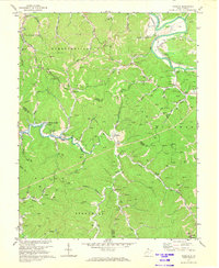
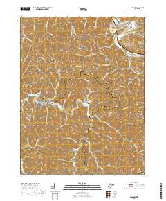
 1957 Winslow1959 Print · USGSThe hills of Cabell and Wayne counties are captured here in the mid-fifties, showing a landscape of winding creek hollows and tight-knit rural communities. Researchers can locate family landmarks like the Baylous Cemetery, Davis Chapel, and the old McComas School.2 unique versions available
 - 1957 Map of Huntington, 1966 Print
 1957 Huntington1966 Print · USGSThe industrial heart of the Ohio River valley is captured here in the mid-sixties, showing the growth of Huntington and Ashland. Researchers can trace the extensive rail networks of the Chesapeake and Ohio RR and locate sites like the Chief Cornstalk Hunting Ground.3 unique versions available
 - 1960 Map of Huntington
 1960 Huntington1960 Print · USGSThe tri-state river valley thrived in the late fifties as a hub of heavy industry and Appalachian rail transit. Genealogists and historians can trace the connection between river towns like Ashland and Portsmouth or locate family homesteads near Coleman Ridge.
 - 1972 Map of Winslow, 1973 Print
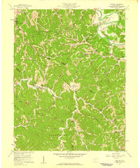
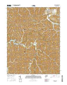
 1972 Winslow1973 Print · USGSWestern West Virginia hill country is captured here during the early seventies just as the terrain began to change. Researchers can trace the footprint of the area before the inundation of Beech Fork Lake, identifying sites like Winslow, Davis Chapel, and the McComas Sch.4 unique versions available
 - 1982 Map of Huntington, 1983 Print
 1982 Huntington1983 Print · USGSThe tri-state region around Huntington and Ashland is shown in the early 1980s, documenting a landscape shaped by river commerce and coal-country railroads. Trace family roots and old routes through Barboursville, the Gas Field, and the Tug Fork valley.
 - 2011 Map of Winslow, 2011 Print
 2011 Winslow2011 Print · USGSCovers Sarah, including Owens Crossing, Bowen, and other nearby areas
 - 2014 Map of Winslow, 2014 Print
 2014 Winslow2014 Print · USGSCovers Sarah, including Owens Crossing, Bowen, and other nearby areas
 - 2016 Map of Winslow, 2016 Print
 2016 Winslow2016 Print · USGSCovers Sarah, including Owens Crossing, Bowen, and other nearby areas
 - 2019 Map of Winslow, 2019 Print
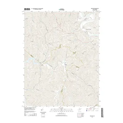
 2019 Winslow2019 Print · USGSCovers Sarah, including Owens Crossing, Bowen, and other nearby areas
 - 2023 Map of Winslow, 2023 Print
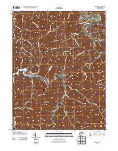
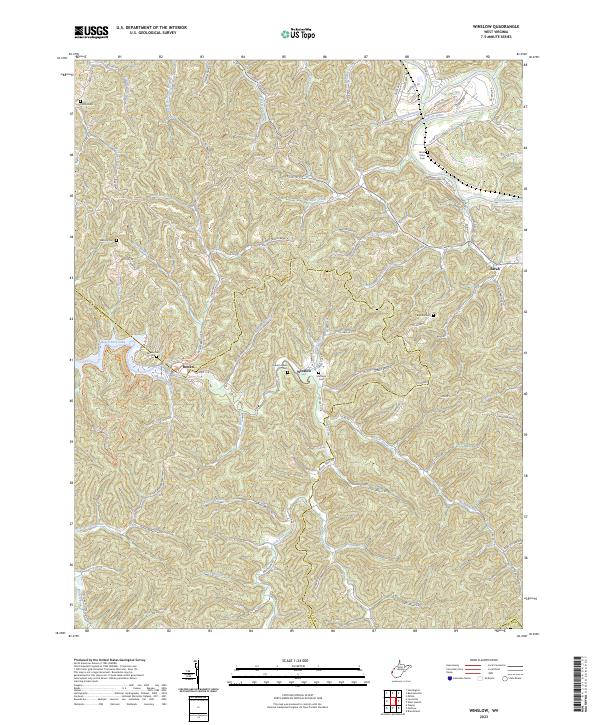 2023 Winslow2023 Print · USGSWestern West Virginia’s ridge-and-valley landscape is documented here along the Cabell and Wayne county lines in the early 2020s. Researchers can locate numerous family-named landmarks and burial sites including Everett Adkins Cem, Morrison Cem, and the old Coal Mine Trl.
End of results
Showing maps 1-14 of 14
Top cities near Sarah
- Huntington historical maps
- Rome historical maps
- Hurricane historical maps
- Barboursville historical maps
- Culloden historical maps
- Milton historical maps
See more
Frequently asked questions
- What are the different types of historical maps available for Sarah?
- What is the oldest map of Sarah?
- Where can I purchase historical maps of Sarah for my home or office?
- Where can I download high-res historical maps of Sarah?
- Are there historical topographic maps available for Sarah?
- Is there historical aerial imagery available for Sarah?
- Where are historical maps of Sarah sourced from?