Old Maps of Gilmer County, West Virginia for Genealogy
Trace your family roots with 125 historic maps of Gilmer County. These high-res maps reveal old neighborhoods, homesites, landmarks, and streets — helping you uncover where your ancestors lived and how the area evolved over time.
- Explore historic neighborhoods: Identify where your relatives may have lived in the 1800s or 1900s.
- Compare maps over time: Trace the changes in streets, buildings, and landmarks for multi-generational research.
- Perfect for genealogy & ancestry research: Used by family historians and researchers to map out lineage and migration.
These maps are an incredible resource for exploring your personal connection to Gilmer County's past.
Gilmer County, WV maps
(125)- 1893 Map of Sutton
 1893 Sutton1893 Print · USGSCentral West Virginia at the end of the nineteenth century was a world of river-bottom settlements and high mountain ridges. Genealogists can locate family-named landmarks like Bealls Mills, Hickory Knob, and the riverside town of Sutton.3 unique versions available
 - 1904 Map of Vadis
 1904 Vadis1904 Print · USGSLewis and Doddridge counties appear here at the start of the twentieth century, showing a landscape shaped by narrow creek valleys and small upland farms. Genealogists can trace family footprints in historic settlements like Vadis, Freemansburg, and St.Clare.2 unique versions available
 - 1906 Map of Holbrook
 1906 Holbrook1906 Print · USGSRitchie County and the surrounding highlands are captured here at the dawn of the twentieth century. Genealogists can trace family names and early homesteads near Burnt House, the Staunton and Parkersburg Pike, and the village of Pullman.2 unique versions available
 - 1906 Map of Glenville
 1906 Glenville1906 Print · USGSThe Little Kanawha River valley in the early 1900s was a landscape of remote hills and riverfront hamlets. Genealogists can trace family connections in vanished post offices and creek-side settlements like Stumptown, Lettergap, and Dekalb.2 unique versions available
 - 1906 Map of Burnsville
 1906 Burnsville1906 Print · USGSCentral West Virginia at the turn of the century reveals a landscape of river-fed mills and mountain post offices. Trace family roots and early industry through Burnsville, Bulltown, and the various local works at Falls Mill and Bealls Mills.2 unique versions available
 - 1906 Map of Otter, 1961 Print
 1906 Otter1961 Print · USGSCentral West Virginia at the start of the twentieth century shows a landscape of deep hollows and high ridges before modern highways. Researchers can trace early settlements and family homesteads near Ivydale, Newton, and the remote Redhouse Siding along the Elk River.
 - 1907 Map of Otter
 1907 Otter1907 Print · USGSCentral West Virginia at the turn of the century shows a landscape defined by its river valleys and new industrial rails. Genealogists can trace family homes near Newton, Linden, and Minnora, or follow the path of the Coal and Coke R R through Ivydale.3 unique versions available
 - 1907 Map of Harrisville
 1907 Harrisville1907 Print · USGSRitchie County at the start of the twentieth century is centered on the rugged valleys of the North Fork and South Fork Hughes River. Researchers can trace the path of the Baltimore and Ohio RR and locate rural hubs like Silver Run Station and the Ritchie Mine.2 unique versions available
 - 1907 Map of Arnoldsburg
 1907 Arnoldsburg1907 Print · USGSCalhoun County's rugged terrain and river life are preserved here in the first decade of the twentieth century. Researchers can trace ancestral home sites and rural post offices from Grantsville to Chestnut Grove Big Springs PO and Brooksville Big Bend PO.2 unique versions available
 - 1908 Map of Gassaway
 1908 Gassaway1908 Print · USGSCentral West Virginia at the height of the early rail era reveals a landscape of isolated hill settlements and river industry. Genealogists can trace early homesteads and rail stops like Gassaway, Strange Creek, and the many family-named peaks like Davis Knob.
 - 1910 Map of Gassaway
 1910 Gassaway1910 Print · USGSBraxton County at the peak of its rail-and-river era is captured here, centered on the growing industrial hub of Gassaway. Genealogists and historians can trace early post offices and settlements like Villa Nova Duck PO, Strange Creek, and the Coal and Coke Ry corridor.3 unique versions available
 - 1924 Map of Harrisville, 1957 Print
 1924 Harrisville1957 Print · USGSRitchie County during the mid-1920s reveals a landscape of ridge-top schools and river-valley industry. Genealogists can trace family roots through numerous local landmarks like Silver Run Sta Donohue PO, Ritchie Mines, and Star Settlement.
 - 1924 Map of Holbrook, 1961 Print
 1924 Holbrook1961 Print · USGSNorth-central West Virginia at the height of its rural settlement density reveals a landscape of ridge-top knobs and narrow hollows. Genealogists and historians can trace dozens of family-named landmarks and local institutions, from Mt Union Church to the many schools like Alum Fork School and Moonrise School.
 - 1925 Map of Glenville, 1962 Print
 1925 Glenville1962 Print · USGSGilmer and Braxton Counties appear in the mid-1920s as a landscape of river-valley hamlets and dozens of one-room schoolhouses. Genealogists can trace family roots through specific landmarks like Otterbein Church, Stumptown, and the Lynch Run School.
 - 1925 Map of Arnoldsburg, 1964 Print
 1925 Arnoldsburg1964 Print · USGSCalhoun County in the mid-twenties shows a landscape of winding river bends and hundreds of named rural landmarks. Genealogists can trace family names through dozens of community sites like Jackson School, Mt Vernon Church, and Annamoriah Flats.
 - 1925 Map of Burnsville, 1964 Print
 1925 Burnsville1964 Print · USGSCentral West Virginia's rugged river valleys come alive in the mid-1920s, showing the dense network of hill-country settlements and schools. Genealogists can trace family footprints near Bealls Mills, Stouts Mills, or the many rural schoolhouses like Slidinghill School.
 - 1925 Map of Vadis, 1981 Print
 1925 Vadis1981 Print · USGSCentral West Virginia's highlands in the mid-twenties reveal a landscape of hollows and ridges dotted with one-room schoolhouses and country parishes. Genealogists can trace family roots through numerous sites like St Marys Church, Vadis, and Lower Walnut School.
 - 1926 Map of Harrisville
 1926 Harrisville1926 Print · USGSRitchie County in the mid-twenties is a landscape of winding river valleys and bustling rail hubs like Cairo and Harrisville. Researchers can trace the heritage of remote hill communities through dozens of local landmarks like the Ritchie Mine, Donohue PO, and Star Settlement.
 - 1926 Map of Holbrook
 1926 Holbrook1926 Print · USGSRitchie and Gilmer Counties are shown here in the mid-1920s, before modern highways altered these mountain valleys. Genealogists can trace family names across dozens of rural institutions, from Fairview Church to the Coal Alum Fork School.2 unique versions available
 - 1927 Map of Vadis
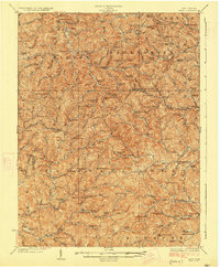 1927 Vadis1927 Print · USGSWest Virginia's central highlands are shown here in the mid-1920s, a landscape defined by isolated farmsteads and valley-bottom settlements. Genealogists and historians can trace dozens of rural school sites and landmarks like St Boniface Church, Alum Bridge, and Freemansburg.2 unique versions available
 - 1927 Map of Burnsville
 1927 Burnsville1927 Print · USGSCentral West Virginia in the late twenties was a land of river-side rail hubs and secluded valley schools. Genealogists can trace family lines through dozens of local landmarks like Roalls Mills, St Bernards Church, and the Sand Fork PO.3 unique versions available
 - 1927 Map of Arnoldsburg
 1927 Arnoldsburg1927 Print · USGSCalhoun County's winding river valleys and high ridges are captured here during the late twenties, showing a rural landscape of scattered hill farms and tiny schools. Genealogists can trace family footprints near Grantsville, Rocksdale, and Mt Zion.3 unique versions available
 - 1928 Map of Glenville
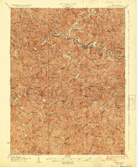 1928 Glenville1928 Print · USGSWest Virginia's central hills in the late twenties are captured here, centered on the Little Kanawha River and its upland communities. Genealogists can locate dozens of country schools and churches, including Peachtree School, Sugar Grove School, and Poplar Tree Church.2 unique versions available
 - 1949 Map of Clarksburg
 1949 Clarksburg1949 Print · USGSThe upper Ohio River valley and the industrial heart of West Virginia come into focus during this post-war period. Genealogists and researchers can trace the rail corridors of the Baltimore and Ohio and locate centers like Fairmont, Grafton, and Waynesburg.
 - 1954 Map of Charleston
 1954 Charleston1954 Print · USGSWest Virginia’s industrial heart and mountain highlands are captured here during the mid-fifties, centered on the capital city. Researchers can trace historic river-and-rail corridors along the Kanawha River and locate remote peaks within the Monongahela National Forest.
Showing maps 1-25 of 125
Top cities of Gilmer County
Frequently asked questions
- What are the different types of historical maps available for Gilmer County?
- What is the oldest map of Gilmer County?
- Where can I purchase historical maps of Gilmer County for my home or office?
- Where can I download high-res historical maps of Gilmer County?
- Are there historical topographic maps available for Gilmer County?
- Is there historical aerial imagery available for Gilmer County?
- Where are historical maps of Gilmer County sourced from?