1960s Maps of Gilmer County, West Virginia
Explore 17 historic maps of Gilmer County from the 1960s. These maps offer a rare glimpse into what life looked like during the 1960s — showing old roads, neighborhoods, homes, and landmarks that have changed or disappeared over time.
Whether you're researching your family's past, planning a metal detecting trip, or studying how Gilmer County's landscape evolved across the 1960s, these high-resolution maps are a powerful tool for exploring the history of this region.
- Focus on a specific era: All maps on this page are from the 1960s, giving you a focused view of this time period.
- See what’s changed: Compare century-old streets, trails, and buildings to today's modern landscape using overlays and satellite layers.
- Research with precision: Use these maps for genealogy, historical research, land use analysis, or educational projects.
- View, download, or print: Maps are fully viewable online in high resolution, and can be downloaded or printed for your own records.
Start exploring Gilmer County's history through authentic maps from the 1960s. This is your window into the past.
Gilmer County, WV maps
(17)- 1961 Map of Clarksburg
 1961 Clarksburg1961 Print · USGSThe mid-century industrial and river landscapes of West Virginia and Ohio are detailed here, centered on the Ohio River. Researchers can trace the Baltimore and Ohio rail lines connecting towns like Parkersburg, Clarksburg, and Monongah.
 - 1961 Map of Charleston
 1961 Charleston1961 Print · USGSWest Virginia's capital region and the highlands to the east are shown in detail during the early sixties. Genealogists and historians can trace rail networks like the Baltimore and Ohio RR and find early state parks such as Watoga State Park.
 - 1964 Map of Burnt House, 1966 Print
 1964 Burnt House1966 Print · USGSMid-century Ritchie and Gilmer counties are documented here at the height of the local energy and rural agricultural era. Genealogists and historians can trace family locations through numerous sites like Burnt House, Roseville Ch, and the Bush Cem.3 unique versions available
 - 1964 Map of Smithville, 1966 Print
 1964 Smithville1966 Print · USGSIn the mid-1960s, the Ritchie County hills were a busy landscape of energy extraction and remote settlements. Genealogists and historians can trace family roots at Westfall Cem or Ayers Cem while locating old sites like Deep Valley School and Bethany Ch.
 - 1964 Map of Vadis, 1966 Print
 1964 Vadis1966 Print · USGSWest Virginia's rural Lewis and Gilmer County borderlands are shown here in the mid-1960s as the local economy revolved around active extraction and creek-bottom farming. Researchers can locate numerous country churches and cemeteries like Doyle Chapel, Rock Grove Ch, and Liberty Cem.2 unique versions available
 - 1964 Map of Auburn, 1966 Print
 1964 Auburn1966 Print · USGSCentral West Virginia in the mid-1960s was a landscape of remote oil and gas wells connected by winding creek-side roads. Genealogists can trace family roots through numerous landmarks like Lawther Cem, Mt Earnest Ch, and the settlement of Auburn.2 unique versions available
 - 1965 Map of Tanner, 1967 Print
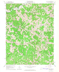
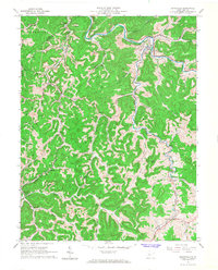
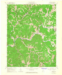 1965 Tanner1967 Print · USGSGilmer County in the mid-1960s reveals a landscape defined by the winding Little Kanawha River and a busy oil-extraction economy. Genealogists can trace family landmarks like Jobe Temple Cem and Riddle Cem, or explore local centers like Tanner and De Kalb.
 - 1965 Map of Glenville, 1967 Print
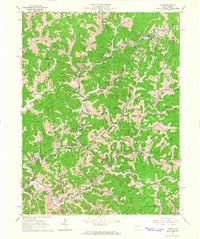
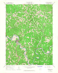
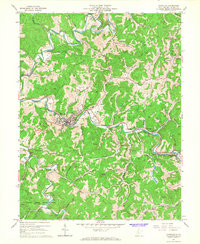 1965 Glenville1967 Print · USGSIn the mid-sixties, the Little Kanawha River valley was a hub of academic life and extractive industry centered on the town of Glenville. Researchers can trace the early footprint of Glenville State College or locate family sites like Stalnaker Cem and Alice Ch.2 unique versions available
 - 1965 Map of Millstone, 1967 Print
 1965 Millstone1967 Print · USGSCalhoun County's interior is shown here in the mid-1960s during a peak era of oil and gas production. Genealogists and historians can trace family locations near Millstone, Alberta Chapel, or the Apple Grove Sch amidst the area's many named runs and hollows.
 - 1965 Map of Rosedale, 1967 Print
 1965 Rosedale1967 Print · USGSBraxton County’s rural landscape is captured here in the mid-1960s, showing a network of ridge-top knobs and valley-bottom hamlets. Genealogists and local historians can trace family roots through sites like Charity Ch, Lower Sleith Sch, and the small community of Rosedale.2 unique versions available
 - 1965 Map of Burnsville, 1968 Print
 1965 Burnsville1968 Print · USGSBraxton County in the mid-1960s was a landscape where traditional Appalachian hollows met a growing energy sector. Genealogists and historians can trace family-named landmarks and old rail stops like Bower, Rollyson, and the Cedar Creek Sch along the Baltimore and Ohio line.3 unique versions available
 - 1966 Map of Cedarville, 1967 Print
 1966 Cedarville1967 Print · USGSNear the border of Gilmer and Braxton counties in the mid-1960s, this area shows a landscape of deep hollows and active energy production. Genealogists can locate family burial grounds like Moss Cem and Gerwig Cem or historic rural congregations at Rhodes Chapel.2 unique versions available
 - 1966 Map of Grantsville, 1967 Print
 1966 Grantsville1967 Print · USGSCalhoun County in the mid-1960s is defined by the winding Little Kanawha River and a landscape dotted with oil and gas wells. Genealogists can trace family footprints at Big Springs, the Fairview Ch, or the rural Stevens Sch.
 - 1966 Map of Normantown, 1967 Print
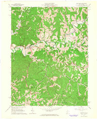
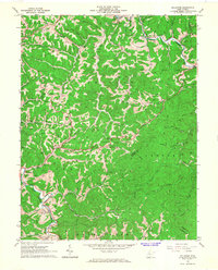
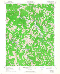
 1966 Normantown1967 Print · USGSMid-century Gilmer County is shown here at the height of its gas-well development, where narrow hollows dictate the layout of small communities. Researchers can locate remote family sites like Elihu-Stump Cem and Snakeroot Cem or trace the early paths of Hunt Road.2 unique versions available
 - 1966 Map of Gilmer, 1968 Print
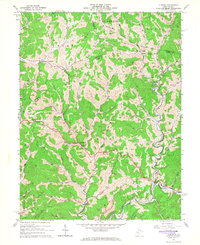
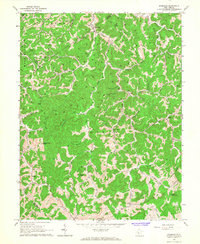
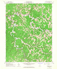
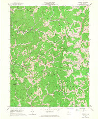
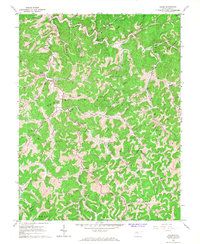
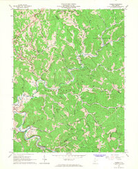 1966 Gilmer1968 Print · USGSThe mid-1960s central West Virginia hills are captured here, centered on the river and rail lines that sustained local industry. Genealogists can trace family landmarks and rural congregations like Hiney Ch, Stouts Mills, and Edmiston Cem.2 unique versions available
 - 1966 Map of Peterson, 1968 Print
 1966 Peterson1968 Print · USGSLewis County hill country is captured here in the mid-sixties, showing a landscape defined by isolated farmsteads and narrow creek valleys. Genealogists can trace family roots through Collins Settlement and landmarks like St Bernards Ch and Bealls Mills.3 unique versions available
 - 1966 Map of Chloe, 1968 Print
 1966 Chloe1968 Print · USGSCalhoun County in the mid-sixties reveals a landscape shaped by creek-bottom farming and the gas industry. Genealogists can trace family names and small-town centers like Minnora, Nicut, and Chloe, alongside rural landmarks such as Ebenezer Ch and the Matheny Cem.2 unique versions available
End of results
Showing maps 1-17 of 17
Top cities of Gilmer County
Frequently asked questions
- What are the different types of historical maps available for Gilmer County?
- What is the oldest map of Gilmer County?
- Where can I purchase historical maps of Gilmer County for my home or office?
- Where can I download high-res historical maps of Gilmer County?
- Are there historical topographic maps available for Gilmer County?
- Is there historical aerial imagery available for Gilmer County?
- Where are historical maps of Gilmer County sourced from?