Old Maps of Diamond, West Virginia for Genealogy
Trace your family roots with 18 historic maps of Diamond. These high-res maps reveal old neighborhoods, homesites, landmarks, and streets — helping you uncover where your ancestors lived and how the area evolved over time.
- Explore historic neighborhoods: Identify where your relatives may have lived in the 1800s or 1900s.
- Compare maps over time: Trace the changes in streets, buildings, and landmarks for multi-generational research.
- Perfect for genealogy & ancestry research: Used by family historians and researchers to map out lineage and migration.
These maps are an incredible resource for exploring your personal connection to Diamond's past.
Diamond, WV maps
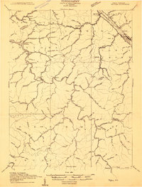
(18)- 1899 Map of Charleston
 1899 Charleston1899 Print · USGSWest Virginia's capital and the surrounding coalfields are documented here during the late nineteenth-century industrial boom. Researchers can trace early mining operations at the Graham Mines and follow pioneer rail lines like the Winifrede R. R. through the rugged river hollows.6 unique versions available
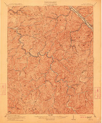
 - 1909 Map of Peytona
 1909 Peytona1909 Print · USGSBoone and Kanawha Counties are shown here during a period of industrial expansion along the river forks and mountain ridges. Researchers can trace early railroad sidings and post offices at Winifrede Jct, Lewiston PO, and the riverside community of Peytona.
 - 1911 Map of Peytona
 1911 Peytona1911 Print · USGSSouthern West Virginia’s coal and rail landscape is captured here in the decade before the Great War, centered on the winding Coal River. Researchers can trace the early rail hubs and hollows including Winifrede, Peytona, and the vanished Lewiston PO.3 unique versions available
 - 1929 Map of Peytona, 1960 Print
 1929 Peytona1960 Print · USGSThe Coal River valley and the industrial corridor of the Kanawha River are captured here during the late 1920s. Genealogists and historians can trace rail-side communities and local schools like Brushton Costa PO, Peytona, and Williams Sch.
 - 1931 Map of Peytona
 1931 Peytona1931 Print · USGSThe coal hollows and river bends of Kanawha and Boone Counties are captured here between the wars as the rail-and-river economy flourished. Genealogists can trace early twentieth-century homesites and infrastructure at Peytona, the Brushton Costa PO, and along the Winifrede RR.3 unique versions available
 - 1954 Map of Charleston
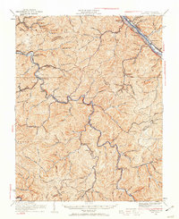
 1954 Charleston1954 Print · USGSWest Virginia’s industrial heart and mountain highlands are captured here during the mid-fifties, centered on the capital city. Researchers can trace historic river-and-rail corridors along the Kanawha River and locate remote peaks within the Monongahela National Forest.
 - 1957 Map of Charleston, 1966 Print
 1957 Charleston1966 Print · USGSMid-century West Virginia unfolds along the industrial Kanawha River valley and into the high Allegheny Mountains. Genealogists and historians can trace the vital rail lines of the Chesapeake and Ohio and locate riverside settlements from Saint Albans to Buckhannon.3 unique versions available
 - 1958 Map of Charleston
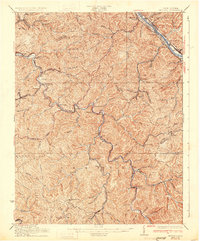
 1958 Charleston1958 Print · USGSMid-century West Virginia is defined here by the industrial corridor of the Kanawha River and the high ridges of the Allegheny Mountains. Researchers can trace the rail networks of the New York Central or locate remote highland communities like Pickens and Hillsboro.
 - 1961 Map of Charleston
 1961 Charleston1961 Print · USGSWest Virginia's capital region and the highlands to the east are shown in detail during the early sixties. Genealogists and historians can trace rail networks like the Baltimore and Ohio RR and find early state parks such as Watoga State Park.
 - 1965 Map of Belle, 1966 Print
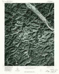
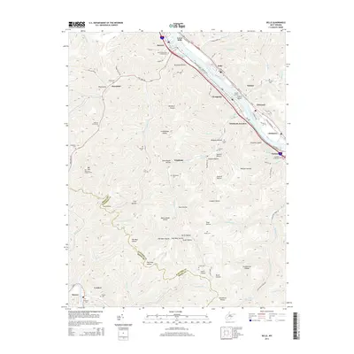
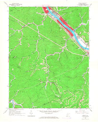 1965 Belle1966 Print · USGSMid-century industry and coal mining define the Kanawha valley in the 1960s as river traffic and railroads converge near Belle and Marmet. Genealogists and historians can trace the steep hollows to find local landmarks like Lens Creek Ch, Mitchell Cem, and the specialized Opera House Hol.4 unique versions available
 - 1977 Map of Belle, 1980 Print
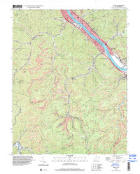
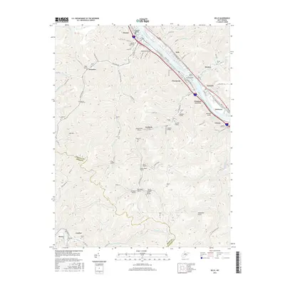
 1977 Belle1980 Print · USGSThe Kanawha River valley was a bustling corridor of West Virginia industry and riverfront life in the late seventies. Genealogists and historians can trace the footprints of riverside towns like Belle, Marmet, and the inland settlement of Winifrede.
 - 1984 Map of Charleston
 1984 Charleston1984 Print · USGSWest Virginia's capital and the industrial Kanawha Valley are shown here in the mid-eighties as modern interstates began to reshape the region. Local researchers can locate family-named landmarks like Reamer (Sybial PO) and institutional anchors like West Virginia State College.2 unique versions available
 - 1996 Map of Belle, 2000 Print
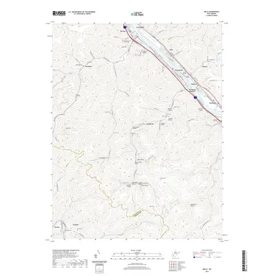
 1996 Belle2000 Print · USGSThe industrial corridor of the Kanawha River comes into sharp focus during the mid-nineties, showing the integration of rail, water, and mining. Genealogists and historians can trace family locations through numerous sites like Wrightsville Cem, Winifrede, and Lens Creek Ch.
 - 2011 Map of Belle, 2011 Print
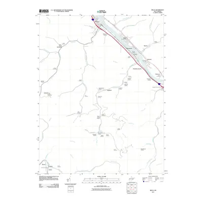 2011 Belle2011 Print · USGSCovers Diamond, including Marmet, Chesapeake, and other nearby areas
 - 2014 Map of Belle, 2014 Print
 2014 Belle2014 Print · USGSCovers Diamond, including Marmet, Chesapeake, and other nearby areas
 - 2016 Map of Belle, 2016 Print
 2016 Belle2016 Print · USGSCovers Diamond, including Marmet, Chesapeake, and other nearby areas
 - 2019 Map of Belle, 2019 Print
 2019 Belle2019 Print · USGSCovers Diamond, including Marmet, Chesapeake, and other nearby areas
 - 2023 Map of Belle, 2023 Print
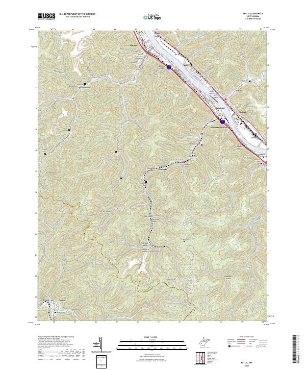 2023 Belle2023 Print · USGSThe Kanawha River valley comes alive in this contemporary record of its industrial towns and storied hollows. Genealogists can trace family lineages through Marmet Memorial Gardens Cem, Hoffman Cemeteries, and remote settlements like Winifrede and Comfort.
End of results
Showing maps 1-18 of 18
Top cities near Diamond
- Charleston historical maps
- South Charleston historical maps
- Dunbar historical maps
- Montgomery historical maps
- Marmet historical maps
- Chesapeake historical maps
See more
Frequently asked questions
- What are the different types of historical maps available for Diamond?
- What is the oldest map of Diamond?
- Where can I purchase historical maps of Diamond for my home or office?
- Where can I download high-res historical maps of Diamond?
- Are there historical topographic maps available for Diamond?
- Is there historical aerial imagery available for Diamond?
- Where are historical maps of Diamond sourced from?