Old Maps of Lincoln County, West Virginia for Academic Research
Study the evolution of Lincoln County with 157 high-resolution historic maps. Whether you're teaching, researching, or modeling changes in land use, these maps provide essential visual documentation of urban, environmental, and geographic change.
- Analyze long-term change: Track patterns in development, transportation, and natural features.
- Ideal for environmental or urban studies: Support academic projects with primary historical map data.
- Use in the classroom or lab: Educators and researchers rely on these maps to bring historical context to life.
These maps are a powerful tool for teaching, research, and visualizing how Lincoln County has changed over the decades.
Lincoln County, WV maps
(157)- 1887 Map of Warfield
 1887 Warfield1887 Print · USGSThe West Virginia and Kentucky borderlands come into focus in the late nineteenth century along the winding Tug Fork of Big Sandy River. Genealogists and historians can trace early valley life through sites like Warfield, Chapmansville, and the remote White Post settlement.
 - 1891 Map of Warfield
 1891 Warfield1891 Print · USGSThe Tug Fork valley in the 1880s is captured here at the intersection of Kentucky and West Virginia. Researchers can trace the early Appalachian landscape through riverfront settlements like Warfield and White Post, or find family-named hubs such as Hatfield and Mate.7 unique versions available
 - 1892 Map of Huntington, 1895 Print
 1892 Huntington1895 Print · USGSWest Virginia and Ohio meet along the river in the late nineteenth century, showing the rail-fueled growth of Huntington and Wayne. Local historians can trace the paths of the Chesapeake and Ohio Railroad past Barboursville and find early landmarks like Blue Sulphur Sp's and Davis Mill.
 - 1898 Map of Huntington
 1898 Huntington1898 Print · USGSNear the turn of the century, the Ohio River valley was transforming through the expansion of the Chesapeake and Ohio RR. Modern researchers can trace early nineteenth-century settlements from the bustling streets of Huntington to the inland hubs of Hamlin and Barboursville.3 unique versions available
 - 1899 Map of Charleston
 1899 Charleston1899 Print · USGSWest Virginia's capital and the surrounding coalfields are documented here during the late nineteenth-century industrial boom. Researchers can trace early mining operations at the Graham Mines and follow pioneer rail lines like the Winifrede R. R. through the rugged river hollows.6 unique versions available
 - 1901 Map of Guyandot, 1953 Print
 1901 Guyandot1953 Print · USGSThe Ohio River valley at the start of the twentieth century shows a bustling corridor of industry and river commerce. Genealogists and historians can trace the early footprints of Huntington and Ceredo alongside early rail routes like the Baltimore and Ohio RR.
 - 1902 Map of Guyandot
 1902 Guyandot1902 Print · USGSThe industrial hub of Huntington and the river town of Guyandot sit at the center of this early century border survey. Genealogists can trace family names and small settlements along Twelvepole Creek and Russell Creek, including Lavalette, Shoals, and Dickson.4 unique versions available
 - 1902 Map of Milton
 1902 Milton1902 Print · USGSTeays Valley and the western Virginia hill country are shown here at the turn of the century, as the railroad era transformed the region's commerce. Genealogists can trace early homesteads and landmarks like Howell Mill, Salt Rock, and the Ben Johnson Ford.3 unique versions available
 - 1902 Map of Midkiff, 1925 Print
 1902 Midkiff1925 Print · USGSLincoln and Cabell Counties at the turn of the century show a region transitioning through the arrival of the railroad and the growth of river-valley commerce. Family historians can trace early property sites and communities like Milton, Hamlin, and the historic Blue Sulphur Springs along the Mud River corridor.
 - 1907 Map of Midkiff, 1964 Print
 1907 Midkiff1964 Print · USGSThe Guyandotte River valley is captured here in the early twentieth century, showing a network of small settlements and rail lines. Genealogists can trace family roots through labels like Laverne PO Brown City, Griffithsville, and Ranger.
 - 1909 Map of Wayne
 1909 Wayne1909 Print · USGSWayne County is shown in the first decade of the century, when the rail-and-river network dictated the rhythm of local life. Researchers can trace family roots through numerous post offices and rural settlements like Sidney PO, East Lynn, and Genoa along the Twelvepole Creek.2 unique versions available
 - 1909 Map of Midkiff
 1909 Midkiff1909 Print · USGSLincoln County at the turn of the century is defined by the winding Guyandot River and its accompanying rail line. Genealogists can trace early homesteads and post offices in communities like Griffithsville, Luzerne PO (Brown City), and Spurlockville.3 unique versions available
 - 1909 Map of Saint Albans
 1909 Saint Albans1909 Print · USGSThe Kanawha and Coal Rivers converge at the height of the river-and-rail era, revealing a landscape of busy lock systems and mountain settlements. Researchers can trace family roots through numerous rural landmarks like Blacks School, Scott Depot, and Alum Creek Rome PO.2 unique versions available
 - 1910 Map of Holden
 1910 Holden1910 Print · USGSLogan County’s rugged coalfield landscape is captured here in the early 1900s as development followed the winding Guyandot River. Researchers can trace old family-named settlements like Mc Cloud, Whirlwind, and Halcyon tucked into the hollows.
 - 1910 Map of Naugatuck
 1910 Naugatuck1910 Print · USGSMingo and Wayne Counties come into focus in the early twentieth century as the coal and timber industry transformed these hollows. Genealogists and researchers can trace the Norfolk and Western rail line through early settlements like Kermit, Breeden, and Naugatuck.
 - 1911 Map of Madison
 1911 Madison1911 Print · USGSBoone and Lincoln counties appear here in the early twentieth century as the rail network began to reshape the coal-bearing valleys. Researchers can trace early infrastructure through the Chesapeake and Ohio line and settlements like Madison, Uneeda, and Danville.2 unique versions available
 - 1912 Map of Naugatuck
 1912 Naugatuck1912 Print · USGSMingo and Wayne County borderlands are shown here in the early twentieth century, as the river-and-rail economy transformed these Appalachian hollows. Genealogists and historians can trace family-named sites along the Tug Fork and Norfolk and Western Ry, including Kermit, Naugatuck, and Breeden.
 - 1912 Map of Holden
 1912 Holden1912 Print · USGSSouthern West Virginia’s coal and rail landscape comes into focus at the dawn of the twentieth century. Genealogists and local historians can trace family-named hollows and early settlements like Holden, Whirlwind, and Chapmanville along the Guyandot River.
 - 1915 Map of Naugatuck
 1915 Naugatuck1915 Print · USGSThe Tug Fork valley in the early twentieth century appears in fine detail here along the Kentucky and West Virginia border. Genealogists and historians can trace early settlements and valley schools including Warfield, Naugatuck, and the Priest School.
 - 1917 Map of Naugatuck
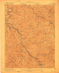 1917 Naugatuck1917 Print · USGSThe Tug Fork borderlands of Mingo and Wayne counties were defined by the rail-and-river economy during the early twentieth century. Genealogists and historians can trace riverside settlements like Kermit and Naugatuck, or search for upland landmarks such as Priest School and the Breeden Breading Post Office.3 unique versions available
 - 1926 Map of Naugatuck, 1957 Print
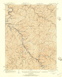 1926 Naugatuck1957 Print · USGSThe Tug Fork valley hums with activity in the 1920s as the rail-and-river economy shapes the West Virginia and Kentucky border. Genealogists and historians can trace numerous rural schools and early settlements like Kermit, Warfield, and the Cassie post office.
 - 1926 Map of Holden, 1957 Print
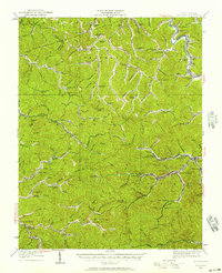 1926 Holden1957 Print · USGSSouthern West Virginia in the mid-1920s shows a landscape of mountain schools and expanding rail networks. Researchers can trace dozens of early rural schools like Dave Dingess School and Hager School alongside rail hubs at Whitman Junction and Holden.
 - 1928 Map of Holden
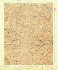 1928 Holden1928 Print · USGSLogan County's coal-country heart is captured here in the late twenties, showing the peak of the mountain rail and mining economy. Researchers can trace the narrow-gauge lines and spurs serving Holden, Verdunville, and Whitman Junction, while locating family landmarks like the Dave Dingess School or Ellis Camp.2 unique versions available
 - 1928 Map of Naugatuck
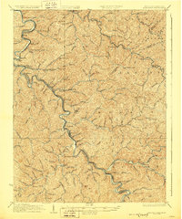 1928 Naugatuck1928 Print · USGSThe Tug Fork valley at the close of the 1920s reveals a landscape defined by the Norfolk and Western RR and riverside coal towns. Genealogists can trace family footprints through remote schoolhouses like The Bend Sch and rural post offices at Cassie Po and Kermit.2 unique versions available
 - 1929 Map of Madison, 1960 Print
 1929 Madison1960 Print · USGSThe Coal River valley in the late twenties reveals a landscape of industrial rail and rural schoolhouses. Genealogists can trace family footprints through numerous local sites like Julian, Uneeda, and Pine Grove Ch, or the many scattered schools such as Slabtown Sch.
Showing maps 1-25 of 157
Top cities of Lincoln County
Frequently asked questions
- What are the different types of historical maps available for Lincoln County?
- What is the oldest map of Lincoln County?
- Where can I purchase historical maps of Lincoln County for my home or office?
- Where can I download high-res historical maps of Lincoln County?
- Are there historical topographic maps available for Lincoln County?
- Is there historical aerial imagery available for Lincoln County?
- Where are historical maps of Lincoln County sourced from?