Old Maps of Tolbert, West Virginia for Academic Research
Study the evolution of Tolbert with 20 high-resolution historic maps. Whether you're teaching, researching, or modeling changes in land use, these maps provide essential visual documentation of urban, environmental, and geographic change.
- Analyze long-term change: Track patterns in development, transportation, and natural features.
- Ideal for environmental or urban studies: Support academic projects with primary historical map data.
- Use in the classroom or lab: Educators and researchers rely on these maps to bring historical context to life.
These maps are a powerful tool for teaching, research, and visualizing how Tolbert has changed over the decades.
Tolbert, WV maps
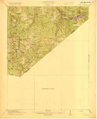
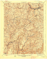
(20)- 1889 Map of Nicholas
 1889 Nicholas1889 Print · USGSNicholas County and parts of the surrounding highlands are documented here in the late nineteenth century. Genealogists can trace family landmarks and river life through recorded sites like Carnifax Ferry, Beaver Mills, and Mt. Nebo.
 - 1891 Map of Nicholas
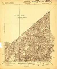
 1891 Nicholas1891 Print · USGSNicholas County and the surrounding highlands are captured here in the late nineteenth century, when mountain life depended on a network of river crossings. Genealogists can trace family roots through sites like Nicholas C.h., Hookersville, and early river crossings such as Carnifax Ferry.
 - 1901 Map of Nicholas
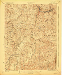
 1901 Nicholas1901 Print · USGSCentral West Virginia's river valleys and high ridges are shown here at the turn of the century as the timber industry expanded. Genealogists can trace family landmarks and river crossings like Camden on Gauley, Wainville P.O., and Bays Ferry Ford.3 unique versions available
 - 1918 Map of Richwood
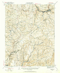
 1918 Richwood1918 Print · USGSNicholas County’s timber and rail economy is in full swing during the late years of the Great War. Genealogists can trace family roots through over a dozen rural schools such as Mayflower School and Dawson School, or find ancestors in riverside towns like Richwood and Fenwick.2 unique versions available
 - 1921 Map of Richwood
 1921 Richwood1921 Print · USGSThe West Virginia mountain country of Greenbrier and Nicholas counties is captured here just after the Great War. Researchers can trace rural life through old schoolhouses like Fallbrook School and Big Stone School, or locate settlements at Jettsville and Quinnwood.2 unique versions available
 - 1923 Map of Richwood
 1923 Richwood1923 Print · USGSThe Gauley River and its mountain forks in the early 1920s reveal a landscape of deep timber valleys and upland schoolhouses. Trace the path of the Baltimore and Ohio RR to Richwood and locate old sites like Hominy Mill or Namos Chapel.3 unique versions available
 - 1935 Map of Richwood, 1962 Print
 1935 Richwood1962 Print · USGSRichwood and the surrounding coal and timber lands of Nicholas and Greenbrier Counties are shown here in the mid-1930s. Researchers can trace the early industrial footprint of the Chesapeake and Ohio railroad through mountain settlements like Quinwood, Saxman, and Marfrance.2 unique versions available
 - 1939 Map of Richwood
 1939 Richwood1939 Print · USGSThe West Virginia coal and timber country around Richwood and Quinwood is shown here during its industrial peak. Researchers can trace the Chesapeake and Ohio RR to remote hollows and find lost schools and churches like Bamboo School and Mountain Chapel.2 unique versions available
 - 1954 Map of Charleston
 1954 Charleston1954 Print · USGSWest Virginia’s industrial heart and mountain highlands are captured here during the mid-fifties, centered on the capital city. Researchers can trace historic river-and-rail corridors along the Kanawha River and locate remote peaks within the Monongahela National Forest.
 - 1957 Map of Charleston, 1966 Print
 1957 Charleston1966 Print · USGSMid-century West Virginia unfolds along the industrial Kanawha River valley and into the high Allegheny Mountains. Genealogists and historians can trace the vital rail lines of the Chesapeake and Ohio and locate riverside settlements from Saint Albans to Buckhannon.3 unique versions available
 - 1958 Map of Charleston
 1958 Charleston1958 Print · USGSMid-century West Virginia is defined here by the industrial corridor of the Kanawha River and the high ridges of the Allegheny Mountains. Researchers can trace the rail networks of the New York Central or locate remote highland communities like Pickens and Hillsboro.
 - 1961 Map of Charleston
 1961 Charleston1961 Print · USGSWest Virginia's capital region and the highlands to the east are shown in detail during the early sixties. Genealogists and historians can trace rail networks like the Baltimore and Ohio RR and find early state parks such as Watoga State Park.
 - 1972 Map of Nettie, 1974 Print
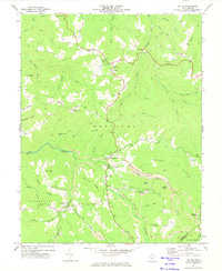 1972 Nettie1974 Print · USGSNettie and the Nicholas County highlands are mapped here in the early 1970s during a period of active coal production. Researchers can locate family-named landmarks like Fields Cem, rural congregations at Mt Zion Ch, and the industrial footprint of numerous local Strip Mines.2 unique versions available
 - 1979 Map of Marlinton, 1982 Print
 1979 Marlinton1982 Print · USGSThe West Virginia highlands are shown in detail during the late seventies, featuring the dense rail networks and mountain towns of the Allegheny range. Researchers can trace family roots through sites like Buckeye Cem, Mount Nebo Ch, and the lumber and coal hubs of Richwood and Rainelle.
 - 1995 Map of Nettie, 1998 Print
 1995 Nettie1998 Print · USGSNicholas County in the mid-nineties shows a landscape defined by mountain settlements and coal operations along the edge of the national forest. Genealogists and historians can trace community roots at Downtain Chapel, Leivasy, and Fairview Cem while locating old Strip Mines.
 - 2011 Map of Nettie, 2011 Print
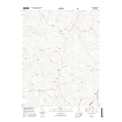
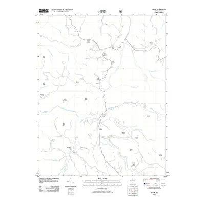 2011 Nettie2011 Print · USGSCovers Tolbert, including Hominy Falls, Grassy Falls, and other nearby areas
 - 2014 Map of Nettie, 2014 Print
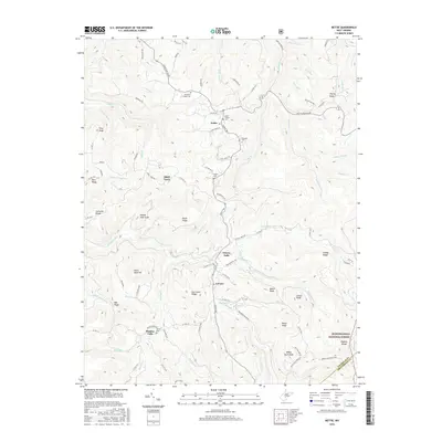
 2014 Nettie2014 Print · USGSCovers Tolbert, including Hominy Falls, Grassy Falls, and other nearby areas
 - 2016 Map of Nettie, 2016 Print
 2016 Nettie2016 Print · USGSCovers Tolbert, including Hominy Falls, Grassy Falls, and other nearby areas
 - 2019 Map of Nettie, 2019 Print
 2019 Nettie2019 Print · USGSCovers Tolbert, including Hominy Falls, Grassy Falls, and other nearby areas
 - 2023 Map of Nettie, 2023 Print
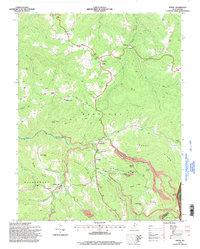
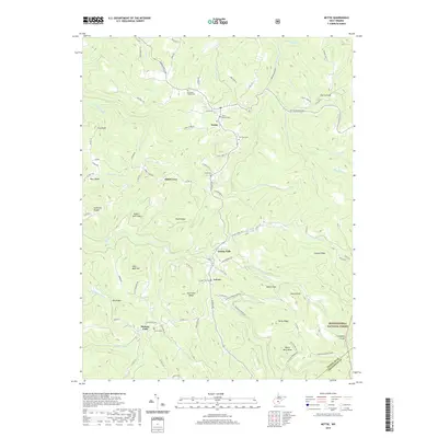
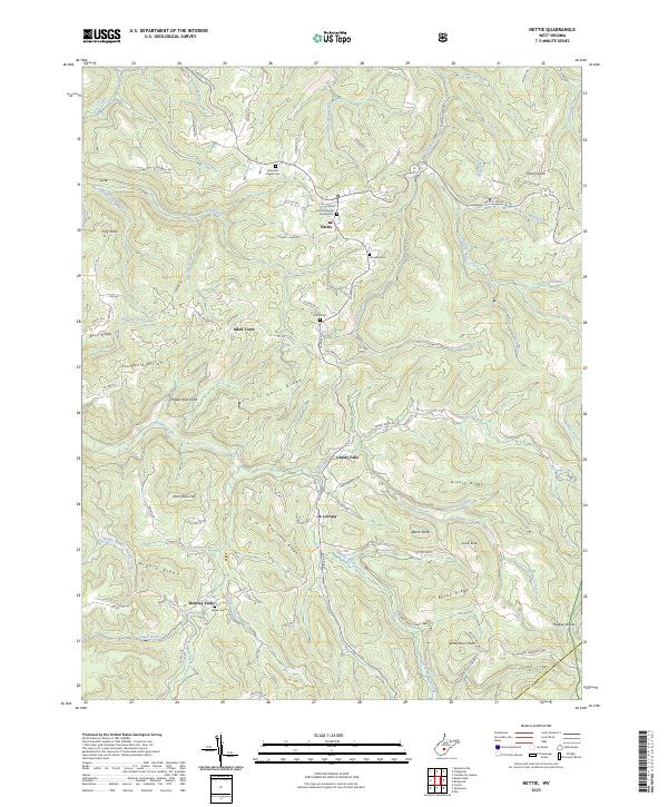 2023 Nettie2023 Print · USGSNicholas County settlements and high ridge country are mapped in detail during this modern era. Genealogists can trace family connections at Olive Branch Baptist Church Cem and Penile Cem or explore the drainage of Hominy Creek and Grassy Creek.
End of results
Showing maps 1-20 of 20
Top cities near Tolbert
- Summersville historical maps
- Richwood historical maps
- Craigsville historical maps
- Rainelle historical maps
- Cowen historical maps
- Quinwood historical maps
See more
Frequently asked questions
- What are the different types of historical maps available for Tolbert?
- What is the oldest map of Tolbert?
- Where can I purchase historical maps of Tolbert for my home or office?
- Where can I download high-res historical maps of Tolbert?
- Are there historical topographic maps available for Tolbert?
- Is there historical aerial imagery available for Tolbert?
- Where are historical maps of Tolbert sourced from?