Old Maps of Pleasants County, West Virginia for Hiking & Exploration
Hike through history with 62 historic maps of Pleasants County. Explore old trails, ghost towns, and forgotten backroads — perfect for outdoor adventurers and local explorers.
- Rediscover forgotten places: Map out old mining camps, roads, and footpaths that no longer exist on modern maps.
- Layer with modern tools: Combine with LiDAR or satellite views to plan hikes through historical terrain.
- Made for exploration: Popular among hikers, overlanders, and local history lovers.
Use these maps to find adventure and explore the hidden past of Pleasants County.
Pleasants County, WV maps
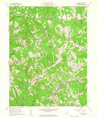
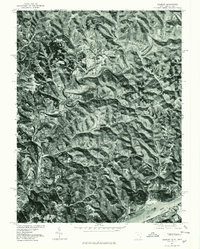
(62)- 1904 Map of Marietta, 1923 Print
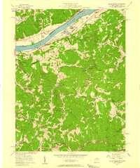
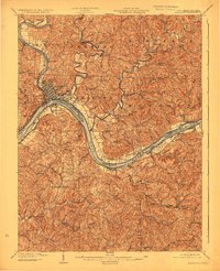 1904 Marietta1923 Print · USGSThe riverfront communities of the Ohio Valley come to life in this early 1900s survey of the border region. Trace the historic Steamboat Route past Kerr Island or locate ancestral homes in rural Valley Mills and Stanleyville.
 - 1906 Map of Saint Marys
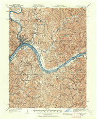
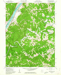
 1906 Saint Marys1906 Print · USGSThe riverfront around St Marys and the Ohio River islands is captured here in the early 1900s. Genealogists and researchers can trace early rural life through landmarks like Ninemile Schoolhouse, Union Mills, and the Baltimore and Ohio RR corridor.3 unique versions available
 - 1924 Map of St Marys, 1956 Print
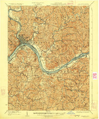
 1924 St Marys1956 Print · USGSPleasants County and the Ohio River valley are shown here in the mid-twenties, just as the local rail and river networks reached their peak. Genealogists can trace hundreds of family sites near St Marys, including Bibbys Chapel, Ellenboro, and the Willow Island School.
 - 1924 Map of Marietta, 1962 Print
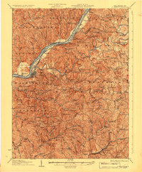
 1924 Marietta1962 Print · USGSThe Ohio River borderlands near the Muskingum confluence are captured here in the 1920s, showing a landscape of river-bend towns and hilltop farmsteads. Researchers can trace historic schools and rural meeting places like Rising Sun School, Social Chapel, and the Baltimore and Ohio RR line.
 - 1927 Map of Marietta
 1927 Marietta1927 Print · USGSThe Mid-Ohio Valley comes alive in this mid-1920s survey of the river confluence at the Ohio River. Genealogists can trace family roots through numerous country schools and churches like Last Chance School and Shiloh Church.3 unique versions available
 - 1927 Map of Saint Marys
 1927 Saint Marys1927 Print · USGSPleasants and Ritchie counties come into focus during the mid-twenties as the Baltimore and Ohio railroad skirts the Ohio River. Researchers can trace ancestral locations through dozens of rural landmarks, from the Northwestern Turnpike to the Willow Island School and Mt Carmel Church.3 unique versions available
 - 1949 Map of Clarksburg
 1949 Clarksburg1949 Print · USGSThe upper Ohio River valley and the industrial heart of West Virginia come into focus during this post-war period. Genealogists and researchers can trace the rail corridors of the Baltimore and Ohio and locate centers like Fairmont, Grafton, and Waynesburg.
 - 1956 Map of Clarksburg, 1966 Print
 1956 Clarksburg1966 Print · USGSThe Ohio River valley and the industrial heart of West Virginia are seen here in the mid-1950s as rail and river commerce thrived. Researchers can trace historic transport lines like the Baltimore and Ohio RR and locate ancestral homes in Clarksburg, Moundsville, or Parkersburg.2 unique versions available
 - 1957 Map of Willow Island, 1958 Print
 1957 Willow Island1958 Print · USGSThe Ohio River valley and its industrial backcountry come into focus in the mid-1950s, showing a landscape of oil wells and river-rail transport. Trace ancestral roots at Middle Ridge Ch, Pumpkin Knob Sch, or the sprawling Volcano Oil Field.3 unique versions available
 - 1958 Map of Belmont, 1960 Print
 1958 Belmont1960 Print · USGSThe Ohio River borderlands in the late 1950s were a hub of river transport and oil extraction. Genealogists can locate family burial sites like Old Dutch Cem and Chambers Cem or trace the Baltimore and Ohio Railroad past Belmont and Yankeeburg.2 unique versions available
 - 1960 Map of Bens Run, 1962 Print
 1960 Bens Run1962 Print · USGSThe West Virginia riverfront and rugged interior ridges are captured here in the early sixties, showing the industrial pulse of the Ohio River. Researchers can trace the Baltimore and Ohio rail line to the Salt Evaporator at Bens Run or locate rural family landmarks like Beech Run Ch and Oak Grove Cem.3 unique versions available
 - 1961 Map of Clarksburg
 1961 Clarksburg1961 Print · USGSThe mid-century industrial and river landscapes of West Virginia and Ohio are detailed here, centered on the Ohio River. Researchers can trace the Baltimore and Ohio rail lines connecting towns like Parkersburg, Clarksburg, and Monongah.
 - 1961 Map of Schultz, 1962 Print
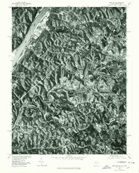
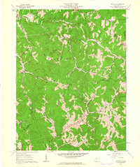 1961 Schultz1962 Print · USGSPleasants and Ritchie counties in the early sixties reveal a landscape of deep hollows and narrow ridgeline roads. Genealogists can locate family sites near Cloverdale Ch, the settlement at Maxwell, or tracing the paths along Goose Creek.3 unique versions available
 - 1961 Map of Ellenboro, 1962 Print
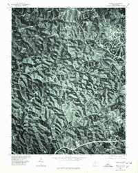
 1961 Ellenboro1962 Print · USGSRitchie County in the early sixties is captured here as a landscape of deep hollows and rail-side towns. Genealogists and historians can trace family locations near Ellenboro and Lamberton or find rural landmarks like Zoar Church and Mt Zion Church.3 unique versions available
 - 1961 Map of Raven Rock, 1962 Print
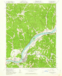 1961 Raven Rock1962 Print · USGSThe Ohio River valley at the start of the sixties reveals a landscape of industrial river towns and quiet upland ridges. Genealogists and historians can trace family sites at Deucher, Union Mills, and St Marys, or locate the Covered Bridge and several old ridge-top chapels.4 unique versions available
 - 1969 Map of Belmont, 1971 Print
 1969 Belmont1971 Print · USGSThe Ohio River valley at the close of the sixties reveals a landscape shaped by active oil fields and traditional river life. Researchers can find old family burial grounds like the Old Dutch Cem, rural outposts at Dart, and the tracks of the Baltimore and Ohio rail line.2 unique versions available
 - 1975 Map of Raven Rock, 1979 Print
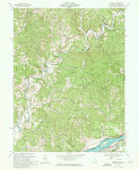
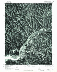 1975 Raven Rock1979 Print · USGSThe Ohio River valley in the mid-1970s is documented here through high-resolution aerial imagery of the West Virginia and Ohio border. Researchers can trace the riverfront development of St Marys and Newport or locate the rural hamlet of Raven Rock.
 - 1975 Map of Ellenboro, 1979 Print
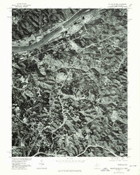
 1975 Ellenboro1979 Print · USGSEllenboro and the Ritchie County hills are shown in detail through mid-1970s aerial imagery. Researchers can trace the exact road layouts and land clearances around Hebron, Lamberton, and the winding path of Bonds Creek.
 - 1975 Map of Bens Run, 1979 Print
 1975 Bens Run1979 Print · USGSThe Ohio River valley in the mid-seventies reveals a landscape defined by industrial riverfronts and winding inland waterways. Genealogists and local historians can trace the residential layouts of Bens Run and Beavertown or follow the deep loops of Middle Island Creek.
 - 1975 Map of Schultz, 1979 Print
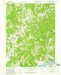
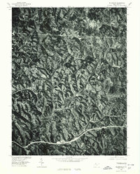
 1975 Schultz1979 Print · USGSThe wooded ridges of Pleasants County are seen in high detail in this mid-seventies orthophoto survey. Local researchers can trace the rural road networks connecting the small settlements of Calcutta, Schultz, and Glendale.
 - 1976 Map of Willow Island, 1979 Print
 1976 Willow Island1979 Print · USGSThe Ohio River valley in the mid-seventies is seen here through high-resolution aerial imagery, showing the mix of industrial riverfronts and rural ridges. Genealogists and researchers can trace the roads and homesteads around Willow Island, Eureka, and Deerwalk.
 - 1976 Map of Belmont, 1979 Print
 1976 Belmont1979 Print · USGSThe Ohio River valley and the winding Little Muskingum River are captured in this mid-seventies aerial survey. Researchers can trace the riverfront development of Belmont and locate the rural settlement of Dart tucked among the wooded ridges.
 - 1981 Map of Parkersburg, 1984 Print
 1981 Parkersburg1984 Print · USGSThe Ohio River valley at the start of the 1980s reveals a landscape shaped by river commerce and the rail networks of the Baltimore and Ohio RR. Genealogists and historians can trace the development of riverfront communities like Parkersburg, Marietta, and Williamstown, alongside rural landmarks like Blennerhassett Island and Elizabeth.
 - 1988 Map of Clarksburg, 1989 Print
 1988 Clarksburg1989 Print · USGSThe central Appalachians are documented in detail during the late eighties, showing the industrial and river-based economies of West Virginia, Ohio, and Pennsylvania. Researchers can trace historic rail routes like the B & O RR and locate river towns from St Marys to Parkersburg.
 - 1994 Map of Willow Island, 1998 Print
 1994 Willow Island1998 Print · USGSThe Ohio River valley and its rugged West Virginia hinterlands are captured here in the late twentieth century. Genealogists can trace local roots through numerous country landmarks like Pleasant Grove Ch, Old Parrish Cem, and the historic Volcano Oil Field.
Showing maps 1-25 of 62
Top cities of Pleasants County
Frequently asked questions
- What are the different types of historical maps available for Pleasants County?
- What is the oldest map of Pleasants County?
- Where can I purchase historical maps of Pleasants County for my home or office?
- Where can I download high-res historical maps of Pleasants County?
- Are there historical topographic maps available for Pleasants County?
- Is there historical aerial imagery available for Pleasants County?
- Where are historical maps of Pleasants County sourced from?