Old Maps of Marlinton, West Virginia
Explore 18 old maps of Marlinton, spanning from 1891 to today. These high-resolution historic maps reveal how streets, neighborhoods, landmarks, and natural features evolved over time — perfect for genealogy, metal detecting, research, and local history exploration.
What you can do with these maps:
- See how Marlinton changed over time: Compare historical maps to modern-day views to trace roads, homesites, rail lines & more.
- View detailed metadata: Each map includes creators, publishers, year, scale, and archive source.
- Overlay maps with satellite & LiDAR: Visualize the past alongside modern tools to explore terrain & human change.
- Trusted historical sources: Maps sourced from the USGS, Library of Congress, and other archives.
- Access maps your way: View online, download high-res files, or order prints for personal or research use.
Start exploring old maps of Marlinton to uncover forgotten places, hidden landmarks, and the deep history beneath your feet.
Marlinton, WV maps
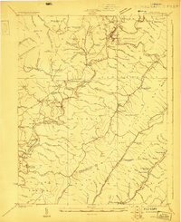
(18)- 1891 Map of Huntersville
 1891 Huntersville1891 Print · USGSCovers Marlinton, including Addison (Webster Springs), Webster Springs, and other nearby areas
 - 1894 Map of Huntersville
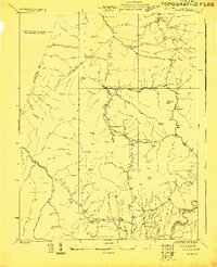
 1894 Huntersville1894 Print · USGSCovers Marlinton, including Addison (Webster Springs), Webster Springs, and other nearby areas5 unique versions available
 - 1923 Map of Marlinton
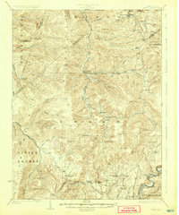
 1923 Marlinton1923 Print · USGSCovers Marlinton, including Hillsboro, Huntersville, and other nearby areas6 unique versions available
 - 1923 Map of Mingo
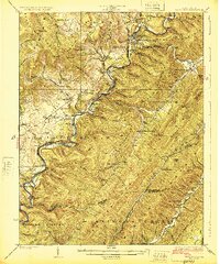
 1923 Mingo1923 Print · USGSCovers Marlinton, including Upper Mingo, Mingo, and other nearby areas2 unique versions available
 - 1925 Map of Mingo
 1925 Mingo1925 Print · USGSCovers Marlinton, including Upper Mingo, Mingo, and other nearby areas4 unique versions available
 - 1925 Map of Marlinton
 1925 Marlinton1925 Print · USGSCovers Marlinton, including Hillsboro, Huntersville, and other nearby areas3 unique versions available
 - 1954 Map of Charleston
 1954 Charleston1954 Print · USGSCovers Marlinton, including Charleston, Teays Valley, and other nearby areas
 - 1957 Map of Charleston, 1966 Print
 1957 Charleston1966 Print · USGSCovers Marlinton, including Charleston, Teays Valley, and other nearby areas3 unique versions available
 - 1958 Map of Charleston
 1958 Charleston1958 Print · USGSCovers Marlinton, including Charleston, Teays Valley, and other nearby areas
 - 1961 Map of Charleston
 1961 Charleston1961 Print · USGSCovers Marlinton, including Charleston, Teays Valley, and other nearby areas
 - 1974 Map of Edray, 1989 Print
 1974 Edray1989 Print · USGSCovers Marlinton, including Edray, Harter, and other nearby areas
 - 1977 Map of Edray, 1978 Print
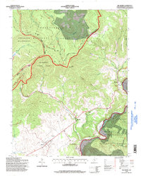
 1977 Edray1978 Print · USGSCovers Marlinton, including Edray, Harter, and other nearby areas
 - 1977 Map of Marlinton, 1978 Print
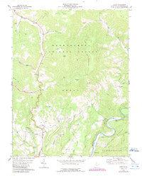
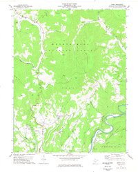
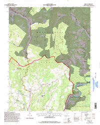
 1977 Marlinton1978 Print · USGSCovers Marlinton, including Huntersville, Beard Heights, and other nearby areas
 - 1977 Map of Hillsboro, 1978 Print
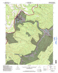
 1977 Hillsboro1978 Print · USGSCovers Marlinton, including Hillsboro, Raintown, and other nearby areas2 unique versions available
 - 1979 Map of Marlinton, 1982 Print
 1979 Marlinton1982 Print · USGSCovers Marlinton, including Summersville, Richwood, and other nearby areas
 - 1995 Map of Edray, 1998 Print
 1995 Edray1998 Print · USGSCovers Marlinton, including Edray, Harter, and other nearby areas
 - 1995 Map of Marlinton, 1998 Print
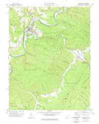
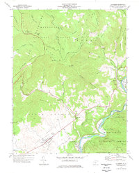
 1995 Marlinton1998 Print · USGSCovers Marlinton, including Huntersville, Beard Heights, and other nearby areas
 - 1995 Map of Hillsboro, 1998 Print
 1995 Hillsboro1998 Print · USGSCovers Marlinton, including Hillsboro, Raintown, and other nearby areas
End of results
Showing maps 1-18 of 18
Top cities near Marlinton
Top neighborhoods of Marlinton
Frequently asked questions
- What are the different types of historical maps available for Marlinton?
- What is the oldest map of Marlinton?
- Where can I purchase historical maps of Marlinton for my home or office?
- Where can I download high-res historical maps of Marlinton?
- Are there historical topographic maps available for Marlinton?
- Is there historical aerial imagery available for Marlinton?
- Where are historical maps of Marlinton sourced from?