1900-1909 Maps of Emma, West Virginia
Explore 2 historic maps of Emma from 1900-1909. These maps offer a rare glimpse into what life looked like during the 1900s — showing old roads, neighborhoods, homes, and landmarks that have changed or disappeared over time.
Whether you're researching your family's past, planning a metal detecting trip, or studying how Emma's landscape evolved across the 1900s, these high-resolution maps are a powerful tool for exploring the history of this region.
- Focus on a specific era: All maps on this page are from the 1900s, giving you a focused view of this time period.
- See what’s changed: Compare century-old streets, trails, and buildings to today's modern landscape using overlays and satellite layers.
- Research with precision: Use these maps for genealogy, historical research, land use analysis, or educational projects.
- View, download, or print: Maps are fully viewable online in high resolution, and can be downloaded or printed for your own records.
Start exploring Emma's history through authentic maps from the 1900s. This is your window into the past.
Emma, WV maps
(2)- 1906 Map of Kenna, 1959 Print
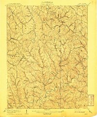
 1906 Kenna1959 Print · USGSThe West Virginia hills north of Charleston appear in this early century survey of the Jackson and Kanawha county border. Researchers can locate early homesteads and community hubs like Sissonville, the Emma Belle School, and Staats Mills.
 - 1907 Map of Kenna
 1907 Kenna1907 Print · USGSThe hill country of Jackson and Kanawha counties is captured here in the early twentieth century as a landscape of isolated valley farms and ridge-top communities. Genealogists can trace family footprints through rural centers like Sissonville, Staats Mills, and White Chapel.3 unique versions available
End of results
Showing maps 1-2 of 2
Top cities near Emma
- Ripley historical maps
- Winfield historical maps
- Eleanor historical maps
- Poca historical maps
- Bancroft historical maps
Frequently asked questions
- What are the different types of historical maps available for Emma?
- What is the oldest map of Emma?
- Where can I purchase historical maps of Emma for my home or office?
- Where can I download high-res historical maps of Emma?
- Are there historical topographic maps available for Emma?
- Is there historical aerial imagery available for Emma?
- Where are historical maps of Emma sourced from?