Old Maps of Thornhill Addition, West Virginia for Genealogy
Trace your family roots with 15 historic maps of Thornhill Addition. These high-res maps reveal old neighborhoods, homesites, landmarks, and streets — helping you uncover where your ancestors lived and how the area evolved over time.
- Explore historic neighborhoods: Identify where your relatives may have lived in the 1800s or 1900s.
- Compare maps over time: Trace the changes in streets, buildings, and landmarks for multi-generational research.
- Perfect for genealogy & ancestry research: Used by family historians and researchers to map out lineage and migration.
These maps are an incredible resource for exploring your personal connection to Thornhill Addition's past.
Thornhill Addition, WV maps
(15)- 1906 Map of Winfield, 1961 Print
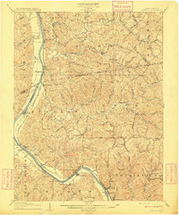
 1906 Winfield1961 Print · USGSThe Kanawha River valley at the turn of the century shows a landscape defined by river locks and the growing influence of the railroad. Genealogists and historians can trace old homesteads and landings from Redhouse Shoals to the small village of Confidence.
 - 1908 Map of Winfield
 1908 Winfield1908 Print · USGSThe Kanawha River valley at the turn of the century shows a landscape defined by river traffic and rail expansion. Genealogists and historians can trace riverside settlements like Winfield and Buffalo, or find lost rail stops and river locks including Lock No 10 and Black Betsey.3 unique versions available
 - 1954 Map of Charleston
 1954 Charleston1954 Print · USGSWest Virginia’s industrial heart and mountain highlands are captured here during the mid-fifties, centered on the capital city. Researchers can trace historic river-and-rail corridors along the Kanawha River and locate remote peaks within the Monongahela National Forest.
 - 1957 Map of Charleston, 1966 Print
 1957 Charleston1966 Print · USGSMid-century West Virginia unfolds along the industrial Kanawha River valley and into the high Allegheny Mountains. Genealogists and historians can trace the vital rail lines of the Chesapeake and Ohio and locate riverside settlements from Saint Albans to Buckhannon.3 unique versions available
 - 1958 Map of Charleston
 1958 Charleston1958 Print · USGSMid-century West Virginia is defined here by the industrial corridor of the Kanawha River and the high ridges of the Allegheny Mountains. Researchers can trace the rail networks of the New York Central or locate remote highland communities like Pickens and Hillsboro.
 - 1958 Map of Bancroft, 1960 Print
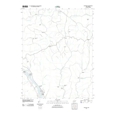
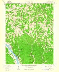 1958 Bancroft1960 Print · USGSIn the late fifties, the West Virginia hills near Bancroft retained their traditional upland settlement patterns. Genealogists and historians can trace the ridges and hollows that defined early homesteads, from Sandhill Ridge to the community at Extra.2 unique versions available
 - 1961 Map of Charleston
 1961 Charleston1961 Print · USGSWest Virginia's capital region and the highlands to the east are shown in detail during the early sixties. Genealogists and historians can trace rail networks like the Baltimore and Ohio RR and find early state parks such as Watoga State Park.
 - 1976 Map of Bancroft, 1980 Print
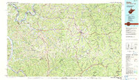
 1976 Bancroft1980 Print · USGSThe Kanawha River valley in the mid-seventies shows a landscape shaped by river commerce and steep ridges. Trace the local settlement patterns of Bancroft and Hometown or locate the upland clearings around Confidence and Heizer.
 - 1984 Map of Ripley
 1984 Ripley1984 Print · USGSThe West Virginia riverfront and interior highlands are captured here in the mid-eighties as energy production reshaped the landscape. Researchers can trace the Ohio River industrial corridor through Ravenswood or locate smaller inland communities like Gandeeville and Reedy.
 - 1999 Map of Bancroft, 2000 Print
 1999 Bancroft2000 Print · USGSThe Kanawha River corridor near the turn of the millennium shows a landscape defined by industrial riverside towns and high-ridge rural settlements. Researchers can trace family sites at Wade Chapel, the riverfront community of Black Betsey, or the upland Oklahoma Sch.
 - 2011 Map of Bancroft, 2011 Print
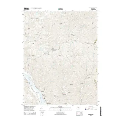
 2011 Bancroft2011 Print · USGSCovers Thornhill Addition, including Winfield, Bancroft, and other nearby areas
 - 2014 Map of Bancroft, 2014 Print
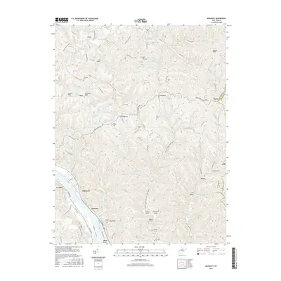
 2014 Bancroft2014 Print · USGSCovers Thornhill Addition, including Winfield, Bancroft, and other nearby areas
 - 2016 Map of Bancroft, 2016 Print
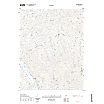
 2016 Bancroft2016 Print · USGSCovers Thornhill Addition, including Winfield, Bancroft, and other nearby areas
 - 2019 Map of Bancroft, 2019 Print
 2019 Bancroft2019 Print · USGSCovers Thornhill Addition, including Winfield, Bancroft, and other nearby areas
 - 2023 Map of Bancroft, 2023 Print
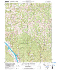
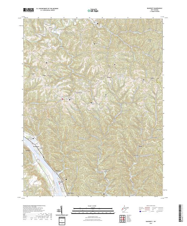 2023 Bancroft2023 Print · USGSThe Kanawha River valley and its surrounding ridges come alive in this contemporary record of West Virginia's heartland. Genealogists can trace family names and burial sites at Schowen Cem, Wade Chapel Cem, and the riverfront community of Black Betsey.
End of results
Showing maps 1-15 of 15
Top cities near Thornhill Addition
- Charleston historical maps
- Teays Valley historical maps
- South Charleston historical maps
- Saint Albans historical maps
- St. Albans historical maps
- Dunbar historical maps
See more
Frequently asked questions
- What are the different types of historical maps available for Thornhill Addition?
- What is the oldest map of Thornhill Addition?
- Where can I purchase historical maps of Thornhill Addition for my home or office?
- Where can I download high-res historical maps of Thornhill Addition?
- Are there historical topographic maps available for Thornhill Addition?
- Is there historical aerial imagery available for Thornhill Addition?
- Where are historical maps of Thornhill Addition sourced from?