Old Maps of Summers County, West Virginia for Academic Research
Study the evolution of Summers County with 61 high-resolution historic maps. Whether you're teaching, researching, or modeling changes in land use, these maps provide essential visual documentation of urban, environmental, and geographic change.
- Analyze long-term change: Track patterns in development, transportation, and natural features.
- Ideal for environmental or urban studies: Support academic projects with primary historical map data.
- Use in the classroom or lab: Educators and researchers rely on these maps to bring historical context to life.
These maps are a powerful tool for teaching, research, and visualizing how Summers County has changed over the decades.
Summers County, WV maps
(61)- 1887 Map of Hinton
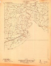
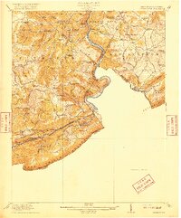
 1887 Hinton1887 Print · USGSSouthern West Virginia’s rugged river corridors and mineral spring resorts come alive in this late nineteenth-century survey. Trace the rail-and-river economy through the Big Bend Tunnel, the Greenbrier Stock Yards, and the historic springs at Red Sulphur Springs.
 - 1890 Map of Dublin
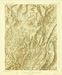
 1890 Dublin1890 Print · USGSThe mountainous borderlands of Virginia and West Virginia are captured here in the late nineteenth century as industry and rail expanded along the New River. Genealogists and historians can trace the foundations of local commerce through sites like Pearisburg, the Belle Hampton Mine, and river crossings at Peppers Ferry.
 - 1891 Map of Dublin
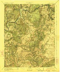
 1891 Dublin1891 Print · USGSAcross Southwest Virginia and West Virginia in the late nineteenth century, the river and rail lines dictated the pace of mountain life. Genealogists can trace family footprints through numerous river crossings like Ingles Ferry and historic industry sites like Altoona Mines and Mercers Salt Works.9 unique versions available
 - 1891 Map of Raleigh
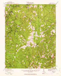
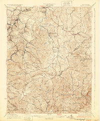
 1891 Raleigh1891 Print · USGSRaleigh County and the New River Gorge are captured in the late nineteenth century during the initial rise of the coal industry. Genealogists can trace family holdings along Paint Creek or locate early river settlements such as Quinnimont and Fire Creek.
 - 1892 Map of Hinton
 1892 Hinton1892 Print · USGSSouthern West Virginia in the late nineteenth century centers on the river-and-rail hub of Hinton and the high ridges of the Alleghenies. Researchers can trace early railroad engineering at the Big Bend Tunnel or locate historic mineral spring resorts like Salt Sulphur Springs and Blue Sulphur Springs.5 unique versions available
 - 1897 Map of Raleigh
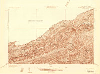
 1897 Raleigh1897 Print · USGSThe New River Gorge area at the height of the coal and rail boom comes to life on this late nineteenth-century sheet. Genealogists and historians can trace riverside rail stops like Thurmond and Glenjean, or explore the high-plateau settlement at Marshes P.O. (Trap Hill).
 - 1902 Map of Raleigh
 1902 Raleigh1902 Print · USGSRaleigh County and the New River Gorge were entering their industrial peak when this survey was conducted in the late nineteenth century. Researchers can trace the early rail network of the CHESAPEAKE AND OHIO RR through booming towns like Thurmond, Beury, and East Sewell.3 unique versions available
 - 1911 Map of Flattop
 1911 Flattop1911 Print · USGSSouthern West Virginia’s coal and timber country comes into focus just as the railroads transformed these ridges and hollows. Genealogists can trace dozens of rural schoolhouses and family-named landmarks like Huff Knob, Egeria, and the VIRGINIAN RY corridor.
 - 1912 Map of Meadow Creek
 1912 Meadow Creek1912 Print · USGSWest Virginia's Fayette and Greenbrier borderlands are captured here in the early twentieth century, showing a landscape of timber and mountain settlements. Genealogists can locate dozens of country schools like Rock of Ages School and Eureka School, alongside the Sandstone Falls on the New River.3 unique versions available
 - 1912 Map of Big Bend, 1964 Print
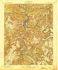
 1912 Big Bend1964 Print · USGSSummers County at the height of the steam era reveals a landscape shaped by the meeting of the Greenbrier and New Rivers. You can trace the path of the Chesapeake and Ohio RR through the Big Bend Tunnel or locate long-lost rural schools like Rock Bottom School and Spicklick School.
 - 1913 Map of Peterstown
 1913 Peterstown1913 Print · USGSPeterstown and the New River valley are captured in the early twentieth century as the railroad transformed these mountain borderlands. Genealogists and historians can trace dozens of rural schoolhouses and stops like Willowton PO, Shanklins Ferry, and Oakvale.
 - 1914 Map of Big Bend
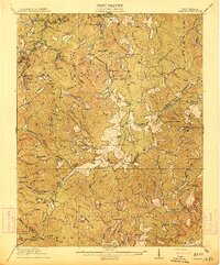
 1914 Big Bend1914 Print · USGSIn the early twentieth century, the New River valley was a bustling corridor defined by its railroads and mountain settlements. Genealogists can trace family footprints at Packs Ferry PO, the Big Bend Tunnel, and numerous rural sites like Indian Mills.4 unique versions available
 - 1914 Map of Flattop
 1914 Flattop1914 Print · USGSSouthern West Virginia in the early twentieth century was a landscape of steep coal hollows and high-altitude ridge farming. Genealogists can locate dozens of country schools like Chestnut Ridge School and Phillips School alongside the emerging rail lines at Winding Gulf.2 unique versions available
 - 1915 Map of Meadow Creek
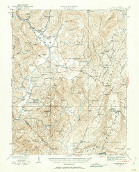
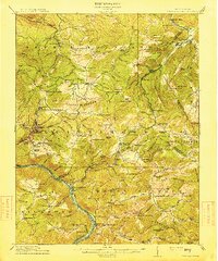 1915 Meadow Creek1915 Print · USGSThe West Virginia highlands come to life in this detailed survey of the mountain ridges and river valleys just before the First World War. Genealogists can locate dozens of country schools and remote post offices like Rock of Ages School, Brownwood Lawton P.O., and Layland.3 unique versions available
 - 1916 Map of Peterstown
 1916 Peterstown1916 Print · USGSMonroe and Mercer Counties are seen here in the decade before the First World War, defined by steep ridges and the critical rail corridors of the New River valley. Genealogists can locate dozens of country schools and remote landmarks like Mauvern Saltworks, Goodwin Chapel, and Shanklins Ferry.2 unique versions available
 - 1921 Map of Alderson
 1921 Alderson1921 Print · USGSThe Greenbrier River valley and the West Virginia highlands come alive in the early 1920s, showing the region's rail-dependent economy and rural school networks. Researchers can trace family roots at Nickels Mill, Spider Den School, and the settlement of Sinks Grove.3 unique versions available
 - 1921 Map of Clintonville
 1921 Clintonville1921 Print · USGSGreenbrier County is captured in the early twentieth century as a landscape of mountain ridges and valley settlements connected by the historic James River and Kanawha Turnpike. Researchers can locate dozens of family-named landmarks, including Baker Mill, Maude Chapel, and the famous mineral waters at Blue Sulphur Springs.
 - 1923 Map of Clintonville
 1923 Clintonville1923 Print · USGSGreenbrier County in the early twenties was a landscape of remote mountain valleys and thermal springs connected by early turnpikes. Researchers can trace ancestral farmsteads near Blue Sulphur Springs, Sam Black Church, and the many district schools like Sugar Grove School.2 unique versions available
 - 1923 Map of Alderson
 1923 Alderson1923 Print · USGSMonroe and Greenbrier Counties are shown here in the early 1920s, a landscape defined by mineral springs and a dense network of rural schoolhouses. Researchers can locate dozens of local sites like Hokes Mill, Sinks Grove P O, and the Spider Den School.3 unique versions available
 - 1925 Map of Peterstown
 1925 Peterstown1925 Print · USGSThe border of West Virginia and Virginia is captured in the mid-1920s, dominated by the winding path of the New River and the steep slopes of Peters Mtn. Genealogists can trace family locations near Mercers Saltworks, Wills Sta Willowton PO, and the Scratchgravel School.
 - 1929 Map of Flattop, 1963 Print
 1929 Flattop1963 Print · USGSRaleigh County and the surrounding coalfields are seen here during the 1920s mining boom. Researchers can trace the legacy of mountain communities through dozens of rural landmarks like Blue Jay Mine No 7, Vine Chapel, and Chestnut Ridge School.
 - 1932 Map of Flattop
 1932 Flattop1932 Print · USGSCoal and rail activity dominate the valleys of southern West Virginia in the early thirties. Trace the mining towns along the Virginian RR and locate local landmarks like Blue Jay Mine No 7, Vine Chapel, and Flattop School.2 unique versions available
 - 1932 Map of Peterstown
 1932 Peterstown1932 Print · USGSThe borderlands of Giles and Mercer counties come alive in the early 1930s as the New River carves a path through the Appalachian ridges. Trace the rail-and-river economy of Narrows and find family-named landmarks like Blankenship Sch and Cedar Grove Ch.3 unique versions available
 - 1935 Map of Clintonville, 1962 Print
 1935 Clintonville1962 Print · USGSGreenbrier County is captured here in the mid-1930s, showing a landscape defined by small farming hamlets and a remarkable density of rural schools. Researchers can locate family landmarks like Berrys Mill, the landmark Sam Black Church, and the mineral waters of Blue Sulphur Springs.
 - 1937 Map of Narrows
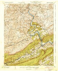 1937 Narrows1937 Print · USGSThe New River corridor comes alive in the late 1930s, showing the vital rail and river connections between Virginia and West Virginia. Genealogists and historians can locate dozens of country schools, family-named ridges, and landmarks like Shanklins Ferry and Mercers Saltworks.4 unique versions available
Showing maps 1-25 of 61
Top cities of Summers County
Frequently asked questions
- What are the different types of historical maps available for Summers County?
- What is the oldest map of Summers County?
- Where can I purchase historical maps of Summers County for my home or office?
- Where can I download high-res historical maps of Summers County?
- Are there historical topographic maps available for Summers County?
- Is there historical aerial imagery available for Summers County?
- Where are historical maps of Summers County sourced from?