Old Maps of Taylor County, West Virginia for Academic Research
Study the evolution of Taylor County with 40 high-resolution historic maps. Whether you're teaching, researching, or modeling changes in land use, these maps provide essential visual documentation of urban, environmental, and geographic change.
- Analyze long-term change: Track patterns in development, transportation, and natural features.
- Ideal for environmental or urban studies: Support academic projects with primary historical map data.
- Use in the classroom or lab: Educators and researchers rely on these maps to bring historical context to life.
These maps are a powerful tool for teaching, research, and visualizing how Taylor County has changed over the decades.
Taylor County, WV maps
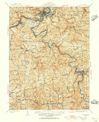
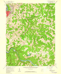
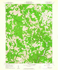
(40)- 1886 Map of St. George
 1886 St. George1886 Print · USGSCovers Taylor County, including Grafton, Kingwood, and other nearby areas
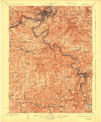
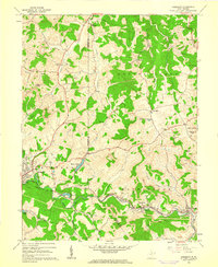
 - 1891 Map of St. George, 1895 Print
 1891 St. George1895 Print · USGSCovers Taylor County, including Grafton, Kingwood, and other nearby areas3 unique versions available
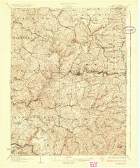
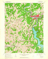
 - 1902 Map of Fairmont
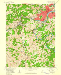
 1902 Fairmont1902 Print · USGSCovers Taylor County, including Fairmont, Clarksburg, and other nearby areas4 unique versions available
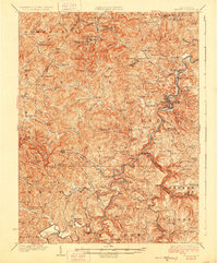
 - 1904 Map of Philippi
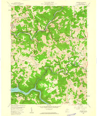
 1904 Philippi1904 Print · USGSCovers Taylor County, including Buckhannon, Philippi, and other nearby areas2 unique versions available
 - 1907 Map of Thornton
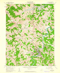
 1907 Thornton1907 Print · USGSCovers Taylor County, including Grafton, Newburg, and other nearby areas2 unique versions available
 - 1923 Map of Fairmont, 1956 Print
 1923 Fairmont1956 Print · USGSCovers Taylor County, including Fairmont, Clarksburg, and other nearby areas2 unique versions available
 - 1925 Map of Philippi, 1954 Print
 1925 Philippi1954 Print · USGSCovers Taylor County, including Buckhannon, Philippi, and other nearby areas
 - 1926 Map of Fairmont
 1926 Fairmont1926 Print · USGSCovers Taylor County, including Fairmont, Clarksburg, and other nearby areas3 unique versions available
 - 1926 Map of Thornton
 1926 Thornton1926 Print · USGSCovers Taylor County, including Grafton, Newburg, and other nearby areas2 unique versions available
 - 1928 Map of Philippi
 1928 Philippi1928 Print · USGSCovers Taylor County, including Buckhannon, Philippi, and other nearby areas2 unique versions available
 - 1948 Map of Cumberland
 1948 Cumberland1948 Print · USGSCovers Taylor County, including Morgantown, Winchester, and other nearby areas3 unique versions available
 - 1949 Map of Clarksburg
 1949 Clarksburg1949 Print · USGSCovers Taylor County, including Parkersburg, Zanesville, and other nearby areas
 - 1952 Map of Cumberland
 1952 Cumberland1952 Print · USGSCovers Taylor County, including Morgantown, Winchester, and other nearby areas
 - 1956 Map of Cumberland, 1966 Print
 1956 Cumberland1966 Print · USGSCovers Taylor County, including Morgantown, Winchester, and other nearby areas6 unique versions available
 - 1956 Map of Clarksburg, 1966 Print
 1956 Clarksburg1966 Print · USGSCovers Taylor County, including Parkersburg, Zanesville, and other nearby areas2 unique versions available
 - 1957 Map of Cumberland
 1957 Cumberland1957 Print · USGSCovers Taylor County, including Morgantown, Winchester, and other nearby areas
 - 1958 Map of Fairmont East, 1959 Print
 1958 Fairmont East1959 Print · USGSCovers Taylor County, including Fairmont, Forksburg, and other nearby areas3 unique versions available
 - 1958 Map of Fairmont West, 1960 Print
 1958 Fairmont West1960 Print · USGSCovers Taylor County, including Fairmont, Pleasant Valley, and other nearby areas4 unique versions available
 - 1958 Map of Thornton, 1960 Print
 1958 Thornton1960 Print · USGSCovers Taylor County, including Grafton, Claude, and other nearby areas4 unique versions available
 - 1960 Map of Philippi, 1961 Print
 1960 Philippi1961 Print · USGSCovers Taylor County, including Philippi, Berryburg, and other nearby areas3 unique versions available
 - 1960 Map of Gladesville, 1961 Print
 1960 Gladesville1961 Print · USGSCovers Taylor County, including Irontown, Halleck, and other nearby areas4 unique versions available
 - 1960 Map of Rosemont, 1962 Print
 1960 Rosemont1962 Print · USGSCovers Taylor County, including Clarksburg, Bridgeport, and other nearby areas3 unique versions available
 - 1960 Map of Grafton, 1963 Print
 1960 Grafton1963 Print · USGSCovers Taylor County, including Grafton, Flemington, and other nearby areas3 unique versions available
 - 1961 Map of Clarksburg
 1961 Clarksburg1961 Print · USGSCovers Taylor County, including Parkersburg, Zanesville, and other nearby areas
 - 1961 Map of Cumberland
 1961 Cumberland1961 Print · USGSCovers Taylor County, including Morgantown, Winchester, and other nearby areas
Showing maps 1-25 of 40
Top cities of Taylor County
Frequently asked questions
- What are the different types of historical maps available for Taylor County?
- What is the oldest map of Taylor County?
- Where can I purchase historical maps of Taylor County for my home or office?
- Where can I download high-res historical maps of Taylor County?
- Are there historical topographic maps available for Taylor County?
- Is there historical aerial imagery available for Taylor County?
- Where are historical maps of Taylor County sourced from?