Old Maps of Taylor County, West Virginia for Genealogy
Trace your family roots with 40 historic maps of Taylor County. These high-res maps reveal old neighborhoods, homesites, landmarks, and streets — helping you uncover where your ancestors lived and how the area evolved over time.
- Explore historic neighborhoods: Identify where your relatives may have lived in the 1800s or 1900s.
- Compare maps over time: Trace the changes in streets, buildings, and landmarks for multi-generational research.
- Perfect for genealogy & ancestry research: Used by family historians and researchers to map out lineage and migration.
These maps are an incredible resource for exploring your personal connection to Taylor County's past.
Taylor County, WV maps
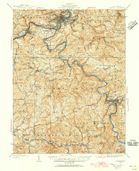
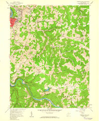
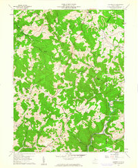
(40)- 1886 Map of St. George
 1886 St. George1886 Print · USGSCovers Taylor County, including Grafton, Kingwood, and other nearby areas
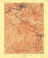
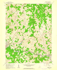
 - 1891 Map of St. George, 1895 Print
 1891 St. George1895 Print · USGSCovers Taylor County, including Grafton, Kingwood, and other nearby areas3 unique versions available
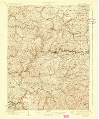
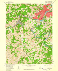
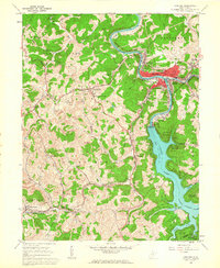
 - 1902 Map of Fairmont
 1902 Fairmont1902 Print · USGSCovers Taylor County, including Fairmont, Clarksburg, and other nearby areas4 unique versions available
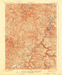
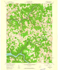
 - 1904 Map of Philippi
 1904 Philippi1904 Print · USGSCovers Taylor County, including Buckhannon, Philippi, and other nearby areas2 unique versions available
 - 1907 Map of Thornton
 1907 Thornton1907 Print · USGSCovers Taylor County, including Grafton, Newburg, and other nearby areas2 unique versions available
 - 1923 Map of Fairmont, 1956 Print
 1923 Fairmont1956 Print · USGSCovers Taylor County, including Fairmont, Clarksburg, and other nearby areas2 unique versions available
 - 1925 Map of Philippi, 1954 Print
 1925 Philippi1954 Print · USGSCovers Taylor County, including Buckhannon, Philippi, and other nearby areas
 - 1926 Map of Fairmont
 1926 Fairmont1926 Print · USGSCovers Taylor County, including Fairmont, Clarksburg, and other nearby areas3 unique versions available
 - 1926 Map of Thornton
 1926 Thornton1926 Print · USGSCovers Taylor County, including Grafton, Newburg, and other nearby areas2 unique versions available
 - 1928 Map of Philippi
 1928 Philippi1928 Print · USGSCovers Taylor County, including Buckhannon, Philippi, and other nearby areas2 unique versions available
 - 1948 Map of Cumberland
 1948 Cumberland1948 Print · USGSCovers Taylor County, including Morgantown, Winchester, and other nearby areas3 unique versions available
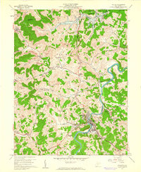
 - 1949 Map of Clarksburg
 1949 Clarksburg1949 Print · USGSCovers Taylor County, including Parkersburg, Zanesville, and other nearby areas
 - 1952 Map of Cumberland
 1952 Cumberland1952 Print · USGSCovers Taylor County, including Morgantown, Winchester, and other nearby areas
 - 1956 Map of Cumberland, 1966 Print
 1956 Cumberland1966 Print · USGSCovers Taylor County, including Morgantown, Winchester, and other nearby areas6 unique versions available
 - 1956 Map of Clarksburg, 1966 Print
 1956 Clarksburg1966 Print · USGSCovers Taylor County, including Parkersburg, Zanesville, and other nearby areas2 unique versions available
 - 1957 Map of Cumberland
 1957 Cumberland1957 Print · USGSCovers Taylor County, including Morgantown, Winchester, and other nearby areas
 - 1958 Map of Fairmont East, 1959 Print
 1958 Fairmont East1959 Print · USGSCovers Taylor County, including Fairmont, Forksburg, and other nearby areas3 unique versions available
 - 1958 Map of Fairmont West, 1960 Print
 1958 Fairmont West1960 Print · USGSCovers Taylor County, including Fairmont, Pleasant Valley, and other nearby areas4 unique versions available
 - 1958 Map of Thornton, 1960 Print
 1958 Thornton1960 Print · USGSCovers Taylor County, including Grafton, Claude, and other nearby areas4 unique versions available
 - 1960 Map of Philippi, 1961 Print
 1960 Philippi1961 Print · USGSCovers Taylor County, including Philippi, Berryburg, and other nearby areas3 unique versions available
 - 1960 Map of Gladesville, 1961 Print
 1960 Gladesville1961 Print · USGSCovers Taylor County, including Irontown, Halleck, and other nearby areas4 unique versions available
 - 1960 Map of Rosemont, 1962 Print
 1960 Rosemont1962 Print · USGSCovers Taylor County, including Clarksburg, Bridgeport, and other nearby areas3 unique versions available
 - 1960 Map of Grafton, 1963 Print
 1960 Grafton1963 Print · USGSCovers Taylor County, including Grafton, Flemington, and other nearby areas3 unique versions available
 - 1961 Map of Clarksburg
 1961 Clarksburg1961 Print · USGSCovers Taylor County, including Parkersburg, Zanesville, and other nearby areas
 - 1961 Map of Cumberland
 1961 Cumberland1961 Print · USGSCovers Taylor County, including Morgantown, Winchester, and other nearby areas
Showing maps 1-25 of 40
Top cities of Taylor County
Frequently asked questions
- What are the different types of historical maps available for Taylor County?
- What is the oldest map of Taylor County?
- Where can I purchase historical maps of Taylor County for my home or office?
- Where can I download high-res historical maps of Taylor County?
- Are there historical topographic maps available for Taylor County?
- Is there historical aerial imagery available for Taylor County?
- Where are historical maps of Taylor County sourced from?