Old Maps of Canaan Crossing, West Virginia for Metal Detecting
Plan your next treasure hunt with 15 historic maps of Canaan Crossing. Find old homesites, ghost towns, trails, and gathering spots that may be lost to time — perfect for identifying promising metal detecting locations.
- Locate forgotten sites: Uncover places like long-lost settlements, abandoned rail lines, or gathering spots.
- Plan better hunts: Use map overlays combined with LiDAR or satellite views to narrow in on historically rich areas.
- Made for detectorists: Thousands of hobbyists use these maps to discover relics, coins, and hidden history.
Use these historic maps to boost your research and find new opportunities beneath the surface of Canaan Crossing.
Canaan Crossing, WV maps
(15)- 1892 Map of Franklin
 1892 Franklin1892 Print · USGSPendleton County and the Potomac Highlands are shown here in the 1890s, organized by the dramatic ridges and river valleys of the Alleghanies. Researchers can trace historic homesteads and early post offices at Fort Seybert, Upper Tract, and the riverside crossroads of Kline Cross Roads.
 - 1896 Map of Franklin, 1907 Print
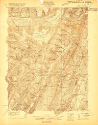
 1896 Franklin1907 Print · USGSThe Potomac River's headwaters and the high ridges of the Alleghenies are documented here in the final years of the nineteenth century. Genealogists and local historians can trace early valley communities like Fort Seybert, Sugar Grove, and the mills at Harper Mill.4 unique versions available
 - 1920 Map of Onego, 1959 Print
 1920 Onego1959 Print · USGSPendleton and Grant counties in the early twentieth century are shown here as a landscape of isolated mountain communities and riverside hamlets. Researchers can trace family-named landmarks and long-standing institutions like the Germany Settlement, Mouth of Seneca, and the Evergreen Church.2 unique versions available
 - 1921 Map of Onego
 1921 Onego1921 Print · USGSThe West Virginia highlands in the early 1920s reveal a network of isolated mountain schools and valley settlements. Genealogists can trace family roots through landmarks like Onego, High Rock Church, and the Boggs School near Seneca Rock.2 unique versions available
 - 1922 Map of Onego
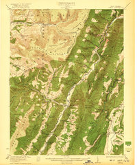 1922 Onego1922 Print · USGSPendleton County's high ridges and river valleys are captured here in the early 1920s as the Monongahela National Forest was being established. Genealogists and hikers can locate old mountain homesteads, numerous remote schools like Keel Spring School, and the iconic Seneca Rock.2 unique versions available
 - 1949 Map of Charlottesville
 1949 Charlottesville1949 Print · USGSThe Shenandoah Valley and Blue Ridge appear in the late 1940s as a thriving corridor of rail and river commerce. Researchers can trace the mid-century footprints of Harrisonburg, Staunton, and Culpeper alongside the historic routes of the Southern Railway.2 unique versions available
 - 1956 Map of Charlottesville, 1966 Print
 1956 Charlottesville1966 Print · USGSThe Shenandoah Valley and Blue Ridge are captured in detail during the mid-1960s as the modern interstate system began to emerge. Genealogists and historians can trace rail-connected hubs like Waynesboro or follow the river paths of the Rapidan River and Rivanna River.4 unique versions available
 - 1969 Map of Laneville, 1973 Print
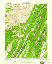
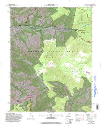
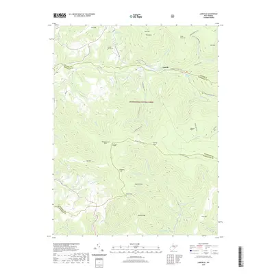
 1969 Laneville1973 Print · USGSThe West Virginia highlands are shown in detail during the late sixties as conservation and recreation areas expanded. Researchers can trace family sites and local landmarks like Flanagan Memorial Cem, the Wolford Ch, and the high plateau at Roaring Plains.3 unique versions available
 - 1981 Map of Elkins, 1983 Print
 1981 Elkins1983 Print · USGSThe West Virginia mountains in the early eighties were a hub of rail-based industry and emerging conservation lands. Genealogists and historians can trace the paths of the Western Maryland RR through Elkins and locate small upland communities like Harpertown, Bowden, and Wymer.
 - 1995 Map of Laneville, 1998 Print
 1995 Laneville1998 Print · USGSHigh Allegheny plateaus and the headwaters of Red Creek define this West Virginia mountain landscape during the mid-1990s. Researchers can locate remote sites like Flanagan Memorial Cem, the Bethel Ch, and landmarks like Thunderstruck Rock.
 - 2011 Map of Laneville, 2011 Print
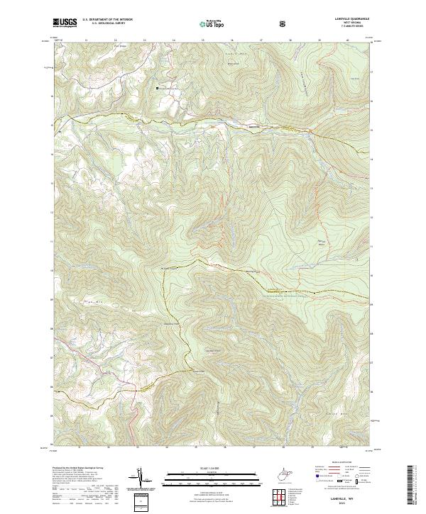
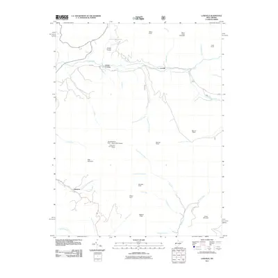 2011 Laneville2011 Print · USGSCovers Canaan Crossing, including Harperton, Stringtown, and other nearby areas
 - 2014 Map of Laneville, 2014 Print
 2014 Laneville2014 Print · USGSCovers Canaan Crossing, including Harperton, Stringtown, and other nearby areas
 - 2016 Map of Laneville, 2016 Print
 2016 Laneville2016 Print · USGSCovers Canaan Crossing, including Harperton, Stringtown, and other nearby areas
 - 2019 Map of Laneville, 2019 Print
 2019 Laneville2019 Print · USGSCovers Canaan Crossing, including Harperton, Stringtown, and other nearby areas
 - 2023 Map of Laneville, 2023 Print
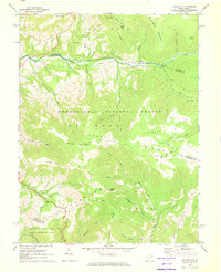
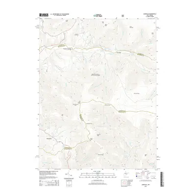
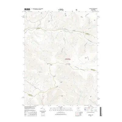
 2023 Laneville2023 Print · USGSThe high plateau of the Allegheny Front is documented in this recent survey, capturing the remote watershed of the Red Creek. Researchers can locate legacy family landmarks like the Flanagan Memorial Cemetery and numerous named springs including Wyatt Farm Spring.
End of results
Showing maps 1-15 of 15
Top cities near Canaan Crossing
- Parsons historical maps
- Davis historical maps
- Thomas historical maps
- Hendricks historical maps
- Hambleton historical maps
- Harman historical maps
Frequently asked questions
- What are the different types of historical maps available for Canaan Crossing?
- What is the oldest map of Canaan Crossing?
- Where can I purchase historical maps of Canaan Crossing for my home or office?
- Where can I download high-res historical maps of Canaan Crossing?
- Are there historical topographic maps available for Canaan Crossing?
- Is there historical aerial imagery available for Canaan Crossing?
- Where are historical maps of Canaan Crossing sourced from?