2000s (21st Century) Maps of Stringtown, West Virginia
Explore 1 historic maps of Stringtown from the 2000s (21st Century). These maps offer a rare glimpse into what life looked like during the 2000s — showing old roads, neighborhoods, homes, and landmarks that have changed or disappeared over time.
Whether you're researching your family's past, planning a metal detecting trip, or studying how Stringtown's landscape evolved across the 2000s, these high-resolution maps are a powerful tool for exploring the history of this region.
- Focus on a specific era: All maps on this page are from the 2000s, giving you a focused view of this time period.
- See what’s changed: Compare century-old streets, trails, and buildings to today's modern landscape using overlays and satellite layers.
- Research with precision: Use these maps for genealogy, historical research, land use analysis, or educational projects.
- View, download, or print: Maps are fully viewable online in high resolution, and can be downloaded or printed for your own records.
Start exploring Stringtown's history through authentic maps from the 2000s. This is your window into the past.
Stringtown, WV maps
(1)- 2023 Map of Laneville, 2023 Print
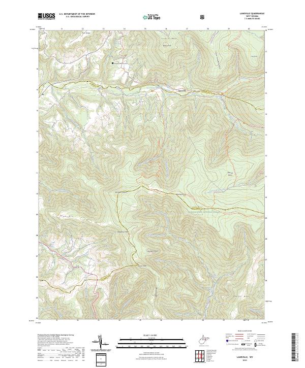 2023 Laneville2023 Print · USGSThe high plateau of the Allegheny Front is documented in this recent survey, capturing the remote watershed of the Red Creek. Researchers can locate legacy family landmarks like the Flanagan Memorial Cemetery and numerous named springs including Wyatt Farm Spring.
End of results
Showing maps 1-1 of 1
Top cities near Stringtown
- Parsons historical maps
- Davis historical maps
- Thomas historical maps
- Hendricks historical maps
- Hambleton historical maps
- Harman historical maps
Frequently asked questions
- What are the different types of historical maps available for Stringtown?
- What is the oldest map of Stringtown?
- Where can I purchase historical maps of Stringtown for my home or office?
- Where can I download high-res historical maps of Stringtown?
- Are there historical topographic maps available for Stringtown?
- Is there historical aerial imagery available for Stringtown?
- Where are historical maps of Stringtown sourced from?