1970s Maps of Palace Valley, West Virginia
Explore 2 historic maps of Palace Valley from the 1970s. These maps offer a rare glimpse into what life looked like during the 1970s — showing old roads, neighborhoods, homes, and landmarks that have changed or disappeared over time.
Whether you're researching your family's past, planning a metal detecting trip, or studying how Palace Valley's landscape evolved across the 1970s, these high-resolution maps are a powerful tool for exploring the history of this region.
- Focus on a specific era: All maps on this page are from the 1970s, giving you a focused view of this time period.
- See what’s changed: Compare century-old streets, trails, and buildings to today's modern landscape using overlays and satellite layers.
- Research with precision: Use these maps for genealogy, historical research, land use analysis, or educational projects.
- View, download, or print: Maps are fully viewable online in high resolution, and can be downloaded or printed for your own records.
Start exploring Palace Valley's history through authentic maps from the 1970s. This is your window into the past.
Palace Valley, WV maps
(2)- 1974 Map of Alton, 1989 Print
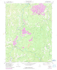 1974 Alton1989 Print · USGSUpshur County’s coal and river valleys are captured here in the mid-seventies, showing a landscape defined by industrial extraction and small settlements. Trace family history at Alton Cem and Indian Camp Ch, or locate old industrial sites like Beans Mill and Alexander.
 - 1977 Map of Alton
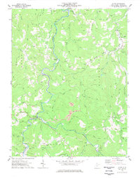 1977 Alton1977 Print · USGSUpshur County’s river valleys and rail lines are captured here in the late seventies, showing the industrial pulse of the Buckhannon River. Researchers can trace genealogy through remote landmarks like Maher Cem, the Stockerts (Site), and small settlements like Palace Valley and Alton.
End of results
Showing maps 1-2 of 2
Top cities near Palace Valley
- Buckhannon historical maps
- Mill Creek historical maps
- Junior historical maps
- Norton historical maps
- Huttonsville historical maps
- Valley Head historical maps
See more
Frequently asked questions
- What are the different types of historical maps available for Palace Valley?
- What is the oldest map of Palace Valley?
- Where can I purchase historical maps of Palace Valley for my home or office?
- Where can I download high-res historical maps of Palace Valley?
- Are there historical topographic maps available for Palace Valley?
- Is there historical aerial imagery available for Palace Valley?
- Where are historical maps of Palace Valley sourced from?