Old Maps of Buffalo Creek, West Virginia for Genealogy
Trace your family roots with 15 historic maps of Buffalo Creek. These high-res maps reveal old neighborhoods, homesites, landmarks, and streets — helping you uncover where your ancestors lived and how the area evolved over time.
- Explore historic neighborhoods: Identify where your relatives may have lived in the 1800s or 1900s.
- Compare maps over time: Trace the changes in streets, buildings, and landmarks for multi-generational research.
- Perfect for genealogy & ancestry research: Used by family historians and researchers to map out lineage and migration.
These maps are an incredible resource for exploring your personal connection to Buffalo Creek's past.
Buffalo Creek, WV maps
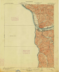
(15)- 1901 Map of Ceredo, 1953 Print
 1901 Ceredo1953 Print · USGSThe tri-state convergence of West Virginia, Ohio, and Kentucky comes alive in this early 20th-century survey of the Ohio River valley. Genealogists and rail historians can trace the vital transport networks of Kenova and Ceredo, alongside family-named landmarks like Walker Br and Rice Run.2 unique versions available
 - 1903 Map of Kenova
 1903 Kenova1903 Print · USGSThe tri-state river junction at Ashland and Kenova was a bustling industrial hub after the turn of the century. Trace early rail lines and mining settlements like Coalton and Boghead, or locate family landmarks along the Little Sandy River and Means Tunnel.5 unique versions available
 - 1904 Map of Kenova
 1904 Kenova1904 Print · USGSThe tri-state confluence of the Ohio River and Big Sandy River hums with early industrial activity at the start of the century. Genealogists can trace rail-side settlements and remote homesteads along Blaine Creek and near Mt Savage or Webbville.
 - 1913 Map of Ceredo
 1913 Ceredo1913 Print · USGSThe confluence of the Ohio and Big Sandy rivers comes alive in this pre-war survey of the West Virginia-Ohio borderlands. Genealogists and rail historians can trace the early footprints of Kenova, Ceredo, and the winding path of Twelvepole Creek.4 unique versions available
 - 1953 Map of Burnaugh, 1956 Print
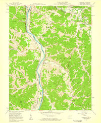
 1953 Burnaugh1956 Print · USGSBoyd County's riverfront and hill country are captured here in the early fifties, following the Big Sandy River and its rail corridor. Genealogists can locate family landmarks like Clarkson Cem, Hall Cem, and the community of Kavanaugh.
 - 1957 Map of Burnaugh, 1959 Print
 1957 Burnaugh1959 Print · USGSThe tri-state border region along the Big Sandy River comes alive in the late fifties, showing the convergence of rail, river, and mountain life. Trace family history through dozens of landmarks like Cyrus Chapel, Durbin Sch, and the U S Veterans Hospital.2 unique versions available
 - 1957 Map of Huntington, 1966 Print
 1957 Huntington1966 Print · USGSThe industrial heart of the Ohio River valley is captured here in the mid-sixties, showing the growth of Huntington and Ashland. Researchers can trace the extensive rail networks of the Chesapeake and Ohio RR and locate sites like the Chief Cornstalk Hunting Ground.3 unique versions available
 - 1960 Map of Huntington
 1960 Huntington1960 Print · USGSThe tri-state river valley thrived in the late fifties as a hub of heavy industry and Appalachian rail transit. Genealogists and historians can trace the connection between river towns like Ashland and Portsmouth or locate family homesteads near Coleman Ridge.
 - 1972 Map of Burnaugh, 1974 Print
 1972 Burnaugh1974 Print · USGSThe river and rail corridor of the Big Sandy River defines this 1970s borderland between Kentucky and West Virginia. Genealogists and local historians can trace family locations through numerous sites like Lockwood Cem, Miller Chapel, and the riverside rail stops at Burnaugh.3 unique versions available
 - 1982 Map of Huntington, 1983 Print
 1982 Huntington1983 Print · USGSThe tri-state region around Huntington and Ashland is shown in the early 1980s, documenting a landscape shaped by river commerce and coal-country railroads. Trace family roots and old routes through Barboursville, the Gas Field, and the Tug Fork valley.
 - 2011 Map of Burnaugh, 2011 Print
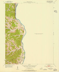
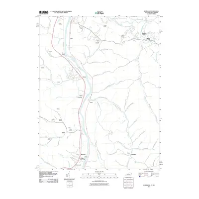 2011 Burnaugh2011 Print · USGSCovers Buffalo Creek, including Centerville, Cyrus, and other nearby areas
 - 2013 Map of Burnaugh, 2013 Print
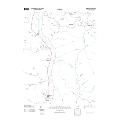 2013 Burnaugh2013 Print · USGSCovers Buffalo Creek, including Centerville, Cyrus, and other nearby areas
 - 2016 Map of Burnaugh, 2016 Print
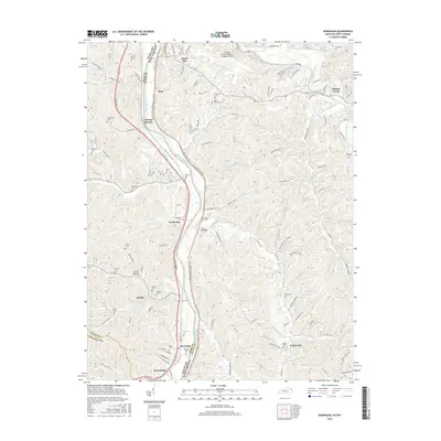 2016 Burnaugh2016 Print · USGSCovers Buffalo Creek, including Centerville, Cyrus, and other nearby areas
 - 2019 Map of Burnaugh, 2019 Print
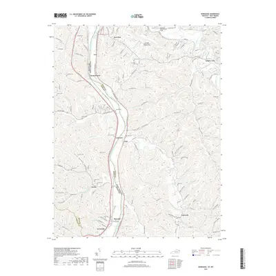 2019 Burnaugh2019 Print · USGSCovers Buffalo Creek, including Centerville, Cyrus, and other nearby areas
 - 2022 Map of Burnaugh, 2022 Print
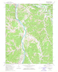
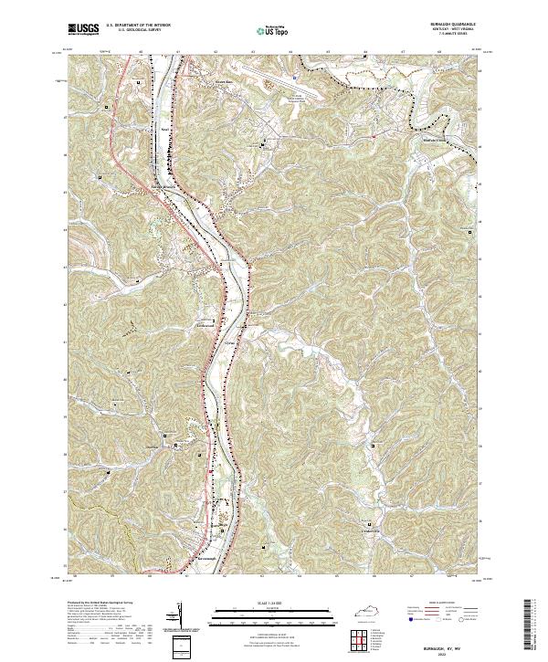 2022 Burnaugh2022 Print · USGSThe Big Sandy River valley at the Kentucky and West Virginia border is shown here as it appears today. Researchers can locate many family burial sites like Lockwood Cem and Thacker Cem near settlements at Burnaugh and Cyrus.
End of results
Showing maps 1-15 of 15
Top cities near Buffalo Creek
- Huntington historical maps
- Ashland historical maps
- Ironton historical maps
- Rome historical maps
- Flatwoods historical maps
- South Point historical maps
See more
Frequently asked questions
- What are the different types of historical maps available for Buffalo Creek?
- What is the oldest map of Buffalo Creek?
- Where can I purchase historical maps of Buffalo Creek for my home or office?
- Where can I download high-res historical maps of Buffalo Creek?
- Are there historical topographic maps available for Buffalo Creek?
- Is there historical aerial imagery available for Buffalo Creek?
- Where are historical maps of Buffalo Creek sourced from?