Old Maps of Ross, West Virginia for Hiking & Exploration
Hike through history with 15 historic maps of Ross. Explore old trails, ghost towns, and forgotten backroads — perfect for outdoor adventurers and local explorers.
- Rediscover forgotten places: Map out old mining camps, roads, and footpaths that no longer exist on modern maps.
- Layer with modern tools: Combine with LiDAR or satellite views to plan hikes through historical terrain.
- Made for exploration: Popular among hikers, overlanders, and local history lovers.
Use these maps to find adventure and explore the hidden past of Ross.
Ross, WV maps
(15)- 1905 Map of Centerpoint
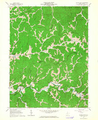
 1905 Centerpoint1905 Print · USGSWest Virginia's heartland at the peak of the railroad era is meticulously charted here, revealing a dense network of ridge-top settlements and valley post offices. Trace the paths of the Baltimore and Ohio RR through Salem and locate lost landmarks like Eagle Mills, Jockeycamp, and Big Battle.3 unique versions available
 - 1924 Map of Centerpoint, 1957 Print
 1924 Centerpoint1957 Print · USGSDoddridge and Harrison counties are shown here in the mid-1920s, when small-town life revolved around the railroad and local schoolhouses. Genealogists can locate family homesteads near landmarks like Alvy P O Stringtown, Smithton Smithburg Sta, and Fairview Church.2 unique versions available
 - 1925 Map of Centerpoint
 1925 Centerpoint1925 Print · USGSDoddridge and Harrison counties are shown here in the mid-1920s, highlighting a landscape of deep hollows and ridge-top farms. Researchers can trace the Baltimore and Ohio rail line through Salem or find small rural landmarks like Victory Church and Lima PO.4 unique versions available
 - 1949 Map of Clarksburg
 1949 Clarksburg1949 Print · USGSThe upper Ohio River valley and the industrial heart of West Virginia come into focus during this post-war period. Genealogists and researchers can trace the rail corridors of the Baltimore and Ohio and locate centers like Fairmont, Grafton, and Waynesburg.
 - 1956 Map of Clarksburg, 1966 Print
 1956 Clarksburg1966 Print · USGSThe Ohio River valley and the industrial heart of West Virginia are seen here in the mid-1950s as rail and river commerce thrived. Researchers can trace historic transport lines like the Baltimore and Ohio RR and locate ancestral homes in Clarksburg, Moundsville, or Parkersburg.2 unique versions available
 - 1961 Map of Clarksburg
 1961 Clarksburg1961 Print · USGSThe mid-century industrial and river landscapes of West Virginia and Ohio are detailed here, centered on the Ohio River. Researchers can trace the Baltimore and Ohio rail lines connecting towns like Parkersburg, Clarksburg, and Monongah.
 - 1961 Map of Center Point, 1964 Print
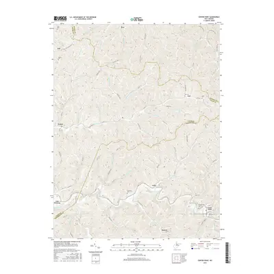
 1961 Center Point1964 Print · USGSDoddridge and Tyler counties come into focus in the early sixties, showing a landscape defined by deep-cut stream valleys and the local gas industry. Genealogists can trace family connections through the Underwood Cem, the Covered Bridge at Center Point, and the Walnut Fork Ch.3 unique versions available
 - 1976 Map of Center Point, 1979 Print
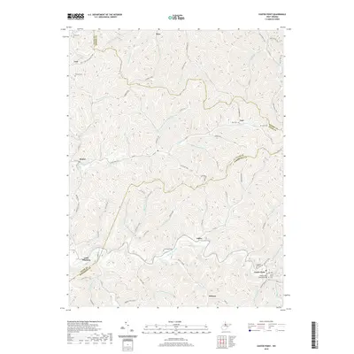
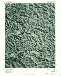 1976 Center Point1979 Print · USGSDoddridge County, West Virginia, is shown through late 1970s aerial imagery, revealing the tight relationship between topography and settlement. Trace the winding course of Mc Elroy Creek to find the small communities of Center Point and Stringtown.
 - 1982 Map of Clarksburg, 1983 Print
 1982 Clarksburg1983 Print · USGSNorth Central West Virginia in the early eighties reveals a landscape deeply connected to its coal and gas resources. Genealogists and researchers can trace family landmarks and historical settlements from Clarksburg to Buckhannon, or locate sites like Quiet Dell and Watters Smith Memorial State Park.
 - 1988 Map of Clarksburg, 1989 Print
 1988 Clarksburg1989 Print · USGSThe central Appalachians are documented in detail during the late eighties, showing the industrial and river-based economies of West Virginia, Ohio, and Pennsylvania. Researchers can trace historic rail routes like the B & O RR and locate river towns from St Marys to Parkersburg.
 - 2011 Map of Center Point, 2011 Print
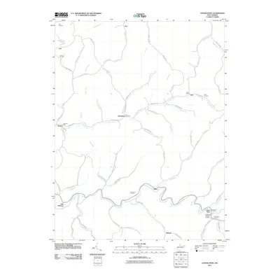 2011 Center Point2011 Print · USGSCovers Ross, including Roberts, Braden, and other nearby areas
 - 2014 Map of Center Point, 2014 Print
 2014 Center Point2014 Print · USGSCovers Ross, including Roberts, Braden, and other nearby areas
 - 2016 Map of Center Point, 2016 Print
 2016 Center Point2016 Print · USGSCovers Ross, including Roberts, Braden, and other nearby areas
 - 2019 Map of Center Point, 2019 Print
 2019 Center Point2019 Print · USGSCovers Ross, including Roberts, Braden, and other nearby areas
 - 2023 Map of Center Point, 2023 Print
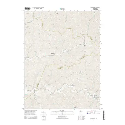
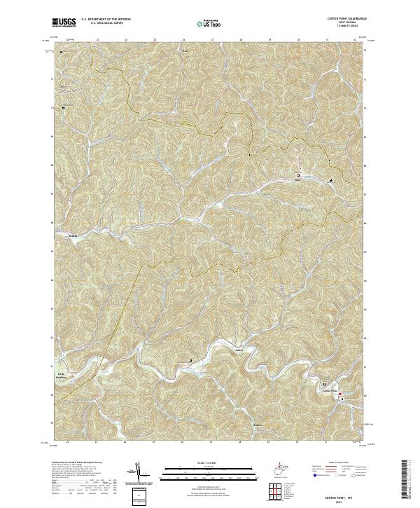 2023 Center Point2023 Print · USGSWest Virginia's rural heartland is meticulously documented here, showing the intricate ridge-and-hollow topography where Doddridge, Tyler, and Wetzel counties meet. Family researchers can pinpoint remote locations like Little Pittsburg or trace family plots at Lyons Cem and Main Cem.
End of results
Showing maps 1-15 of 15
Top cities near Ross
- New Martinsville historical maps
- Salem historical maps
- Middlebourne historical maps
- West Union historical maps
- Pine Grove historical maps
- Littleton historical maps
See more
Frequently asked questions
- What are the different types of historical maps available for Ross?
- What is the oldest map of Ross?
- Where can I purchase historical maps of Ross for my home or office?
- Where can I download high-res historical maps of Ross?
- Are there historical topographic maps available for Ross?
- Is there historical aerial imagery available for Ross?
- Where are historical maps of Ross sourced from?