2020s Maps of Wirt County, West Virginia
Explore 10 historic maps of Wirt County from the 2020s. These maps offer a rare glimpse into what life looked like during the 2020s — showing old roads, neighborhoods, homes, and landmarks that have changed or disappeared over time.
Whether you're researching your family's past, planning a metal detecting trip, or studying how Wirt County's landscape evolved across the 2020s, these high-resolution maps are a powerful tool for exploring the history of this region.
- Focus on a specific era: All maps on this page are from the 2020s, giving you a focused view of this time period.
- See what’s changed: Compare century-old streets, trails, and buildings to today's modern landscape using overlays and satellite layers.
- Research with precision: Use these maps for genealogy, historical research, land use analysis, or educational projects.
- View, download, or print: Maps are fully viewable online in high resolution, and can be downloaded or printed for your own records.
Start exploring Wirt County's history through authentic maps from the 2020s. This is your window into the past.
Wirt County, WV maps
(10)- 2023 Map of Reedy, 2023 Print
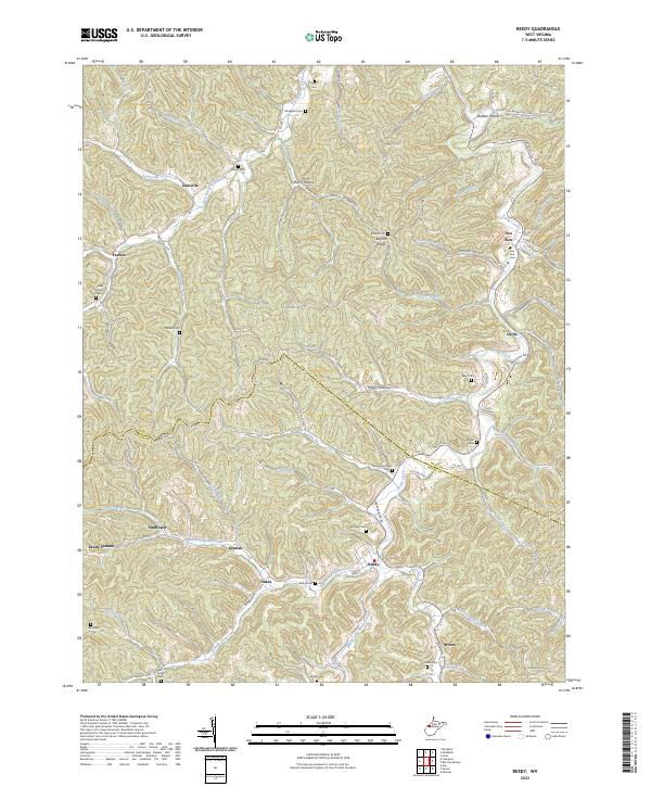 2023 Reedy2023 Print · USGSThe hills of Roane and Wirt counties are documented here in recent detail, showing the deeply etched hollows and ridges of the Reedy Creek watershed. Researchers can locate many family burial grounds, such as Good Hope Cem, and early settlements like Zackville and Peewee.
 - 2023 Map of Annamoriah, 2023 Print
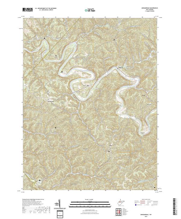 2023 Annamoriah2023 Print · USGSCalhoun County's river-carved landscape is shown here in the 2020s, centered on the tight meanders of the Little Kanawha River. Local researchers can trace family roots through several ridge-top burial grounds including Sixteen Ridge Cem, Maze Cem, and Villers Cem.
 - 2023 Map of Liverpool, 2023 Print
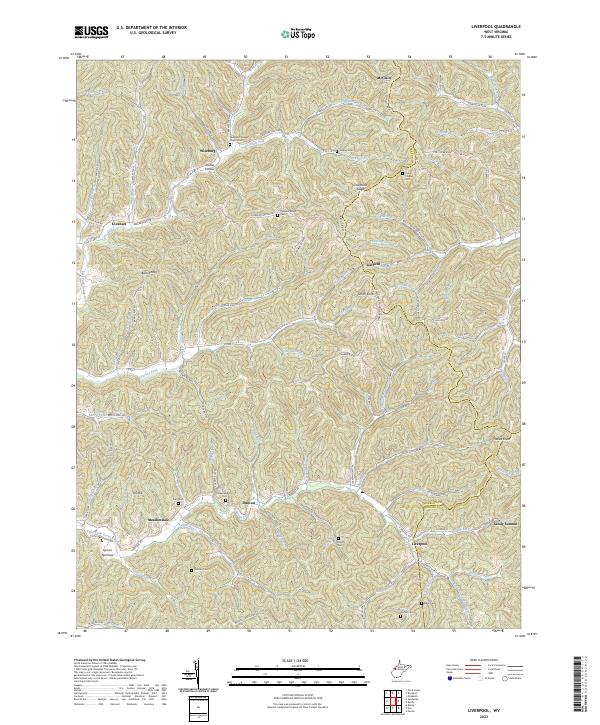 2023 Liverpool2023 Print · USGSThe West Virginia hill country at the intersection of Jackson, Wirt, and Roane counties is shown in detail during the early 2020s. Researchers can trace numerous ancestral burial sites including Sheppard Chapel Church Cem and Wright Cem near the settlements of Liverpool and Duncan.
 - 2023 Map of Petroleum, 2023 Print
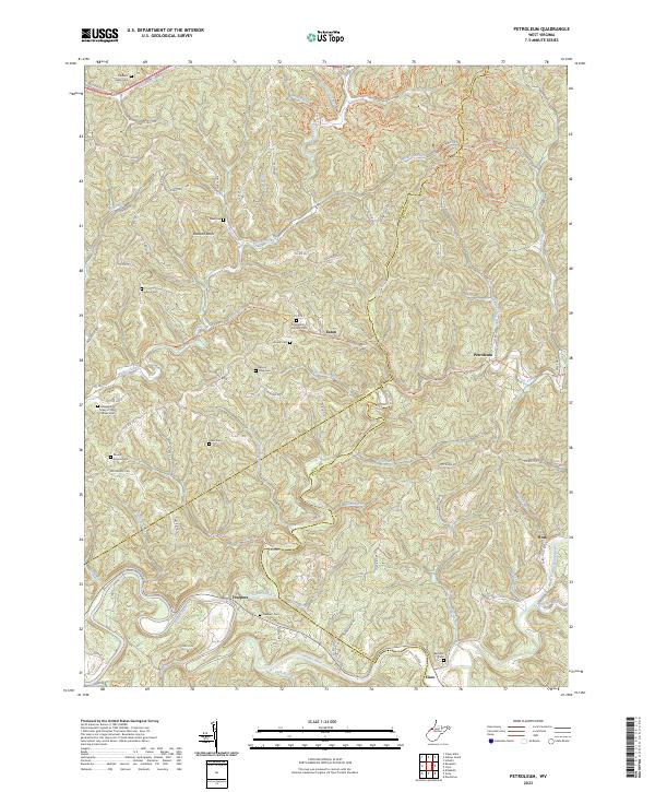 2023 Petroleum2023 Print · USGSThe borderlands of Wood, Wirt, and Ritchie Counties come alive in this modern survey of the historic West Virginia hill country. Researchers can trace ancestral roots at the Greenhill Catholic Cem or follow the old Staunton Tpke as it winds toward Freeport and Petroleum.
 - 2023 Map of Rockport, 2023 Print
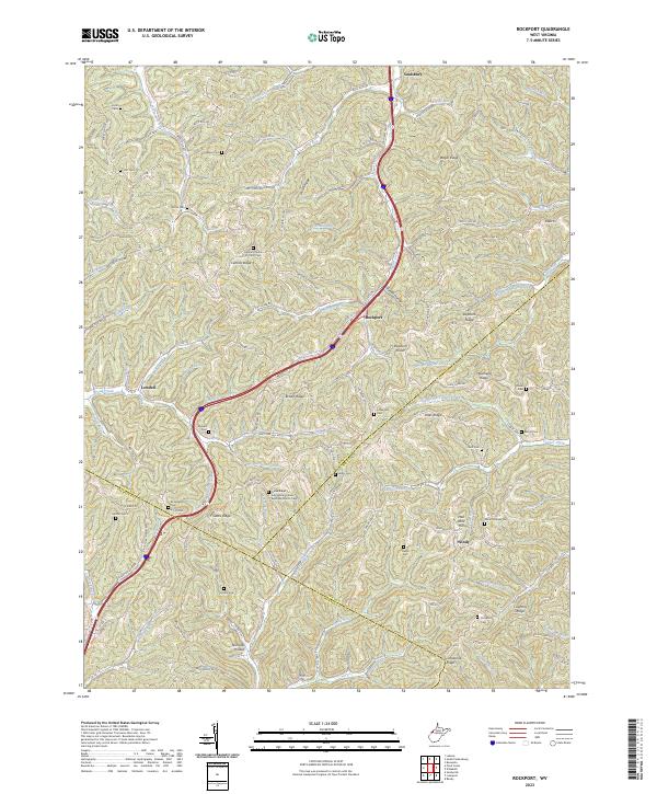 2023 Rockport2023 Print · USGSThe Wood and Jackson County borderlands are shown here in the 2020s, a landscape defined by high ridges and tight valley communities. Researchers can locate numerous family burial sites and rural congregations, including Lowdell Cem, Mount Moriah Cem, and the Central Church of Christ Cem.
 - 2023 Map of Elizabeth, 2023 Print
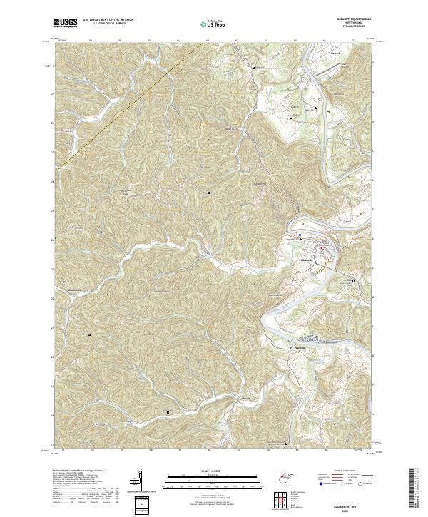 2023 Elizabeth2023 Print · USGSThe Little Kanawha River valley in Wirt County comes into sharp focus here during the early twenty-first century. Genealogists and local historians can trace family roots through numerous upland burial grounds like Antioch Cem and Grandview Cem, or locate landmarks in the county seat such as the Wirt County Courthouse.
 - 2023 Map of Burning Springs, 2023 Print
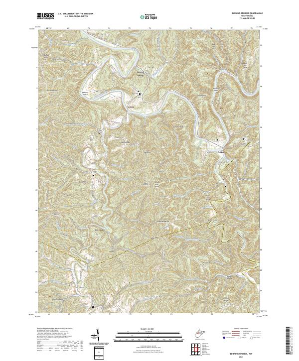 2023 Burning Springs2023 Print · USGSThe West Virginia hills at the triple-border of Wirt, Roane, and Calhoun counties remain defined by the winding Little Kanawha River. Genealogists can trace family heritage through numerous remote burial sites such as Mount Solon Cem, Hill Grove Cem, and Rector Cem.
 - 2023 Map of Kanawha, 2023 Print
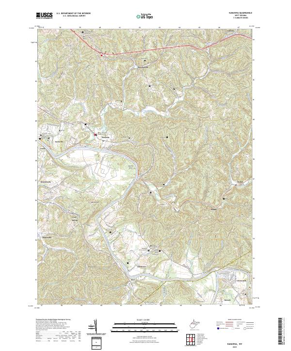 2023 Kanawha2023 Print · USGSThe river valleys and ridges of Wood County appear here as they were in the early twenty-first century. Genealogists can trace family names through numerous burial sites like McCardel - Ross Cem and landmarks along the North Bend Rail-Trl.
 - 2023 Map of Girta, 2023 Print
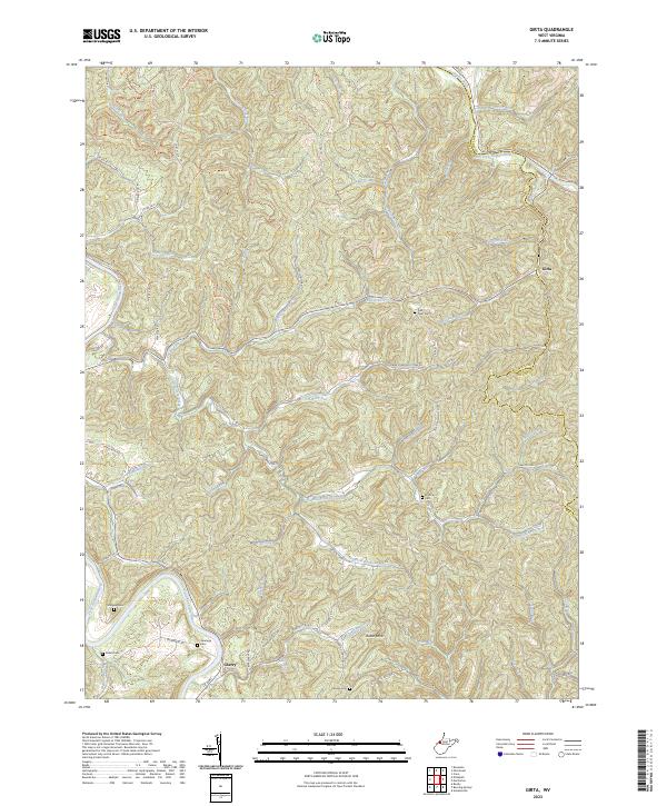 2023 Girta2023 Print · USGSWirt and Ritchie counties are shown here in the 2020s, dominated by the forks of the Hughes and Little Kanawha rivers. Local historians can trace old family sites like Ruble Cem and Saratoga Cem or locate the rural settlements of Girta and Cherry.
 - 2023 Map of MacFarlan, 2023 Print
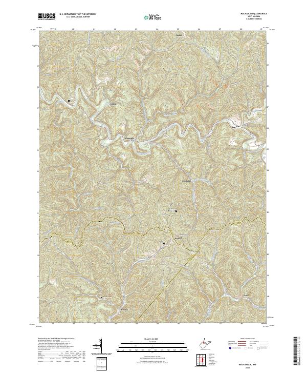 2023 MacFarlan2023 Print · USGSIn this modern survey of the Ritchie and Wirt County borders, the South Fork Hughes River winds through a landscape of historic upland settlements. Genealogists can locate family burial sites at Wolverton Cem and Hartley Cem or trace the rural routes connecting Macfarlan and Beatrice.
End of results
Showing maps 1-10 of 10
Top cities of Wirt County
Frequently asked questions
- What are the different types of historical maps available for Wirt County?
- What is the oldest map of Wirt County?
- Where can I purchase historical maps of Wirt County for my home or office?
- Where can I download high-res historical maps of Wirt County?
- Are there historical topographic maps available for Wirt County?
- Is there historical aerial imagery available for Wirt County?
- Where are historical maps of Wirt County sourced from?