1900s (20th Century) Maps of Wirt County, West Virginia
Explore 37 historic maps of Wirt County from the 1900s (20th Century). These maps offer a rare glimpse into what life looked like during the 1900s — showing old roads, neighborhoods, homes, and landmarks that have changed or disappeared over time.
Whether you're researching your family's past, planning a metal detecting trip, or studying how Wirt County's landscape evolved across the 1900s, these high-resolution maps are a powerful tool for exploring the history of this region.
- Focus on a specific era: All maps on this page are from the 1900s, giving you a focused view of this time period.
- See what’s changed: Compare century-old streets, trails, and buildings to today's modern landscape using overlays and satellite layers.
- Research with precision: Use these maps for genealogy, historical research, land use analysis, or educational projects.
- View, download, or print: Maps are fully viewable online in high resolution, and can be downloaded or printed for your own records.
Start exploring Wirt County's history through authentic maps from the 1900s. This is your window into the past.
Wirt County, WV maps
(37)- 1906 Map of Elizabeth
 1906 Elizabeth1906 Print · USGSWirt and Wood Counties come alive in the first decade of the twentieth century, anchored by the river commerce of the Little Kanawha River. Genealogists and historians can trace defunct post offices and rail stops like Dulin PO, Volcano Junction, and Kanawha Station.2 unique versions available
 - 1906 Map of Belleville
 1906 Belleville1906 Print · USGSWood County at the turn of the century is defined by its deep river valleys and the expansion of the Baltimore and Ohio RR. Genealogists and historians can trace late-Victorian settlements like Mineral Wells, Belleville, and the riverfront at Walkers Crossing.2 unique versions available
 - 1907 Map of Harrisville
 1907 Harrisville1907 Print · USGSRitchie County at the start of the twentieth century is centered on the rugged valleys of the North Fork and South Fork Hughes River. Researchers can trace the path of the Baltimore and Ohio RR and locate rural hubs like Silver Run Station and the Ritchie Mine.2 unique versions available
 - 1907 Map of Arnoldsburg
 1907 Arnoldsburg1907 Print · USGSCalhoun County's rugged terrain and river life are preserved here in the first decade of the twentieth century. Researchers can trace ancestral home sites and rural post offices from Grantsville to Chestnut Grove Big Springs PO and Brooksville Big Bend PO.2 unique versions available
 - 1907 Map of Spencer
 1907 Spencer1907 Print · USGSRoane County at the turn of the century is captured here as a landscape of isolated hollows connected by the Ravenswood and Spencer Turnpike. Researchers can locate dozens of vanished rural centers and local landmarks like Burning Springs, the Morning Star Schoolhouse, and Buffalo Church.2 unique versions available
 - 1907 Map of Ripley, 1922 Print
 1907 Ripley1922 Print · USGSJackson County at the start of the twentieth century shows a landscape of ridge-top schools and creek-bottom settlements. Trace early routes like the Buffalo Turnpike or locate family sites at Lockhart PO and Klondike Schoolhouse.
 - 1924 Map of Belleville, 1954 Print
 1924 Belleville1954 Print · USGSWood County’s riverfront settlements and rural school districts are captured here in the mid-twenties during the height of the rail era. Genealogists can locate long-lost family landmarks like Harris Ferry, Meldahl, and dozens of rural schoolhouses including Leafy Glen School.
 - 1924 Map of Harrisville, 1957 Print
 1924 Harrisville1957 Print · USGSRitchie County during the mid-1920s reveals a landscape of ridge-top schools and river-valley industry. Genealogists can trace family roots through numerous local landmarks like Silver Run Sta Donohue PO, Ritchie Mines, and Star Settlement.
 - 1924 Map of Elizabeth, 1965 Print
 1924 Elizabeth1965 Print · USGSWirt and Wood Counties come alive in the mid-1920s as the Little Kanawha River serves as the primary artery for local life and industry. Genealogists can trace hundreds of family sites near schools like Mountain Flower School or the rural Antioch Church.
 - 1925 Map of Arnoldsburg, 1964 Print
 1925 Arnoldsburg1964 Print · USGSCalhoun County in the mid-twenties shows a landscape of winding river bends and hundreds of named rural landmarks. Genealogists can trace family names through dozens of community sites like Jackson School, Mt Vernon Church, and Annamoriah Flats.
 - 1926 Map of Elizabeth
 1926 Elizabeth1926 Print · USGSMid-century West Virginia hill country comes to life here along the banks of the Little Kanawha River and the Baltimore and Ohio line. Genealogists can trace a remarkable landscape of rural education through Rising Sun School, Mountain Flower School, and Muddy Cut School.3 unique versions available
 - 1926 Map of Belleville
 1926 Belleville1926 Print · USGSThe Ohio River valley and its rugged Wood County hinterlands come into focus in the mid-twenties. Genealogists and historians can locate dozens of rural schools and churches like Leafy Glen School, Torch PO, and Serepta Church along the winding runs.2 unique versions available
 - 1926 Map of Harrisville
 1926 Harrisville1926 Print · USGSRitchie County in the mid-twenties is a landscape of winding river valleys and bustling rail hubs like Cairo and Harrisville. Researchers can trace the heritage of remote hill communities through dozens of local landmarks like the Ritchie Mine, Donohue PO, and Star Settlement.
 - 1926 Map of Ripley, 1958 Print
 1926 Ripley1958 Print · USGSJackson County is shown during its mid-1920s development, centered on the rail-and-river hub of Ripley. Genealogists and historians can trace dozens of early rural schoolhouses and churches, including Klondike Sch, Batchel Chapel, and Parchment Valley Sch.
 - 1927 Map of Arnoldsburg
 1927 Arnoldsburg1927 Print · USGSCalhoun County's winding river valleys and high ridges are captured here during the late twenties, showing a rural landscape of scattered hill farms and tiny schools. Genealogists can trace family footprints near Grantsville, Rocksdale, and Mt Zion.3 unique versions available
 - 1928 Map of Spencer
 1928 Spencer1928 Print · USGSRoane and Wirt counties come alive in the late 1920s, showing a landscape defined by the Baltimore and Ohio railroad and winding creek valleys. Genealogists can locate dozens of country schools like Lone Star Sch and churches such as Mt Zion Ch or Triumph Ch.2 unique versions available
 - 1928 Map of Ripley
 1928 Ripley1928 Print · USGSJackson County hill country in the late twenties is mapped here in detail, showing the rural communities surrounding Ripley and the Baltimore and Ohio Railroad. Genealogists can trace family footprints through numerous landmarks like Morning Star Sch, Kings Chapel, and Hargreave Knob.2 unique versions available
 - 1949 Map of Clarksburg
 1949 Clarksburg1949 Print · USGSThe upper Ohio River valley and the industrial heart of West Virginia come into focus during this post-war period. Genealogists and researchers can trace the rail corridors of the Baltimore and Ohio and locate centers like Fairmont, Grafton, and Waynesburg.
 - 1954 Map of Charleston
 1954 Charleston1954 Print · USGSWest Virginia’s industrial heart and mountain highlands are captured here during the mid-fifties, centered on the capital city. Researchers can trace historic river-and-rail corridors along the Kanawha River and locate remote peaks within the Monongahela National Forest.
 - 1956 Map of Clarksburg, 1966 Print
 1956 Clarksburg1966 Print · USGSThe Ohio River valley and the industrial heart of West Virginia are seen here in the mid-1950s as rail and river commerce thrived. Researchers can trace historic transport lines like the Baltimore and Ohio RR and locate ancestral homes in Clarksburg, Moundsville, or Parkersburg.2 unique versions available
 - 1957 Map of Elizabeth, 1958 Print
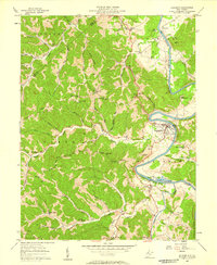 1957 Elizabeth1958 Print · USGSMid-century Wirt County centers on the sharp bends of the Little Kanawha River and the bustling county seat. Researchers can trace the river's industrial past at the Lock & Dam (Ruins) or locate family landmarks like Black Hill Sch and Antioch Ch.2 unique versions available
 - 1957 Map of Petroleum, 1958 Print
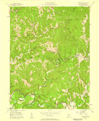 1957 Petroleum1958 Print · USGSIn the mid-1950s, the borders of Wood, Ritchie, and Wirt Counties were defined by a landscape of energy extraction and rail transport. Researchers can trace family roots at Mt Carmel Ch, locate the Eaton Tunnel along the Baltimore and Ohio, or explore the namesake hills of Petroleum.4 unique versions available
 - 1957 Map of Girta, 1958 Print
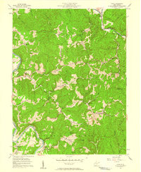 1957 Girta1958 Print · USGSWirt and Ritchie Counties were centers of energy production in the late 1950s, defined by the winding river valleys and ridge-top settlements. Researchers can trace the extensive Burning Springs Oil Field and find family landmarks like Ruble Knob and Guthrie Ch.4 unique versions available
 - 1957 Map of Kanawha, 1958 Print
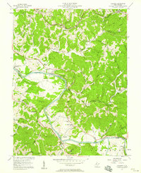 1957 Kanawha1958 Print · USGSMid-century Wood County comes to life along the winding Little Kanawha River and the busy Baltimore and Ohio rail lines. Researchers can trace the era's rural infrastructure through oil wells, the Leachtown Schools, and Kanawha Station.4 unique versions available
 - 1957 Map of Burning Springs, 1959 Print
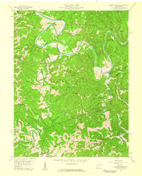 1957 Burning Springs1959 Print · USGSWirt County in the late fifties was a landscape of deep river bends and active mineral extraction. Genealogists can trace family names through the Rector Cem, find rural school sites like Hill Grove Sch, and locate numerous historical Oil Wells.2 unique versions available
Showing maps 1-25 of 37
Top cities of Wirt County
Frequently asked questions
- What are the different types of historical maps available for Wirt County?
- What is the oldest map of Wirt County?
- Where can I purchase historical maps of Wirt County for my home or office?
- Where can I download high-res historical maps of Wirt County?
- Are there historical topographic maps available for Wirt County?
- Is there historical aerial imagery available for Wirt County?
- Where are historical maps of Wirt County sourced from?