2020s Maps of Hilbert, West Virginia
Explore 1 historic maps of Hilbert from the 2020s. These maps offer a rare glimpse into what life looked like during the 2020s — showing old roads, neighborhoods, homes, and landmarks that have changed or disappeared over time.
Whether you're researching your family's past, planning a metal detecting trip, or studying how Hilbert's landscape evolved across the 2020s, these high-resolution maps are a powerful tool for exploring the history of this region.
- Focus on a specific era: All maps on this page are from the 2020s, giving you a focused view of this time period.
- See what’s changed: Compare century-old streets, trails, and buildings to today's modern landscape using overlays and satellite layers.
- Research with precision: Use these maps for genealogy, historical research, land use analysis, or educational projects.
- View, download, or print: Maps are fully viewable online in high resolution, and can be downloaded or printed for your own records.
Start exploring Hilbert's history through authentic maps from the 2020s. This is your window into the past.
Hilbert, WV maps
(1)- 2023 Map of Burning Springs, 2023 Print
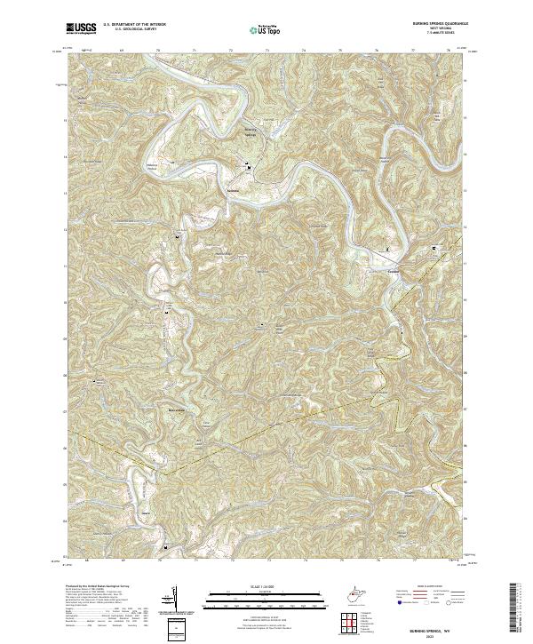 2023 Burning Springs2023 Print · USGSThe West Virginia hills at the triple-border of Wirt, Roane, and Calhoun counties remain defined by the winding Little Kanawha River. Genealogists can trace family heritage through numerous remote burial sites such as Mount Solon Cem, Hill Grove Cem, and Rector Cem.
End of results
Showing maps 1-1 of 1
Top cities near Hilbert
Frequently asked questions
- What are the different types of historical maps available for Hilbert?
- What is the oldest map of Hilbert?
- Where can I purchase historical maps of Hilbert for my home or office?
- Where can I download high-res historical maps of Hilbert?
- Are there historical topographic maps available for Hilbert?
- Is there historical aerial imagery available for Hilbert?
- Where are historical maps of Hilbert sourced from?