Old Maps of Franks Field, Sanborn for Metal Detecting
Plan your next treasure hunt with 12 historic maps of Franks Field. Find old homesites, ghost towns, trails, and gathering spots that may be lost to time — perfect for identifying promising metal detecting locations.
- Locate forgotten sites: Uncover places like long-lost settlements, abandoned rail lines, or gathering spots.
- Plan better hunts: Use map overlays combined with LiDAR or satellite views to narrow in on historically rich areas.
- Made for detectorists: Thousands of hobbyists use these maps to discover relics, coins, and hidden history.
Use these historic maps to boost your research and find new opportunities beneath the surface of Franks Field.
Franks Field, Sanborn maps
(12)- 1943 Map of Odanah, 1952 Print
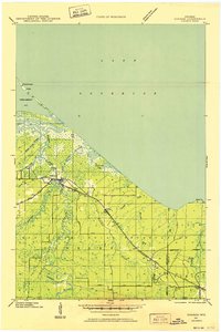 1943 Odanah1952 Print · USGSNorthern Wisconsin's Lake Superior shoreline and the Bad River delta are captured here during the early 1940s. Genealogists and historians can trace the Chicago and Northwestern rail line and local settlements at Odanah, Birch, and Rufus.
 - 1945 Map of Odanah
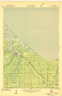 1945 Odanah1945 Print · USGSCoastal Ashland and Iron counties are documented here in the 1940s, highlighting the intricate river systems of the Bad River Indian Reservation. Researchers can trace the Chicago and Northwestern rail line through early settlements like Odanah, Rufus, and Birch.
 - 1953 Map of Ashland, 1964 Print
 1953 Ashland1964 Print · USGSNorthern Wisconsin's lakefront and timberlands are seen here in the mid-1950s, showing the intersection of industrial rail lines and vast wilderness. Genealogists and historians can trace the Soo Line through rail towns like Mellen or locate family roots in the Apostle Islands and Bad River Indian Reservation.3 unique versions available
 - 1958 Map of Ashland
 1958 Ashland1958 Print · USGSCoastal Wisconsin and the Michigan borderlands meet here in the late fifties, dominated by the timbered expanses and iron-rich ranges. Genealogists can trace family footprints in settlements like Odanah and Montreal, or locate landmarks such as the Coast Guard Station and Agricultural Experiment Station.
 - 1964 Map of Cedar, 1965 Print
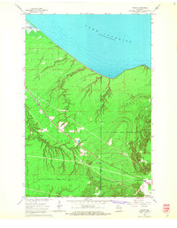 1964 Cedar1965 Print · USGSThe Lake Superior shoreline near the Ashland and Iron County border reveals a landscape of timber and rail in the mid-sixties. Researchers can trace the Chicago and North Western line through Cedar or locate the Birch Ridge Lookout Tower and Waverly Campground.2 unique versions available
 - 1964 Map of Odanah, 1966 Print
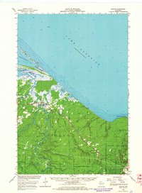 1964 Odanah1966 Print · USGSThe Lake Superior shoreline and the Bad River drainage are captured in the mid-1960s, showing the intersection of rail transit and coastal wetlands. Researchers can trace local history through Odanah, the Odanah Cem, and the Birch Ridge Lookout Tower.2 unique versions available
 - 1989 Map of Ashland
 1989 Ashland1989 Print · USGSCoastal Wisconsin and Michigan at the end of the 1980s show a landscape of deep-water bays, island preserves, and industrial timber towns. Researchers can trace the rail lines of the Soo Line and identify landmarks from Big Bay State Park to the Bad River Indian Reservation.
 - 2010 Map of Cedar, 2010 Print
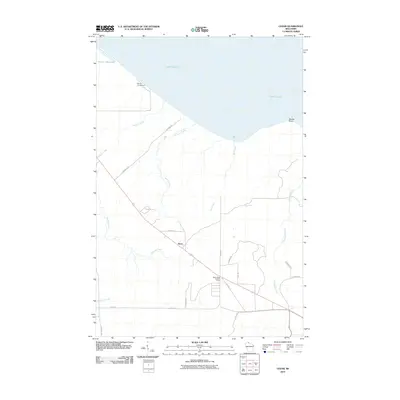 2010 Cedar2010 Print · USGSCovers Franks Field, including Saxon, Gurney, and other nearby areas
 - 2013 Map of Cedar, 2013 Print
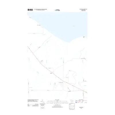 2013 Cedar2013 Print · USGSCovers Franks Field, including Saxon, Gurney, and other nearby areas
 - 2015 Map of Cedar, 2015 Print
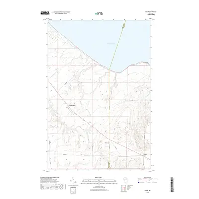
 2015 Cedar2015 Print · USGSCovers Franks Field, including Saxon, Gurney, and other nearby areas
 - 2018 Map of Cedar, 2018 Print
 2018 Cedar2018 Print · USGSCovers Franks Field, including Saxon, Gurney, and other nearby areas
 - 2022 Map of Cedar, 2022 Print
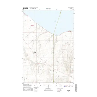
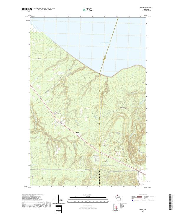 2022 Cedar2022 Print · USGSNear the Ashland and Iron County border in the early 2020s, this landscape meets the waters of the great lake. Researchers can trace rural routes to Cedar, Birch, and Franks Field, or follow the winding courses of Graveyard Cr and Oronto Cr.
End of results
Showing maps 1-12 of 12
Top cities near Franks Field
- Mellen historical maps
- New Odanah historical maps
- Marengo historical maps
- Saxon historical maps
- La Pointe historical maps
- Gurney historical maps
Frequently asked questions
- What are the different types of historical maps available for Franks Field?
- What is the oldest map of Franks Field?
- Where can I purchase historical maps of Franks Field for my home or office?
- Where can I download high-res historical maps of Franks Field?
- Are there historical topographic maps available for Franks Field?
- Is there historical aerial imagery available for Franks Field?
- Where are historical maps of Franks Field sourced from?