2000s (21st Century) Maps of Eaton, Wisconsin
Explore 2 historic maps of Eaton from the 2000s (21st Century). These maps offer a rare glimpse into what life looked like during the 2000s — showing old roads, neighborhoods, homes, and landmarks that have changed or disappeared over time.
Whether you're researching your family's past, planning a metal detecting trip, or studying how Eaton's landscape evolved across the 2000s, these high-resolution maps are a powerful tool for exploring the history of this region.
- Focus on a specific era: All maps on this page are from the 2000s, giving you a focused view of this time period.
- See what’s changed: Compare century-old streets, trails, and buildings to today's modern landscape using overlays and satellite layers.
- Research with precision: Use these maps for genealogy, historical research, land use analysis, or educational projects.
- View, download, or print: Maps are fully viewable online in high resolution, and can be downloaded or printed for your own records.
Start exploring Eaton's history through authentic maps from the 2000s. This is your window into the past.
Eaton, WI maps
(2)- 2022 Map of Poland, 2022 Print
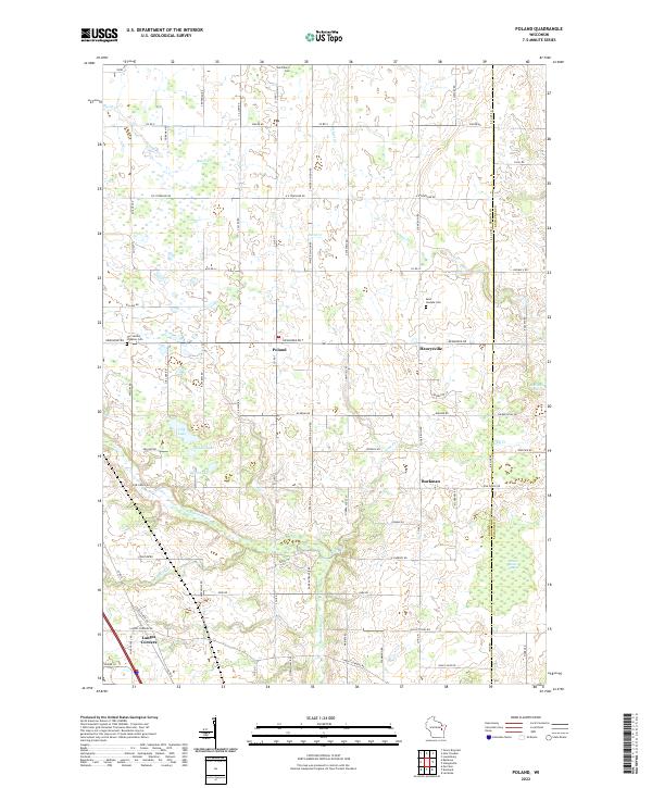 2022 Poland2022 Print · USGSEastern Brown County comes into focus in this recent survey of rural Wisconsin farm country and small crossroads communities. Genealogists and local historians can locate family plots at Saint Marys Cem and trace the wetlands surrounding Section Seven Swamp and Lilly Lake.
 - 2022 Map of Bellevue, 2022 Print
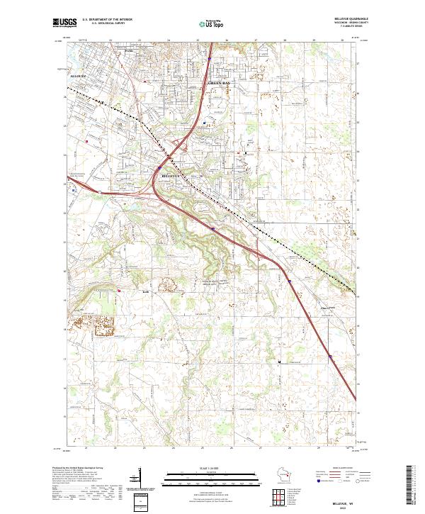 2022 Bellevue2022 Print · USGSBellevue and the southern reaches of Green Bay are shown here in the early 2020s as suburban growth meets rural Brown County. Researchers can pinpoint long-standing landmarks like the Fonferek Glen Natural Arch, Martins Aerodrome, and the Polish Cem.
End of results
Showing maps 1-2 of 2
Top cities near Eaton
- Green Bay historical maps
- De Pere historical maps
- Howard historical maps
- Allouez historical maps
- Bellevue historical maps
- Suamico historical maps
See more
Top neighborhoods of Eaton
Frequently asked questions
- What are the different types of historical maps available for Eaton?
- What is the oldest map of Eaton?
- Where can I purchase historical maps of Eaton for my home or office?
- Where can I download high-res historical maps of Eaton?
- Are there historical topographic maps available for Eaton?
- Is there historical aerial imagery available for Eaton?
- Where are historical maps of Eaton sourced from?