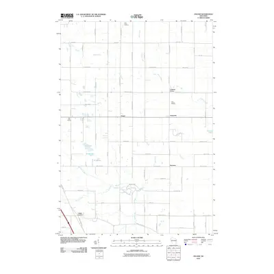
2010 Map of Poland
USGS Topo · Published 2010About this map
The Poland and Henrysville area of eastern Brown County is defined by a grid of rural crossroads and the winding drainage of the Neshota River. In this 2010 survey, small clusters of settlement such as Coppens Corner and Buckman remain as distinct landmarks within a landscape dominated by agriculture and woodlots. The map reveals a dense network of family-named roads, including S Michiels Rd and S Jossart Rd, which reflect the area's deep-rooted community history. Natural features are concentrated in the southern and western portions, where the terrain breaks for Lilly Lake, Middle Lake, and Third Lake. Public space is anchored by Neshota Park, where Twin Hill Creek and King Creek converge with the river. Several religious sites, including Saint Marys Cemetery and Saint Josephs Cemetery, serve as important touchstones for genealogists researching the European settlement patterns of these Wisconsin townships.
Find a feature on this map
66 named features on this map. Tap any name to fly to it.
Don’t see what you’re looking for? This feature index may not catch every label — zoom into the map to look around manually.
Map Details
Editions of this 2010 Poland Map
This is the sole edition of this map. No revisions or reprints were ever made.
Other maps of this area

1952 · Casco
USGS Topo · 1:62,500

1954 · Kewaunee
USGS Topo · 1:62,500

1954 · Denmark
USGS Topo · 1:62,500

1954 · New Franken
USGS Topo · 1:62,500

1954 · Green Bay East
USGS Topo · 1:24,000

1954 · Manitowoc
USGS Topo · 1:250,000

1954 · Bellevue
USGS Topo · 1:24,000

1958 · Manitowoc
USGS Topo · 1:250,000

1978 · Denmark
USGS Topo · 1:24,000

1978 · Poland
USGS Topo · 1:24,000