
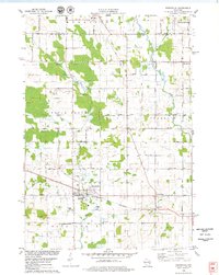
1978 Map of Denmark
USGS Topo · Published 1979About this map
The village of Denmark serves as the focal point of this late 1970s landscape, positioned at the intersection of several regional thoroughfares and the Chicago and North Western rail line. The terrain is defined by the winding paths of the Neshota River and the Devils River, with the latter feeding into Hidden Lake. Cultural and genealogical history is well-preserved through several rural landmarks, including the West Danish Cem and Denmark Cem, alongside educational sites like St James Sch and St Johns Sch. Further south, the landscape transitions into the wooded relief of Hickory Grove and the preserved lands of Maribel Caves County Park. The map also captures the smaller agrarian settlements of Cooperstown, Rosecrans, and Maribel, revealing a stable pattern of Wisconsin dairy-country development where town hall roads and local cemeteries form the backbone of the community.
Find a feature on this map
52 named features on this map. Tap any name to fly to it.
Don’t see what you’re looking for? This feature index may not catch every label — zoom into the map to look around manually.
Map Details
Editions of this 1978 Denmark Map
This is the sole edition of this map. No revisions or reprints were ever made.
Other maps of this area

1954 · Kewaunee
USGS Topo · 1:62,500

1954 · Manitowoc
USGS Topo · 1:62,500

1954 · Denmark
USGS Topo · 1:62,500

1954 · Reedsville
USGS Topo · 1:62,500

1954 · Manitowoc
USGS Topo · 1:250,000

1954 · Bellevue
USGS Topo · 1:24,000

1958 · Manitowoc
USGS Topo · 1:250,000

1978 · Poland
USGS Topo · 1:24,000

1978 · Stangelville
USGS Topo · 1:24,000
1978 · Reedsville
USGS Topo · 1:24,000