1980s Maps of Burnett County, Wisconsin
Explore 30 historic maps of Burnett County from the 1980s. These maps offer a rare glimpse into what life looked like during the 1980s — showing old roads, neighborhoods, homes, and landmarks that have changed or disappeared over time.
Whether you're researching your family's past, planning a metal detecting trip, or studying how Burnett County's landscape evolved across the 1980s, these high-resolution maps are a powerful tool for exploring the history of this region.
- Focus on a specific era: All maps on this page are from the 1980s, giving you a focused view of this time period.
- See what’s changed: Compare century-old streets, trails, and buildings to today's modern landscape using overlays and satellite layers.
- Research with precision: Use these maps for genealogy, historical research, land use analysis, or educational projects.
- View, download, or print: Maps are fully viewable online in high resolution, and can be downloaded or printed for your own records.
Start exploring Burnett County's history through authentic maps from the 1980s. This is your window into the past.
Burnett County, WI maps
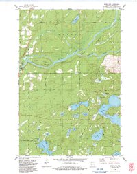
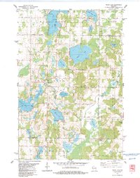
(30)- 1980 Map of Sandstone
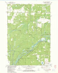
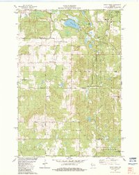
 1980 Sandstone1980 Print · USGSPine County and the Minnesota-Wisconsin borderlands are shown here in the early eighties as a region of dense state forests and river corridors. Genealogists and historians can trace rail-town development along the Burlington Northern including Sandstone, Askov, and Hinckley.
 - 1982 Map of Lake Clayton, 1983 Print
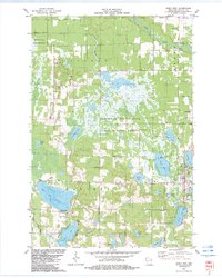
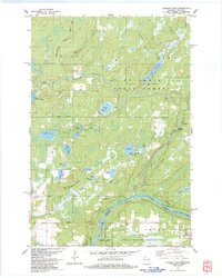
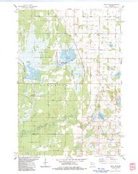
 1982 Lake Clayton1983 Print · USGSThe St. Croix riverfront in the early eighties shows a landscape preserved through state and national forests along the Wisconsin-Minnesota border. Researchers can trace historic river access at Nelson Landing and locate the Ekdall Ch near the marshlands.
 - 1982 Map of Timberland, 1983 Print
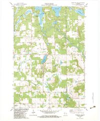
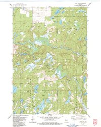
 1982 Timberland1983 Print · USGSThe area surrounding Timberland in the early eighties is a landscape of glacial lakes and river forks. Genealogists and local historians can trace the rural communities at Timberland Cem, South Dewey Community Ch, and the Lookout Tower.
 - 1982 Map of Hertel, 1983 Print
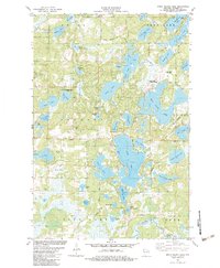
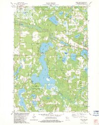
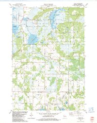
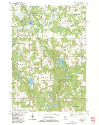
 1982 Hertel1983 Print · USGSThe St. Croix Indian Reservation and the settlement of Hertel are the focus of this early 1980s study of Burnett County lake country. Researchers can find old landmarks like the Big Sand Lake Cem, Whistler Bridge, and the Lakeview Ch.2 unique versions available
 - 1982 Map of Yellow Lake, 1983 Print
 1982 Yellow Lake1983 Print · USGSNorthwestern Wisconsin at the start of the 1980s was a landscape defined by state forests and the winding St. Croix River. Researchers can locate remote cemeteries and camps like Bluff Lake Cem, St Johns Landing, and the Ice House Bridge.
 - 1982 Map of Indian Creek, 1983 Print
 1982 Indian Creek1983 Print · USGSNorthwest Wisconsin’s lake-dotted countryside is documented here in the early 1980s as conservation areas were becoming established. Genealogists and local historians can trace family road names and locate rural landmarks like Indian Creek, the Lorain Ch, and Spencer Lake.
 - 1982 Map of Birch Island Lake, 1983 Print
 1982 Birch Island Lake1983 Print · USGSNorthwest Wisconsin in the early eighties shows a landscape of glacial lakes transitioning into a modern recreational hub. Genealogists and local historians can trace family markers at the Jackson Cem or explore the development around Birch Island Lake and Voyager Village Country Club.
 - 1982 Map of Poquettes Lake, 1983 Print
 1982 Poquettes Lake1983 Print · USGSThe lake-dotted timberlands of Northwest Wisconsin are captured here in the early eighties, showcasing a rural landscape shaped by the Yellow River. Researchers can trace old family names and sites through local landmarks like Greendale Cem, Bashaw Trout Springs, and the St Croix Indian Reservation.
 - 1982 Map of Siren West, 1983 Print
 1982 Siren West1983 Print · USGSWisconsin's lakeland region around Siren comes into focus in the early 1980s, showcasing a landscape of conservation and small-town roots. Genealogists and local historians can trace family sites like Chelmo Cem or explore the geography of Big Doctor Lake and the Clam River.
 - 1982 Map of Siren East, 1983 Print
 1982 Siren East1983 Print · USGSBurnett County’s watery landscape is meticulously detailed in the early eighties, showing the St Croix Indian Reservation and its surrounding wetlands. Local historians can locate the Viola Lake Ch, Clam Lake Cem, and the settlement of Culbertson.
 - 1982 Map of Monson Lake, 1983 Print
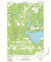
 1982 Monson Lake1983 Print · USGSUpper Wisconsin’s river borderlands are documented here in the early 1980s, showcasing the transition from state forests to vast wildlife refuges. Researchers can locate family landmarks like the Peet Cem, trace Peet Post Office Road, and find the St Johns Landing Camp along the riverbanks.
 - 1982 Map of Grantsburg, 1983 Print
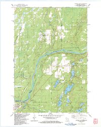
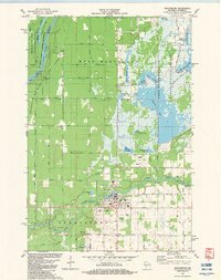 1982 Grantsburg1983 Print · USGSGrantsburg and the wetlands of Burnett County are captured here in the early eighties, where the Wood River meets a vast complex of state-managed flowages. Local historians can trace family plots at Riverside Cem or explore the outskirts of town near the County Fairground and Tobe Lake.
 - 1982 Map of Webster, 1983 Print
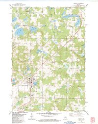
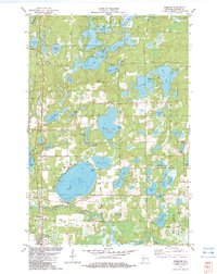 1982 Webster1983 Print · USGSBurnett County in the early eighties was defined by its incredible density of glacial lakes and the quiet growth of Webster. Genealogists and outdoor historians can trace family plots at Oak Grove Cem or explore the perimeter of Devils Lake and the Yellow River.
 - 1982 Map of Falun, 1983 Print
 1982 Falun1983 Print · USGSBurnett County in the early eighties was a landscape of managed wetlands and quiet rural crossroads. Genealogists can trace family roots through sites like Anscarius Cem or the namesake Lundquist Road near the settlement of Falun.
 - 1982 Map of Mc Kenzie Lake, 1983 Print
 1982 Mc Kenzie Lake1983 Print · USGSThe lake country of northwest Wisconsin comes alive in the early eighties, showcasing a landscape of dense woods and glacial basins. Genealogists and local historians can locate the Sacred Hearts Cem, the McKenzie Lake Lookout Tower, and the St Croix Indian Reservation.
 - 1983 Map of Danbury East
 1983 Danbury East1983 Print · USGSThe river border between Wisconsin and Minnesota comes into focus in the early 1980s, highlighting the wild corridor of the St Croix River. Genealogists and local historians can trace the tracks of the Soo Line, locate the Cem at Markville, and explore the layout of Danbury.
 - 1983 Map of Frederic
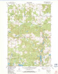
 1983 Frederic1983 Print · USGSThe northwestern Wisconsin lake country is captured here in the early eighties, centered on the rail-line communities of Frederic and Lewis. Researchers can trace local genealogy and land use through the Frederic Cem, the Soo Line tracks, and the Fish Hatchery.
 - 1983 Map of Webb Lake
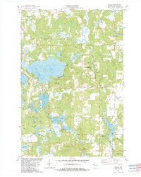
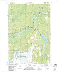
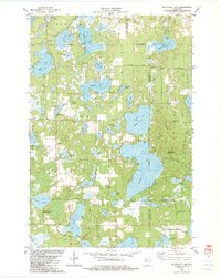
 1983 Webb Lake1983 Print · USGSBurnett County’s glaciated lake country comes into focus in the early 1980s, centered on the confluence of the St. Croix and Namekagon rivers. Genealogists and researchers can trace local family landmarks like Hillcrest Cem, the Swiss Cem, and the riverside community of Riverside.
 - 1983 Map of Danbury West
 1983 Danbury West1983 Print · USGSThe river borderlands of Burnett County were deeply tied to conservation and tribal heritage in the early 1980s. Genealogists and historians can trace family markers at Lena Lake Cem and explore the geography of the Mille Lacs Indian Reservation.
 - 1983 Map of Frog Lake
 1983 Frog Lake1983 Print · USGSThe Burnett and Washburn county borderlands are shown here in the early eighties as a dense maze of glacial lakes and riverways. You can trace early township landmarks like Forest Home Cem, the Fivemile Lookout Tower, and crossings at McDowell Bridge.
 - 1983 Map of Clam Falls
 1983 Clam Falls1983 Print · USGSPolk County in the early eighties shows a landscape of conservation and river-fed industry. Researchers can trace the Clam Falls Flowage near Clam Falls or locate the Lewis Cem and the settlement of Coomer.
 - 1983 Map of Trade Lake
 1983 Trade Lake1983 Print · USGSBurnett County and the surrounding lake country are shown here in the early 1980s, revealing a landscape of family-named lakes and rural crossroads. Genealogists and local historians can trace the sites of the Mission Ch, the Union Cem, and small settlements like Atlas and Trade Lake.
 - 1983 Map of Dairyland
 1983 Dairyland1983 Print · USGSNorthwestern Wisconsin at the Douglas and Burnett county line comes into focus in the early eighties. Genealogists and local historians can trace the rural landscape of Kingsdale and Cozy Corner, or locate family sites near Covenant Ch and the Dairyland Cem.
 - 1983 Map of Trade River
 1983 Trade River1983 Print · USGSIn the early 1980s, the borderlands of Burnett and Polk Counties were defined by the managed waters of the Fish Lake State Wildlife Area and the winding Trade River. Local researchers can find family landmarks and rural heritage sites such as St Olaf Cem, Bethany Ch, and the settlement of Branstad.
 - 1983 Map of Scovils Lake
 1983 Scovils Lake1983 Print · USGSThe St. Croix River corridor in the early 1980s reveals a landscape of protected riverways and quiet Northwoods settlements. Researchers can trace historic access points like Coppermine Dam or locate the Riverhill Cem and the former route of the Old RR Grade Road.
Showing maps 1-25 of 30
Top cities of Burnett County
- Grantsburg historical maps
- Trade Lake historical maps
- Siren historical maps
- Webster historical maps
- Webb Lake historical maps
Frequently asked questions
- What are the different types of historical maps available for Burnett County?
- What is the oldest map of Burnett County?
- Where can I purchase historical maps of Burnett County for my home or office?
- Where can I download high-res historical maps of Burnett County?
- Are there historical topographic maps available for Burnett County?
- Is there historical aerial imagery available for Burnett County?
- Where are historical maps of Burnett County sourced from?