2020s Maps of Swiss, Wisconsin
Explore 6 historic maps of Swiss from the 2020s. These maps offer a rare glimpse into what life looked like during the 2020s — showing old roads, neighborhoods, homes, and landmarks that have changed or disappeared over time.
Whether you're researching your family's past, planning a metal detecting trip, or studying how Swiss's landscape evolved across the 2020s, these high-resolution maps are a powerful tool for exploring the history of this region.
- Focus on a specific era: All maps on this page are from the 2020s, giving you a focused view of this time period.
- See what’s changed: Compare century-old streets, trails, and buildings to today's modern landscape using overlays and satellite layers.
- Research with precision: Use these maps for genealogy, historical research, land use analysis, or educational projects.
- View, download, or print: Maps are fully viewable online in high resolution, and can be downloaded or printed for your own records.
Start exploring Swiss's history through authentic maps from the 2020s. This is your window into the past.
Swiss, WI maps
(6)- 2022 Map of Danbury East, 2022 Print
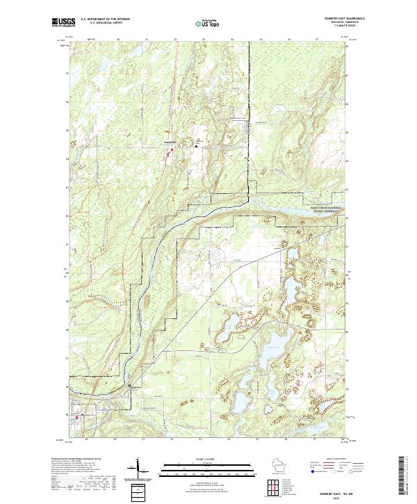 2022 Danbury East2022 Print · USGSThe Wisconsin-Minnesota borderlands are captured here in a period of quiet conservation and rural life. Genealogists can trace family landmarks like Markville Cem and the Danbury Indian Cem, while historians can follow the path of the Gandy Dancer State Trail.
 - 2022 Map of Webb Lake, 2022 Print
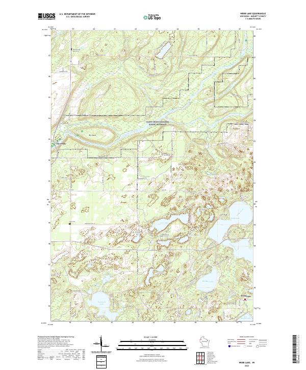 2022 Webb Lake2022 Print · USGSIn this lake-rich pocket of Burnett County during the early 2020s, the protected river corridor meets a dense cluster of historic waterways. Researchers can locate family burial sites at Swiss Cem and Hillcrest Cem Association while tracing the shores of Twentysix Lake and Webb Lake.
 - 2022 Map of Danbury West, 2022 Print
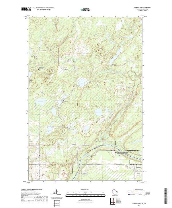 2022 Danbury West2022 Print · USGSThe St. Croix river valley is preserved here in the early twenty-first century as it forms the state line. Genealogists can locate the Native American Burial Grounds, Lena Lake Cem, and Saint Croix Landing.
 - 2022 Map of Birch Island Lake, 2022 Print
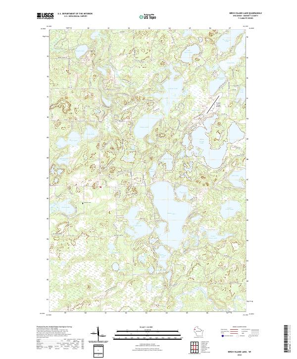 2022 Birch Island Lake2022 Print · USGSNorthern Wisconsin's lake country is captured here during the 2020s, showing a landscape defined by glacial waters and rural roads. Researchers can locate the Jackson Cemetery and trace the area's aviation and recreation at the Voyager Village Airstrip.
 - 2022 Map of Yellow Lake, 2022 Print
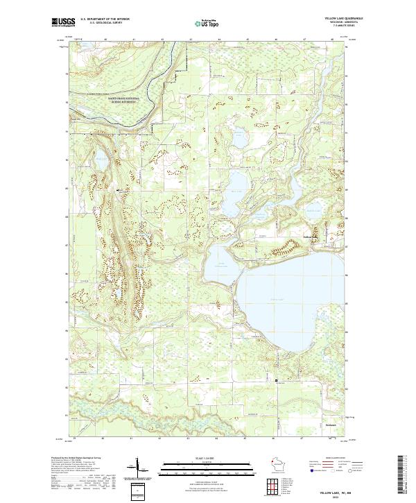 2022 Yellow Lake2022 Print · USGSNorthern Wisconsin lake country and the Minnesota border come alive in this recent survey. Local researchers can trace the shores of Yellow Lake and find ancestral sites at Bluff Lake Cem and Perida Cem.
 - 2022 Map of Webster, 2022 Print
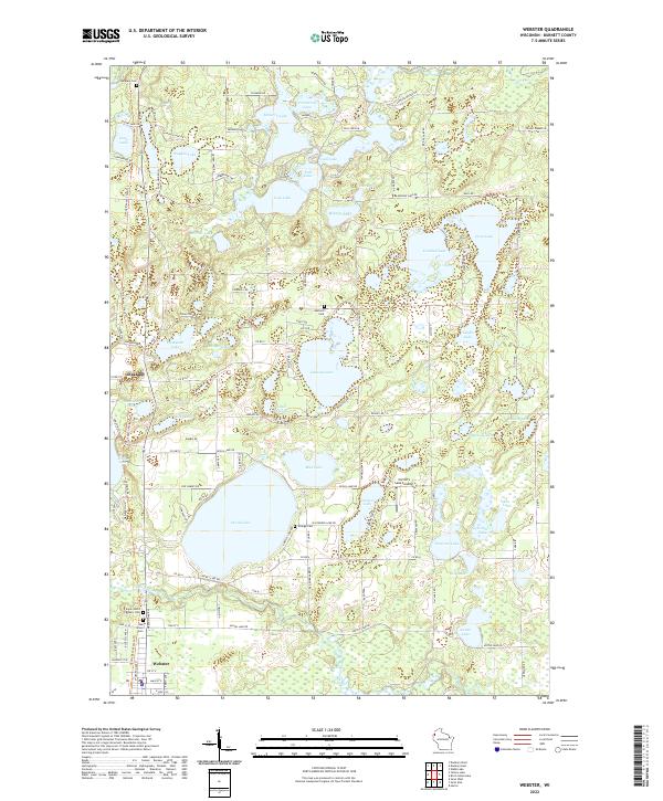 2022 Webster2022 Print · USGSBurnett County’s lake district comes into focus in this contemporary survey, centering on the community of Webster and the multi-use Gandy Dancer State Trl. Researchers can trace local lineage at Oakland Cem or locate old water access points at Connor's Lake Landing and Minerva Lndg.
End of results
Showing maps 1-6 of 6
Top cities near Swiss
Top neighborhoods of Swiss
Frequently asked questions
- What are the different types of historical maps available for Swiss?
- What is the oldest map of Swiss?
- Where can I purchase historical maps of Swiss for my home or office?
- Where can I download high-res historical maps of Swiss?
- Are there historical topographic maps available for Swiss?
- Is there historical aerial imagery available for Swiss?
- Where are historical maps of Swiss sourced from?