Old Maps of Christiana, Wisconsin for Metal Detecting
Plan your next treasure hunt with 39 historic maps of Christiana. Find old homesites, ghost towns, trails, and gathering spots that may be lost to time — perfect for identifying promising metal detecting locations.
- Locate forgotten sites: Uncover places like long-lost settlements, abandoned rail lines, or gathering spots.
- Plan better hunts: Use map overlays combined with LiDAR or satellite views to narrow in on historically rich areas.
- Made for detectorists: Thousands of hobbyists use these maps to discover relics, coins, and hidden history.
Use these historic maps to boost your research and find new opportunities beneath the surface of Christiana.
Christiana, WI maps
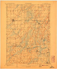
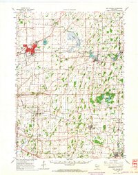
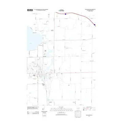
(39)- 1890 Map of Sun Prairie
 1890 Sun Prairie1890 Print · USGSEastern Dane County was a landscape of budding rail towns and glacial ridges in the late nineteenth century. Genealogists and local historians can trace the early footprints of Sun Prairie, Deerfield, and Marshall along the active corridors of the Chicago and Northwestern Railroad.2 unique versions available
 - 1890 Map of Stoughton
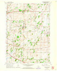
 1890 Stoughton1890 Print · USGSSouthern Wisconsin during the 1890s shows a landscape of thriving river towns and expanding rail networks. Researchers can trace early family homesteads near Stebbinsville, Cooksville, and Fulton Center while following the historic route of the Chicago Milwaukee and St Paul Railroad.6 unique versions available
 - 1896 Map of Sun Prairie
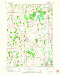
 1896 Sun Prairie1896 Print · USGSEastern Dane County in the 1880s is captured here as a landscape of glacial ridges and emerging rail towns. Genealogists and local historians can trace early homesteads and rail stops like Deansville, Cottage Grove, and London.2 unique versions available
 - 1905 Map of Sun Prairie, 1959 Print
 1905 Sun Prairie1959 Print · USGSIn the early twentieth century, this part of Dane County was a thriving network of rail-stop towns and dairy farms. Genealogists and historians can trace the original rail paths of the Milwaukee Road through settlements like Sun Prairie, Deerfield, and Marshall.
 - 1907 Map of Sun Prairie
 1907 Sun Prairie1907 Print · USGSEastern Dane County at the turn of the century shows a landscape of rail-connected dairy towns and glacial wetlands. Genealogists and historians can trace family locations near York Center, Liberty Mound, and the old rail junction at London.8 unique versions available
 - 1954 Map of Rockford
 1954 Rockford1954 Print · USGSThe Rock River valley and the Illinois-Wisconsin borderlands are captured here in the mid-1950s during a period of robust industrial and agricultural activity. Genealogists and historians can trace rail-era corridors like the Illinois Central RR and locate landmarks from Big Foot Prairie to Lake Geneva.
 - 1955 Map of Rockford
 1955 Rockford1955 Print · USGSThe Rock River valley and southern Wisconsin dairy country are shown here in the mid-fifties as the region's manufacturing centers grew. Genealogists and historians can trace the paths of the Chicago and North Western RR and Illinois Central RR through hubs like Rockford and Beloit.
 - 1957 Map of Madison, 1967 Print
 1957 Madison1967 Print · USGSSouth-central Wisconsin in the mid-fifties reveals a landscape of industrial hubs and glacial lakes linked by a dense rail and highway network. Genealogists and historians can trace the development of lakeside communities and find notable sites like Badger Ordnance Works and the Horicon National Wildlife Refuge.3 unique versions available
 - 1958 Map of Rockford, 1974 Print
 1958 Rockford1974 Print · USGSNorthern Illinois and southern Wisconsin are shown here in the mid-twentieth century as rail-dependent industrial towns began to interface with growing lakefront communities. Genealogists can trace family roots through settlements like Saylesville and Tess Corners or locate historical landmarks like the Rockford Ordnance Depot.4 unique versions available
 - 1960 Map of Madison
 1960 Madison1960 Print · USGSCentral and Southern Wisconsin are captured in the late fifties, showing the region as its rail-and-river network matured. Trace the paths of the Soo Line RR or locate family roots near Lake Mendota and Horicon National Wildlife Refuge.2 unique versions available
 - 1961 Map of Stoughton, 1963 Print
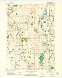
 1961 Stoughton1963 Print · USGSDane and Rock Counties during the early sixties center on the tobacco-processing hubs of the Rock River valley. Genealogists and local researchers can trace family lands near Hanerville, identify remote schools like Bass Lake Sch, or locate historic burials at Jensen Cem and South Porter Cem.2 unique versions available
 - 1961 Map of Rockdale, 1964 Print
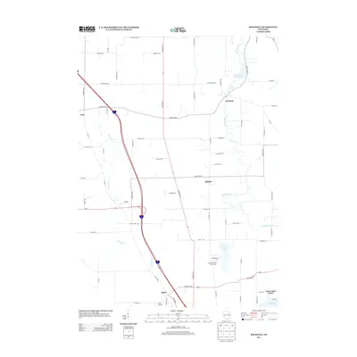
 1961 Rockdale1964 Print · USGSThe rural landscape of eastern Dane County is captured here in the early 1960s, showing the agricultural heartland between Cambridge and Albion. Researchers can trace the heritage of local families through landmarks like East Koshkonong Cemetery, Smithback School, and the Hickory Hill Girl Scout Camp.2 unique versions available
 - 1961 Map of Stoughton, 1964 Print
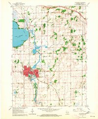 1961 Stoughton1964 Print · USGSStoughton and the southern Dane County countryside appear in the early sixties as a bustling rail-and-river hub. Researchers can locate local landmarks like the Martin Luther Childrens Home, Nelson Airport, and the Skaalen Cem along the Yahara River.3 unique versions available
 - 1962 Map of Sun Prairie, 1964 Print
 1962 Sun Prairie1964 Print · USGSEastern Dane County thrives as a rail-connected agricultural region in the early sixties, centered on the growing community of Sun Prairie. Researchers can trace old family roots through numerous landmarks like the Prairie Queen Sch, York Center Ch, and the Liberty Prairie Cem.2 unique versions available
 - 1962 Map of Cottage Grove, 1964 Print
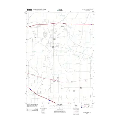
 1962 Cottage Grove1964 Print · USGSCottage Grove and the surrounding Dane County townships are shown here in the early sixties, caught in an era of stable rural life and rail transport. Researchers can find precise locations for Cottage Grove Cem, the Largo Sch, and the winding course of Door Creek.5 unique versions available
 - 1962 Map of Deerfield, 1964 Print
 1962 Deerfield1964 Print · USGSIn the early sixties, the farming communities of eastern Dane County were centered around the Chicago and North Western rail line. Genealogists and local historians can trace rural schoolhouses like Oak Park School and family landmarks such as Hauge Cemetery and Kroghville.2 unique versions available
 - 1963 Map of Rockford
 1963 Rockford1963 Print · USGSThe mid-century industrial corridor along the Rock River is shown here during a period of rapid post-war growth. Researchers can trace the extensive rail lines of the Chicago and North Western or locate local landmarks like the Rockford Ordnance Depot and Holy Hill.
 - 1981 Map of Monroe
 1981 Monroe1981 Print · USGSSouthern Wisconsin and the Illinois borderlands come into focus in the early 1980s, showcasing a landscape defined by dairy farming and river valleys. Genealogists can trace family roots through historic hubs like Monroe, Stoughton, and Brodhead, or locate regional landmarks such as Yellowstone Lake and the Sugar River.
 - 1991 Map of Madison
 1991 Madison1991 Print · USGSMadison and its iconic glacial lakes are captured here during a time of steady urban expansion and regional growth. Researchers can trace the mid-century development of the University of Wisconsin, locate family sites near Forest Hill Cem, or explore the footprint of the Badger Army Ammunition Plant.
 - 2010 Map of Stoughton, 2010 Print
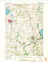
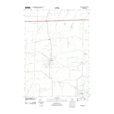
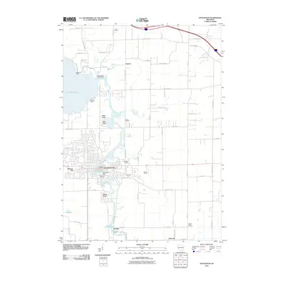 2010 Stoughton2010 Print · USGSCovers Christiana, including Stoughton, Pleasant Springs, and other nearby areas
 - 2010 Map of Deerfield, 2010 Print
 2010 Deerfield2010 Print · USGSCovers Christiana, including Oakland, Deerfield, and other nearby areas
 - 2010 Map of Rockdale, 2010 Print
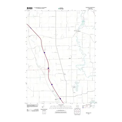 2010 Rockdale2010 Print · USGSCovers Christiana, including Oakland, Albion, and other nearby areas
 - 2011 Map of Cottage Grove, 2011 Print
 2011 Cottage Grove2011 Print · USGSCovers Christiana, including Madison, McFarland, and other nearby areas
 - 2013 Map of Rockdale, 2013 Print
 2013 Rockdale2013 Print · USGSCovers Christiana, including Oakland, Albion, and other nearby areas
 - 2013 Map of Stoughton, 2013 Print
 2013 Stoughton2013 Print · USGSCovers Christiana, including Stoughton, Pleasant Springs, and other nearby areas
Showing maps 1-25 of 39
Top cities near Christiana
- Madison historical maps
- Janesville historical maps
- Sun Prairie historical maps
- Stoughton historical maps
- Fort Atkinson historical maps
- Windsor historical maps
See more
Top neighborhoods of Christiana
Frequently asked questions
- What are the different types of historical maps available for Christiana?
- What is the oldest map of Christiana?
- Where can I purchase historical maps of Christiana for my home or office?
- Where can I download high-res historical maps of Christiana?
- Are there historical topographic maps available for Christiana?
- Is there historical aerial imagery available for Christiana?
- Where are historical maps of Christiana sourced from?