Old Maps of Dunn, Wisconsin for Genealogy
Trace your family roots with 49 historic maps of Dunn. These high-res maps reveal old neighborhoods, homesites, landmarks, and streets — helping you uncover where your ancestors lived and how the area evolved over time.
- Explore historic neighborhoods: Identify where your relatives may have lived in the 1800s or 1900s.
- Compare maps over time: Trace the changes in streets, buildings, and landmarks for multi-generational research.
- Perfect for genealogy & ancestry research: Used by family historians and researchers to map out lineage and migration.
These maps are an incredible resource for exploring your personal connection to Dunn's past.
Dunn, WI maps
(49)- 1889 Map of Evansville
 1889 Evansville1889 Print · USGSSouthern Wisconsin at the end of the nineteenth century was a landscape of growing rail towns and post offices scattered across glacial drumlins. Genealogists can trace family roots through the early plats of Evansville, Oregon, and the Lake View Post Office.
 - 1890 Map of Madison
 1890 Madison1890 Print · USGSMadison and its surrounding lake country are captured in the late 1880s as the capital city began to dominate the central isthmus. Researchers can trace early rail corridors like the Madison and Northern Railroad and locate settlements such as Mendota and Token Creek.
 - 1890 Map of Sun Prairie
 1890 Sun Prairie1890 Print · USGSEastern Dane County was a landscape of budding rail towns and glacial ridges in the late nineteenth century. Genealogists and local historians can trace the early footprints of Sun Prairie, Deerfield, and Marshall along the active corridors of the Chicago and Northwestern Railroad.2 unique versions available
 - 1890 Map of Stoughton
 1890 Stoughton1890 Print · USGSSouthern Wisconsin during the 1890s shows a landscape of thriving river towns and expanding rail networks. Researchers can trace early family homesteads near Stebbinsville, Cooksville, and Fulton Center while following the historic route of the Chicago Milwaukee and St Paul Railroad.6 unique versions available
 - 1892 Map of Madison
 1892 Madison1892 Print · USGSDane County in the late nineteenth century centers on the emerging isthmus city of Madison and its surrounding glacial lakes. Genealogists and historians can trace rail-aligned settlements like Waunakee, De Forest, and Mac Farland alongside the banks of Lake Mendota.3 unique versions available
 - 1894 Map of Evansville
 1894 Evansville1894 Print · USGSSouthern Wisconsin at the end of the nineteenth century was a landscape of expanding rail lines and productive prairie farms. Genealogists and local historians can trace early settlements like Oak Hall, the lakeside community of Lakeview, and the winding course of the Sugar River.2 unique versions available
 - 1896 Map of Sun Prairie
 1896 Sun Prairie1896 Print · USGSEastern Dane County in the 1880s is captured here as a landscape of glacial ridges and emerging rail towns. Genealogists and local historians can trace early homesteads and rail stops like Deansville, Cottage Grove, and London.2 unique versions available
 - 1904 Map of Madison, 1954 Print
 1904 Madison1954 Print · USGSDane County's capital and its surrounding chain of lakes are shown here at the turn of the century. Genealogists and local historians can trace the early footprints of the University of Wisconsin, the Fair Grounds, and settlements like Token and Norway Grove.
 - 1905 Map of Sun Prairie, 1959 Print
 1905 Sun Prairie1959 Print · USGSIn the early twentieth century, this part of Dane County was a thriving network of rail-stop towns and dairy farms. Genealogists and historians can trace the original rail paths of the Milwaukee Road through settlements like Sun Prairie, Deerfield, and Marshall.
 - 1906 Map of Evansville
 1906 Evansville1906 Print · USGSWisconsin's southern prairie and wetlands are mapped here in the early twentieth century as the railroad transformed rural trade. Trace the iron paths of the C. and N. W. R. R. through Evansville and Oregon, or find local landmarks like Red Bridge Crossing and Liberty Pole Hill.3 unique versions available
 - 1906 Map of Madison
 1906 Madison1906 Print · USGSThe state capital and its Four Lakes are captured here in the early twentieth century. Genealogists and historians can trace the early development of Madison and the University of Wisconsin, along with rural hubs like Waunakee and Mc Farland.6 unique versions available
 - 1907 Map of Sun Prairie
 1907 Sun Prairie1907 Print · USGSEastern Dane County at the turn of the century shows a landscape of rail-connected dairy towns and glacial wetlands. Genealogists and historians can trace family locations near York Center, Liberty Mound, and the old rail junction at London.8 unique versions available
 - 1954 Map of Rockford
 1954 Rockford1954 Print · USGSThe Rock River valley and the Illinois-Wisconsin borderlands are captured here in the mid-1950s during a period of robust industrial and agricultural activity. Genealogists and historians can trace rail-era corridors like the Illinois Central RR and locate landmarks from Big Foot Prairie to Lake Geneva.
 - 1955 Map of Rockford
 1955 Rockford1955 Print · USGSThe Rock River valley and southern Wisconsin dairy country are shown here in the mid-fifties as the region's manufacturing centers grew. Genealogists and historians can trace the paths of the Chicago and North Western RR and Illinois Central RR through hubs like Rockford and Beloit.
 - 1957 Map of Madison, 1967 Print
 1957 Madison1967 Print · USGSSouth-central Wisconsin in the mid-fifties reveals a landscape of industrial hubs and glacial lakes linked by a dense rail and highway network. Genealogists and historians can trace the development of lakeside communities and find notable sites like Badger Ordnance Works and the Horicon National Wildlife Refuge.3 unique versions available
 - 1958 Map of Rockford, 1974 Print
 1958 Rockford1974 Print · USGSNorthern Illinois and southern Wisconsin are shown here in the mid-twentieth century as rail-dependent industrial towns began to interface with growing lakefront communities. Genealogists can trace family roots through settlements like Saylesville and Tess Corners or locate historical landmarks like the Rockford Ordnance Depot.4 unique versions available
 - 1959 Map of Madison, 1961 Print
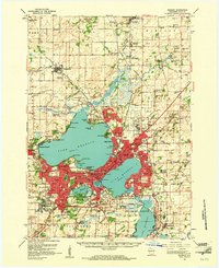 1959 Madison1961 Print · USGSMadison and the surrounding Dane County countryside appear here in the late fifties, showing the city's growth between its iconic lakes. Genealogists and local historians can trace family roots through numerous country schools like Wangness Sch and historic cemeteries such as Norway Grove Cem.3 unique versions available
 - 1959 Map of Madison East, 1970 Print
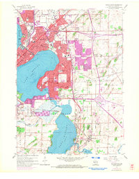 1959 Madison East1970 Print · USGSMadison and its eastern lakefront suburbs are captured during a period of significant post-war expansion. Genealogists can trace family footprints through numerous local institutions like St Bernards Sch, Blooming Grove Cem, and McFarland.2 unique versions available
 - 1960 Map of Madison
 1960 Madison1960 Print · USGSCentral and Southern Wisconsin are captured in the late fifties, showing the region as its rail-and-river network matured. Trace the paths of the Soo Line RR or locate family roots near Lake Mendota and Horicon National Wildlife Refuge.2 unique versions available
 - 1961 Map of Stoughton, 1963 Print
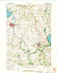 1961 Stoughton1963 Print · USGSDane and Rock Counties during the early sixties center on the tobacco-processing hubs of the Rock River valley. Genealogists and local researchers can trace family lands near Hanerville, identify remote schools like Bass Lake Sch, or locate historic burials at Jensen Cem and South Porter Cem.2 unique versions available
 - 1961 Map of Evansville, 1963 Print
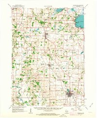 1961 Evansville1963 Print · USGSThe rural landscape between Madison and Janesville is captured here in the early sixties, showing a robust agricultural economy and well-defined town centers. Genealogists can trace family footprints at Franklin Sch, St Marys Cem, and the crossroads at Butts Corners.2 unique versions available
 - 1961 Map of Rutland, 1964 Print
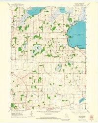 1961 Rutland1964 Print · USGSThe glacial lakes and wetlands south of Madison are captured here in the early sixties. Genealogists and historians can trace the rural layouts of Rutland and Stone, or find old schoolhouses like Oakside Sch and family-named landmarks like Lunds Point.3 unique versions available
 - 1961 Map of Stoughton, 1964 Print
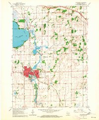 1961 Stoughton1964 Print · USGSStoughton and the southern Dane County countryside appear in the early sixties as a bustling rail-and-river hub. Researchers can locate local landmarks like the Martin Luther Childrens Home, Nelson Airport, and the Skaalen Cem along the Yahara River.3 unique versions available
 - 1962 Map of Sun Prairie, 1964 Print
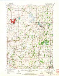 1962 Sun Prairie1964 Print · USGSEastern Dane County thrives as a rail-connected agricultural region in the early sixties, centered on the growing community of Sun Prairie. Researchers can trace old family roots through numerous landmarks like the Prairie Queen Sch, York Center Ch, and the Liberty Prairie Cem.2 unique versions available
 - 1962 Map of Cottage Grove, 1964 Print
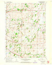 1962 Cottage Grove1964 Print · USGSCottage Grove and the surrounding Dane County townships are shown here in the early sixties, caught in an era of stable rural life and rail transport. Researchers can find precise locations for Cottage Grove Cem, the Largo Sch, and the winding course of Door Creek.5 unique versions available
Showing maps 1-25 of 49
Top cities near Dunn
- Madison historical maps
- Sun Prairie historical maps
- Fitchburg historical maps
- Middleton historical maps
- Waunakee historical maps
- Stoughton historical maps
See more
Top neighborhoods of Dunn
Frequently asked questions
- What are the different types of historical maps available for Dunn?
- What is the oldest map of Dunn?
- Where can I purchase historical maps of Dunn for my home or office?
- Where can I download high-res historical maps of Dunn?
- Are there historical topographic maps available for Dunn?
- Is there historical aerial imagery available for Dunn?
- Where are historical maps of Dunn sourced from?