Old Maps of Superior, Wisconsin
Explore 31 old maps of Superior, spanning from 1915 to today. These high-resolution historic maps reveal how streets, neighborhoods, landmarks, and natural features evolved over time — perfect for genealogy, metal detecting, research, and local history exploration.
What you can do with these maps:
- See how Superior changed over time: Compare historical maps to modern-day views to trace roads, homesites, rail lines & more.
- View detailed metadata: Each map includes creators, publishers, year, scale, and archive source.
- Overlay maps with satellite & LiDAR: Visualize the past alongside modern tools to explore terrain & human change.
- Trusted historical sources: Maps sourced from the USGS, Library of Congress, and other archives.
- Access maps your way: View online, download high-res files, or order prints for personal or research use.
Start exploring old maps of Superior to uncover forgotten places, hidden landmarks, and the deep history beneath your feet.
Superior, WI maps
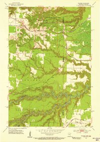
(31)- 1915 Map of Superior
 1915 Superior1915 Print · USGSThe Twin Ports region at the peak of the industrial era shows a landscape defined by massive rail yards and shoreline development. Genealogists and historians can locate early neighborhoods like Morgan Park, find rural landmarks like Saunders Cem, and trace the numerous lines of the Northern Pacific railroad.2 unique versions available
 - 1917 Map of Superior
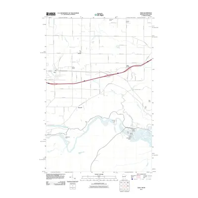
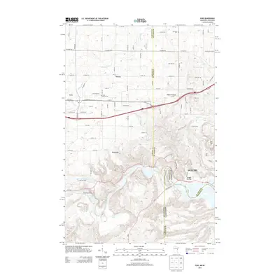
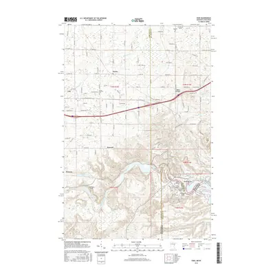
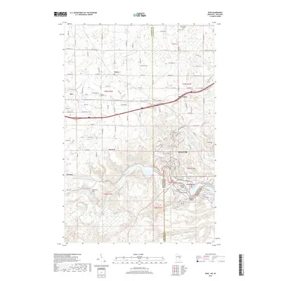
 1917 Superior1917 Print · USGSThe Twin Ports region at the height of its industrial boom reveals a landscape of massive rail yards and shipping docks. Trace the development of South Superior and Steelton, or locate early rural landmarks like Selden School and Manitou Falls.3 unique versions available
 - 1953 Map of Duluth, 1964 Print
 1953 Duluth1964 Print · USGSNortheastern Minnesota and northwestern Wisconsin are shown here during a period of industrial maturity and expanding conservation. Genealogists and historians can trace rail-connected towns like McGrath and Wahkon, or locate heritage sites within the Fond du Lac Indian Reservation.2 unique versions available
 - 1954 Map of West Duluth, 1955 Print
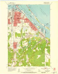
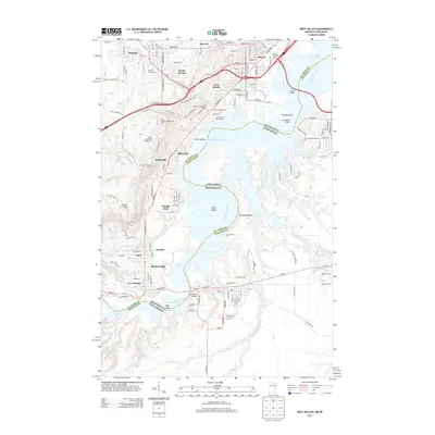
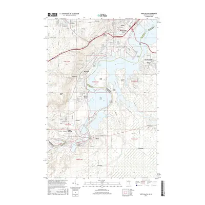
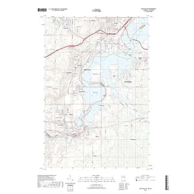
 1954 West Duluth1955 Print · USGSThe industrial waterfronts of the Twin Ports are captured here during the mid-fifties, showing the dense rail networks and residential neighborhoods of the St. Louis River valley. Researchers can trace family sites and local landmarks from Morgan Park to the Oneota Cemetery and the height of Bardon Peak.9 unique versions available
 - 1954 Map of Borea, 1955 Print
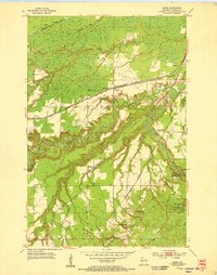 1954 Borea1955 Print · USGSDouglas County was a bustling rail corridor in the mid-fifties, where multiple major lines intersected near the winding Nemadji River. You can trace the historic rail junctions at Boylston, locate St Aloysius Ch, and explore the early layout of Pattison State Park.2 unique versions available
 - 1954 Map of Sunnyside, 1955 Print
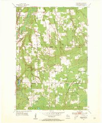 1954 Sunnyside1955 Print · USGSDouglas County landscape in the mid-1950s shows a region of heavy timber, active rail junctions, and the early development of Pattison State Park. Genealogists and hikers can trace old landmarks like the Manitou Falls Ch, Nemadji Sch, and the winding Old Railroad Grade.2 unique versions available
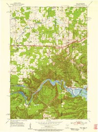
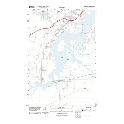
 - 1954 Map of Superior, 1955 Print
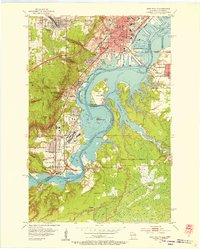
 1954 Superior1955 Print · USGSThe industrial waterfront of Superior at mid-century is captured in this survey, showing a landscape defined by shipping and rail. Researchers can trace family roots through numerous sites like St Francis Cem, Wisconsin State College, and South Itasca.6 unique versions available
 - 1954 Map of Frogner, 1955 Print
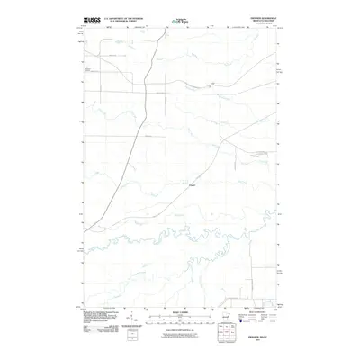
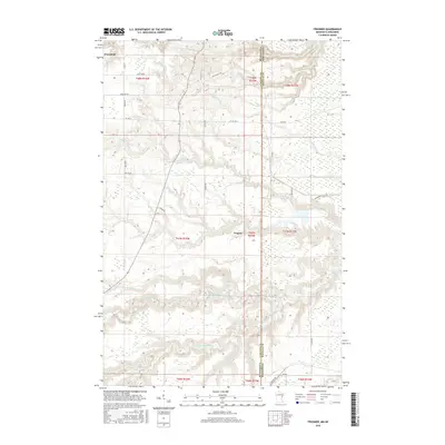
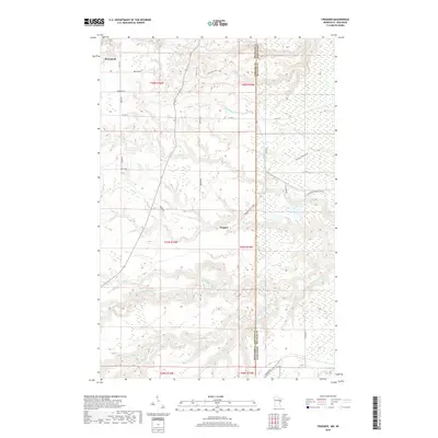
 1954 Frogner1955 Print · USGSThe Minnesota and Wisconsin borderlands come alive in the 1950s, showing a landscape shaped by the Nemadji River and heavy rail traffic. Genealogists and rail historians can trace the paths of the Great Northern through Wrenshall or locate the Foxboro Sch and Maccabee Cem.4 unique versions available
 - 1954 Map of Esko, 1955 Print
 1954 Esko1955 Print · USGSThe St. Louis River valley and the community of Esko are shown here in the mid-1950s as the region's rail and park systems were fully established. Genealogists and local historians can trace the early footprints of Fond du Lac, the Finnish Ch, and the winding Duluth Missabe and Iron Range railroad.5 unique versions available
 - 1954 Map of Superior, 1959 Print
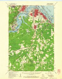 1954 Superior1959 Print · USGSThe Twin Ports and Douglas County are captured in the mid-fifties, showing the industrial waterfronts and rail yards at their peak. Researchers can locate vanished landmarks like the Concrete Sch or trace family roots at St Joseph Orphanage and Morgan Park.
 - 1958 Map of Duluth
 1958 Duluth1958 Print · USGSNortheastern Minnesota and the Wisconsin borderlands are shown in detail during the late 1950s, centered on the bustling rail yards and ports of Duluth. You can trace the historic routes of the Soo Line and Duluth Missabe & Iron Range through small towns like McGrath, Bruno, and Wrenshall.
 - 1980 Map of Duluth
 1980 Duluth1980 Print · USGSThe Twin Ports of the early 1980s showcase a landscape defined by heavy rail lines and Lake Superior shipping. Trace the iron-ore routes through Proctor or locate family sites near Sunrise Memorial Cem and Floodwood.
 - 1997 Map of West Duluth, 1999 Print
 1997 West Duluth1999 Print · USGSThe industrial heart of the Twin Ports comes alive in this late-century study of the riverfront and its rail-connected neighborhoods. Genealogists and historians can trace family roots through Oneota Cemetery or locate old school sites like St Patricks Sch and Stowe Sch.
 - 2010 Map of West Duluth, 2010 Print
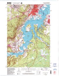
 2010 West Duluth2010 Print · USGSCovers Superior, including Duluth, Proctor, and other nearby areas
 - 2010 Map of Frogner, 2010 Print
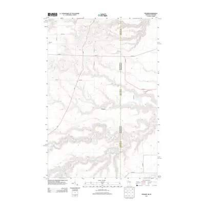
 2010 Frogner2010 Print · USGSCovers Superior, including Wrenshall, Holyoke Township, and other nearby areas
 - 2011 Map of Esko, 2011 Print
 2011 Esko2011 Print · USGSCovers Superior, including Duluth, Harney, and other nearby areas
 - 2013 Map of Frogner, 2013 Print
 2013 Frogner2013 Print · USGSCovers Superior, including Wrenshall, Holyoke Township, and other nearby areas
 - 2013 Map of Esko, 2013 Print
 2013 Esko2013 Print · USGSCovers Superior, including Duluth, Harney, and other nearby areas
 - 2013 Map of West Duluth, 2013 Print
 2013 West Duluth2013 Print · USGSCovers Superior, including Duluth, Proctor, and other nearby areas
 - 2016 Map of West Duluth, 2016 Print
 2016 West Duluth2016 Print · USGSCovers Superior, including Duluth, Proctor, and other nearby areas
 - 2016 Map of Esko, 2016 Print
 2016 Esko2016 Print · USGSCovers Superior, including Duluth, Harney, and other nearby areas
 - 2016 Map of Frogner, 2016 Print
 2016 Frogner2016 Print · USGSCovers Superior, including Wrenshall, Holyoke Township, and other nearby areas
 - 2019 Map of Esko, 2019 Print
 2019 Esko2019 Print · USGSCovers Superior, including Duluth, Harney, and other nearby areas
 - 2019 Map of West Duluth, 2019 Print
 2019 West Duluth2019 Print · USGSCovers Superior, including Duluth, Proctor, and other nearby areas
 - 2019 Map of Frogner, 2019 Print
 2019 Frogner2019 Print · USGSCovers Superior, including Wrenshall, Holyoke Township, and other nearby areas
Showing maps 1-25 of 31
Top cities near Superior
- Duluth historical maps
- Superior historical maps
- Hermantown historical maps
- Proctor historical maps
- Parkland historical maps
- Carlton historical maps
See more
Top neighborhoods of Superior
- Carnegie historical maps
- Pokegama historical maps
- Anton historical maps
- Ambridge historical maps
- Boylston Junction historical maps
- Riverview historical maps
See more
Frequently asked questions
- What are the different types of historical maps available for Superior?
- What is the oldest map of Superior?
- Where can I purchase historical maps of Superior for my home or office?
- Where can I download high-res historical maps of Superior?
- Are there historical topographic maps available for Superior?
- Is there historical aerial imagery available for Superior?
- Where are historical maps of Superior sourced from?