Old Maps of Douglas County, Wisconsin
Explore 72 old maps of Douglas County, spanning from 1915 to today. These high-resolution historic maps reveal how streets, neighborhoods, landmarks, and natural features evolved over time — perfect for genealogy, metal detecting, research, and local history exploration.
What you can do with these maps:
- See how Douglas County changed over time: Compare historical maps to modern-day views to trace roads, homesites, rail lines & more.
- View detailed metadata: Each map includes creators, publishers, year, scale, and archive source.
- Overlay maps with satellite & LiDAR: Visualize the past alongside modern tools to explore terrain & human change.
- Trusted historical sources: Maps sourced from the USGS, Library of Congress, and other archives.
- Access maps your way: View online, download high-res files, or order prints for personal or research use.
Start exploring old maps of Douglas County to uncover forgotten places, hidden landmarks, and the deep history beneath your feet.
Douglas County, WI maps
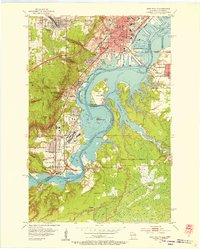
(72)- 1915 Map of Superior
 1915 Superior1915 Print · USGSCovers Douglas County, including Duluth, Superior, and other nearby areas2 unique versions available
 - 1917 Map of Superior
 1917 Superior1917 Print · USGSCovers Douglas County, including Duluth, Superior, and other nearby areas3 unique versions available
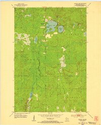
 - 1945 Map of Highland, 1956 Print
 1945 Highland1956 Print · USGSCovers Douglas County, including Hawthorne, Lake Nebagamon, and other nearby areas
 - 1945 Map of Solon Springs, 1957 Print
 1945 Solon Springs1957 Print · USGSCovers Douglas County, including Hawthorne, Gordon, and other nearby areas
 - 1947 Map of Brule
 1947 Brule1947 Print · USGSCovers Douglas County, including Hawthorne, Lake Nebagamon, and other nearby areas2 unique versions available
 - 1947 Map of Chittamo, 1956 Print
 1947 Chittamo1956 Print · USGSCovers Douglas County, including Hayward, Gordon, and other nearby areas2 unique versions available
 - 1947 Map of Minong, 1964 Print
 1947 Minong1964 Print · USGSCovers Douglas County, including Gordon, Wascott, and other nearby areas
 - 1949 Map of Danbury
 1949 Danbury1949 Print · USGSCovers Douglas County, including Dairyland, Kingsdale, and other nearby areas
 - 1949 Map of Solon Springs
 1949 Solon Springs1949 Print · USGSCovers Douglas County, including Hawthorne, Gordon, and other nearby areas
 - 1949 Map of Chittamo
 1949 Chittamo1949 Print · USGSCovers Douglas County, including Hayward, Gordon, and other nearby areas
 - 1949 Map of Holyoke
 1949 Holyoke1949 Print · USGSCovers Douglas County, including Holyoke, Dairyland, and other nearby areas2 unique versions available
 - 1949 Map of Minong
 1949 Minong1949 Print · USGSCovers Douglas County, including Gordon, Wascott, and other nearby areas
 - 1949 Map of Webb Lake
 1949 Webb Lake1949 Print · USGSCovers Douglas County, including Gordon, Wascott, and other nearby areas
 - 1949 Map of Patzau
 1949 Patzau1949 Print · USGSCovers Douglas County, including Gordon, Dairyland, and other nearby areas
 - 1949 Map of Poplar
 1949 Poplar1949 Print · USGSCovers Douglas County, including Superior, Parkland, and other nearby areas
 - 1949 Map of Highland
 1949 Highland1949 Print · USGSCovers Douglas County, including Hawthorne, Lake Nebagamon, and other nearby areas
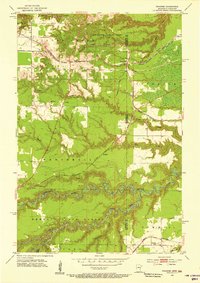
 - 1953 Map of Ashland, 1964 Print
 1953 Ashland1964 Print · USGSCovers Douglas County, including Duluth, Superior, and other nearby areas3 unique versions available
 - 1953 Map of Duluth, 1964 Print
 1953 Duluth1964 Print · USGSCovers Douglas County, including Duluth, Superior, and other nearby areas2 unique versions available
 - 1954 Map of West Duluth, 1955 Print
 1954 West Duluth1955 Print · USGSCovers Douglas County, including Duluth, Superior, and other nearby areas9 unique versions available
 - 1954 Map of Borea, 1955 Print
 1954 Borea1955 Print · USGSCovers Douglas County, including Summit, Boylston, and other nearby areas2 unique versions available
 - 1954 Map of Foxboro, 1955 Print
 1954 Foxboro1955 Print · USGSCovers Douglas County, including Summit, Holyoke Township, and other nearby areas4 unique versions available
 - 1954 Map of Sunnyside, 1955 Print
 1954 Sunnyside1955 Print · USGSCovers Douglas County, including Parkland, Summit, and other nearby areas2 unique versions available
 - 1954 Map of Superior, 1955 Print
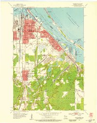 1954 Superior1955 Print · USGSCovers Douglas County, including Duluth, Superior, and other nearby areas6 unique versions available
 - 1954 Map of Amnicon Lake, 1955 Print
 1954 Amnicon Lake1955 Print · USGSCovers Douglas County, including Gordon, Summit, and other nearby areas2 unique versions available
 - 1954 Map of Frogner, 1955 Print
 1954 Frogner1955 Print · USGSCovers Douglas County, including Wrenshall, Summit, and other nearby areas4 unique versions available
Showing maps 1-25 of 72
Top cities of Douglas County
- Superior historical maps
- Parkland historical maps
- Hawthorne historical maps
- Lake Nebagamon historical maps
- Gordon historical maps
- Wascott historical maps
See more
Frequently asked questions
- What are the different types of historical maps available for Douglas County?
- What is the oldest map of Douglas County?
- Where can I purchase historical maps of Douglas County for my home or office?
- Where can I download high-res historical maps of Douglas County?
- Are there historical topographic maps available for Douglas County?
- Is there historical aerial imagery available for Douglas County?
- Where are historical maps of Douglas County sourced from?