Old Maps of Douglas County, Wisconsin for Genealogy
Trace your family roots with 252 historic maps of Douglas County. These high-res maps reveal old neighborhoods, homesites, landmarks, and streets — helping you uncover where your ancestors lived and how the area evolved over time.
- Explore historic neighborhoods: Identify where your relatives may have lived in the 1800s or 1900s.
- Compare maps over time: Trace the changes in streets, buildings, and landmarks for multi-generational research.
- Perfect for genealogy & ancestry research: Used by family historians and researchers to map out lineage and migration.
These maps are an incredible resource for exploring your personal connection to Douglas County's past.
Douglas County, WI maps
(252)- 1915 Map of Superior
 1915 Superior1915 Print · USGSThe Twin Ports region at the peak of the industrial era shows a landscape defined by massive rail yards and shoreline development. Genealogists and historians can locate early neighborhoods like Morgan Park, find rural landmarks like Saunders Cem, and trace the numerous lines of the Northern Pacific railroad.2 unique versions available
 - 1917 Map of Superior
 1917 Superior1917 Print · USGSThe Twin Ports region at the height of its industrial boom reveals a landscape of massive rail yards and shipping docks. Trace the development of South Superior and Steelton, or locate early rural landmarks like Selden School and Manitou Falls.3 unique versions available
 - 1945 Map of Highland, 1956 Print
 1945 Highland1956 Print · USGSNorthwestern Wisconsin at the end of the war is revealed here through its intricate network of glacial lakes and northern forests. Researchers can pinpoint mid-century local landmarks like the Frances Willard Sch, Barnes Cem, and the path of the Brule River.
 - 1945 Map of Solon Springs, 1957 Print
 1945 Solon Springs1957 Print · USGSWisconsin's headwaters region comes to life in the 1940s, showing the early infrastructure and wilderness of Douglas County. Researchers can trace the Old Portage Tr, locate the Sieur du Lhut Monument, and find vanished schoolhouses like Ibsen Sch.
 - 1947 Map of Brule
 1947 Brule1947 Print · USGSDouglas and Bayfield counties are seen here in the mid-1940s, where the legendary trout waters of the Bois Brule River meet the Lake Superior shoreline. Genealogists and local historians can locate early homesteading landmarks like Rest Haven Cem, St Ann Ch, and the rural community hubs of Cloverland and Maple.2 unique versions available
 - 1947 Map of Chittamo, 1956 Print
 1947 Chittamo1956 Print · USGSNorthwest Wisconsin's lake country is captured in the mid-1940s, showing a land of dense wetlands and winding river systems. Genealogists and historians can locate rural schoolhouses like Chittamo Sch and trace the original paths of the Totagatic River and Claire River.2 unique versions available
 - 1947 Map of Minong, 1964 Print
 1947 Minong1964 Print · USGSNorthwest Wisconsin's lake country is captured here in the late 1940s as rail and road corridors began to open the woods for more permanent settlement. Genealogists can locate family-named landmarks and rural hubs like Wascott Ch, Hoover Sch, and the village of Minong.
 - 1949 Map of Danbury
 1949 Danbury1949 Print · USGSDanbury and the surrounding river country are captured here just after the war, showing the boundary lands of Burnett and Pine Counties. Genealogists can trace early rural schooling at Atkinson Sch or locate the Emergency Landing Field and Minerva Dam along the St Croix River.
 - 1949 Map of Solon Springs
 1949 Solon Springs1949 Print · USGSNorthwestern Wisconsin at the end of the 1940s reveals a landscape of timber, rail, and water centered on the St. Croix headwaters. Genealogists and historians can locate rural landmarks like New Hawthorne Cem, Roosevelt Sch, and the Sieur du Lhut Monument near the rail lines at Sauntry.
 - 1949 Map of Chittamo
 1949 Chittamo1949 Print · USGSNorthwestern Wisconsin at the end of the 1940s shows a landscape of scattered settlements and winding rivers before modern development. Genealogists and historians can trace family locations near Chittamo Sch, Stanberry, and the Totagatic Dam.
 - 1949 Map of Holyoke
 1949 Holyoke1949 Print · USGSThe borderlands of Minnesota and Wisconsin are captured in the late 1940s, highlighting the transition from rail settlements to wild interior wetlands. Genealogists and historians can trace the Minneapolis St Paul and Sault Ste Marie RR through Foxboro and locate the rural Nelson Sch.2 unique versions available
 - 1949 Map of Minong
 1949 Minong1949 Print · USGSNorthwestern Wisconsin’s lake country is captured here in the late 1940s, when the North Western railroad still linked small timber and rail towns. Researchers can locate vanished landmarks like Hoover Sch, Wascott Ch, and the small settlement of Lakeside.
 - 1949 Map of Webb Lake
 1949 Webb Lake1949 Print · USGSNorthwest Wisconsin’s lake country is captured here in the late 1940s as rural life centered on the St Croix River. Researchers can trace old crossroads and remote outposts like Dairyland, Cozy Corners, and the historic Webb Lake Sch.
 - 1949 Map of Patzau
 1949 Patzau1949 Print · USGSNorthwestern Wisconsin’s Douglas County is captured here in the late 1940s, a landscape defined by the expansive Empire Swamp and active rail corridors. Genealogists and researchers can trace rural life through the locations of the Amnicon Lake School, the settlement of Patzau, and the Summit Firetower.
 - 1949 Map of Poplar
 1949 Poplar1949 Print · USGSCoastal Douglas County in the late 1940s reveals a landscape of lakeside industry and rural townships organized along the major rail lines. Genealogists and local researchers can trace family roots through landmarks like the Middle River Sanitarium, Lakeside Cem, and the Hawthorne Tabernacle.
 - 1949 Map of Highland
 1949 Highland1949 Print · USGSDouglas County’s lake-strewn interior is captured here just after the war, showing a landscape defined by glacial waters and forestry. Genealogists can locate rural landmarks like the Frances Willard Sch, Barnes Cem, and the Barnes Town Hall.
 - 1953 Map of Ashland, 1964 Print
 1953 Ashland1964 Print · USGSNorthern Wisconsin's lakefront and timberlands are seen here in the mid-1950s, showing the intersection of industrial rail lines and vast wilderness. Genealogists and historians can trace the Soo Line through rail towns like Mellen or locate family roots in the Apostle Islands and Bad River Indian Reservation.3 unique versions available
 - 1953 Map of Duluth, 1964 Print
 1953 Duluth1964 Print · USGSNortheastern Minnesota and northwestern Wisconsin are shown here during a period of industrial maturity and expanding conservation. Genealogists and historians can trace rail-connected towns like McGrath and Wahkon, or locate heritage sites within the Fond du Lac Indian Reservation.2 unique versions available
 - 1954 Map of West Duluth, 1955 Print
 1954 West Duluth1955 Print · USGSThe industrial waterfronts of the Twin Ports are captured here during the mid-fifties, showing the dense rail networks and residential neighborhoods of the St. Louis River valley. Researchers can trace family sites and local landmarks from Morgan Park to the Oneota Cemetery and the height of Bardon Peak.9 unique versions available
 - 1954 Map of Borea, 1955 Print
 1954 Borea1955 Print · USGSDouglas County was a bustling rail corridor in the mid-fifties, where multiple major lines intersected near the winding Nemadji River. You can trace the historic rail junctions at Boylston, locate St Aloysius Ch, and explore the early layout of Pattison State Park.2 unique versions available
 - 1954 Map of Foxboro, 1955 Print
 1954 Foxboro1955 Print · USGSThe borderlands of Minnesota and Wisconsin are depicted here in the mid-fifties, dominated by dense state forests and critical rail corridors. Researchers can locate the settlement of Foxboro, the Summit Cem, and various Gravel Pits along the Great Northern tracks.4 unique versions available
 - 1954 Map of Sunnyside, 1955 Print
 1954 Sunnyside1955 Print · USGSDouglas County landscape in the mid-1950s shows a region of heavy timber, active rail junctions, and the early development of Pattison State Park. Genealogists and hikers can trace old landmarks like the Manitou Falls Ch, Nemadji Sch, and the winding Old Railroad Grade.2 unique versions available
 - 1954 Map of Superior, 1955 Print
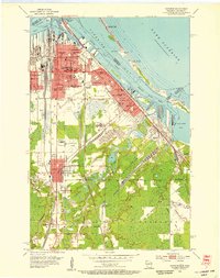 1954 Superior1955 Print · USGSThe industrial waterfront of Superior at mid-century is captured in this survey, showing a landscape defined by shipping and rail. Researchers can trace family roots through numerous sites like St Francis Cem, Wisconsin State College, and South Itasca.6 unique versions available
 - 1954 Map of Amnicon Lake, 1955 Print
 1954 Amnicon Lake1955 Print · USGSDouglas County’s wilderness in the early fifties reveals a landscape of glacial lakes and remnants of early industry. Genealogists and historians can trace the Old Railroad Grade or locate the site of the Amnicon Lake Sch near the shores of Amnicon Lake.2 unique versions available
 - 1954 Map of Frogner, 1955 Print
 1954 Frogner1955 Print · USGSThe Minnesota and Wisconsin borderlands come alive in the 1950s, showing a landscape shaped by the Nemadji River and heavy rail traffic. Genealogists and rail historians can trace the paths of the Great Northern through Wrenshall or locate the Foxboro Sch and Maccabee Cem.4 unique versions available
Showing maps 1-25 of 252
Top cities of Douglas County
- Superior historical maps
- Parkland historical maps
- Hawthorne historical maps
- Lake Nebagamon historical maps
- Gordon historical maps
- Wascott historical maps
See more
Frequently asked questions
- What are the different types of historical maps available for Douglas County?
- What is the oldest map of Douglas County?
- Where can I purchase historical maps of Douglas County for my home or office?
- Where can I download high-res historical maps of Douglas County?
- Are there historical topographic maps available for Douglas County?
- Is there historical aerial imagery available for Douglas County?
- Where are historical maps of Douglas County sourced from?