2020s Maps of Millville, Wisconsin
Explore 4 historic maps of Millville from the 2020s. These maps offer a rare glimpse into what life looked like during the 2020s — showing old roads, neighborhoods, homes, and landmarks that have changed or disappeared over time.
Whether you're researching your family's past, planning a metal detecting trip, or studying how Millville's landscape evolved across the 2020s, these high-resolution maps are a powerful tool for exploring the history of this region.
- Focus on a specific era: All maps on this page are from the 2020s, giving you a focused view of this time period.
- See what’s changed: Compare century-old streets, trails, and buildings to today's modern landscape using overlays and satellite layers.
- Research with precision: Use these maps for genealogy, historical research, land use analysis, or educational projects.
- View, download, or print: Maps are fully viewable online in high resolution, and can be downloaded or printed for your own records.
Start exploring Millville's history through authentic maps from the 2020s. This is your window into the past.
Millville, WI maps
(4)- 2022 Map of Brodtville, 2022 Print
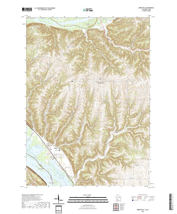 2022 Brodtville2022 Print · USGSGrant County river life and ridge-top farming meet in this modern survey of the Wisconsin-Iowa border. Genealogists and local historians can trace the topography around Bagley and Brodtville, locating family landmarks like Flint Cem and Bagley Cem.
 - 2022 Map of Bloomington, 2022 Print
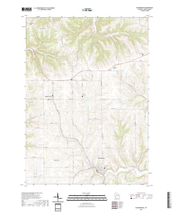 2022 Bloomington2022 Print · USGSSouthwestern Wisconsin’s driftless ridges and fertile prairies are documented here in the early twenty-first century. Genealogists can trace family sites at Hermitage Cem and Saint Johns Cem or explore the historic landscape of Blake Prairie.
 - 2022 Map of Bridgeport, 2022 Print
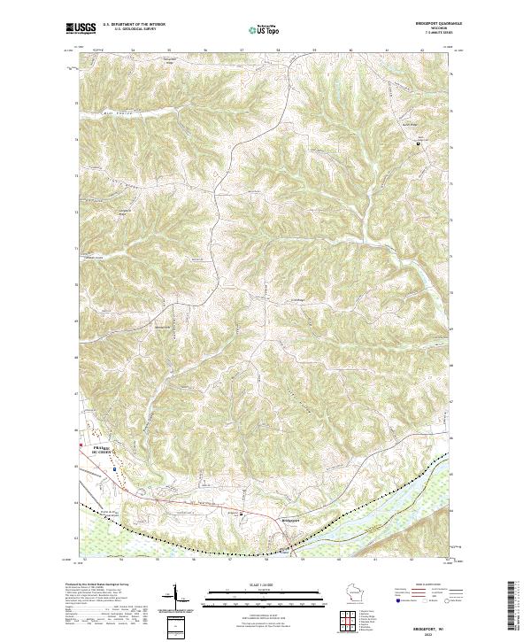 2022 Bridgeport2022 Print · USGSCrawford County's river bluffs and rural ridges are captured here during the early 2020s. Researchers can trace family history through the Bridgeport Cem and Dutch Ridge Cem or locate old homesteads along Famechon Ridge and the Wisconsin River.
 - 2022 Map of Wauzeka West, 2022 Print
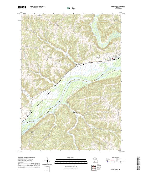 2022 Wauzeka West2022 Print · USGSCrawford County at the start of the 2020s shows a landscape of deep ridges and river bottoms where the Kickapoo and Wisconsin meet. Genealogists can trace family sites at Sacred Heart Cem and Gran Grae Cem or explore the river flats near Millville.
End of results
Showing maps 1-4 of 4
Top cities near Millville
- Prairie du Chien historical maps
- Guttenberg historical maps
- Bridgeport historical maps
- Seneca historical maps
- Wauzeka historical maps
- McGregor historical maps
See more
Frequently asked questions
- What are the different types of historical maps available for Millville?
- What is the oldest map of Millville?
- Where can I purchase historical maps of Millville for my home or office?
- Where can I download high-res historical maps of Millville?
- Are there historical topographic maps available for Millville?
- Is there historical aerial imagery available for Millville?
- Where are historical maps of Millville sourced from?