Old Maps of Millville, Wisconsin for Hiking & Exploration
Hike through history with 30 historic maps of Millville. Explore old trails, ghost towns, and forgotten backroads — perfect for outdoor adventurers and local explorers.
- Rediscover forgotten places: Map out old mining camps, roads, and footpaths that no longer exist on modern maps.
- Layer with modern tools: Combine with LiDAR or satellite views to plan hikes through historical terrain.
- Made for exploration: Popular among hikers, overlanders, and local history lovers.
Use these maps to find adventure and explore the hidden past of Millville.
Millville, WI maps
(30)- 1900 Map of Lancaster
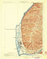
 1900 Lancaster1900 Print · USGSGrant County and the Mississippi River bluffs are captured at the close of the nineteenth century, showing a landscape of river towns and ridge-top farms. Researchers can trace the early rail corridors and vanished river landings from Cassville and Potosi to the county seat at Lancaster.
 - 1902 Map of Elkader
 1902 Elkader1902 Print · USGSNortheast Iowa at the turn of the century is defined by the deep river valleys of the Mississippi, Turkey, and Volga. Genealogists and historians can trace rail lines and early settlements like Elkader, Guttenberg, and Elkport as they appeared in 1898.4 unique versions available
 - 1903 Map of Waukon
 1903 Waukon1903 Print · USGSThe Upper Mississippi River valley comes alive in the early 1900s, showing a landscape of steep bluffs, river landings, and early rail lines. You can trace the path of the Chicago Milwaukee and St. Paul RR to the county seat at Waukon or find old riverfront points like Harpers Ferry and Lansing.5 unique versions available
 - 1904 Map of Lancaster, 1953 Print
 1904 Lancaster1953 Print · USGSSouthwest Wisconsin and its neighboring river lands are shown at the turn of the century as railroads began to dominate the ridge tops. Researchers can trace the development of the river-and-rail economy through sites like Spechts Ferry, Sinsinawa Mound, and Lancaster.
 - 1908 Map of Lancaster
 1908 Lancaster1908 Print · USGSGrant County and the Mississippi River border appear in the first decade of the twentieth century, when river crossings and new rail lines defined local commerce. Researchers can trace the landings at Spechts Ferry and Mc Cartney or locate early settlements like British Hollow and Beetown.5 unique versions available
 - 1926 Map of Wauzeka
 1926 Wauzeka1926 Print · USGSThe confluence of the Kickapoo and Wisconsin Rivers in the 1920s reveals a landscape of ridge-top schools and valley railroads. Genealogists can trace family locations near Wauzeka, Woodman, and the Crawford County Infirmary, or find old rural sites like Anderson Mills.2 unique versions available
 - 1929 Map of Prairie Du Chien, 1963 Print
 1929 Prairie Du Chien1963 Print · USGSThe Mississippi River valley of Crawford County at the end of the twenties shows a landscape of complex sloughs and rugged ridges. Genealogists can locate family schoolhouses like Frenchtown Sch and Hazen Corners Sch or trace the early rail lines through Prairie du Chien.
 - 1932 Map of Prairie Du Chien
 1932 Prairie Du Chien1932 Print · USGSCrawford County at the confluence of the two great rivers in the early thirties shows a landscape of ridge-top schools and bustling riverfront rail towns. Genealogists can trace family footprints at Wrights Ferry, Hazen Corners, or rural outposts like Lamer Ridge Sch.4 unique versions available
 - 1958 Map of La Crosse, 1979 Print
 1958 La Crosse1979 Print · USGSThe Driftless Area of Wisconsin and Iowa is captured here during the late seventies, showing the intricate river valleys and ridge-top settlements. Genealogists and historians can trace the rail corridors of the Soo Line or locate landmarks like Grandad Bluff and Effigy Mounds National Monument.2 unique versions available
 - 1959 Map of Dubuque, 1982 Print
 1959 Dubuque1982 Print · USGSThe Tri-State region comes alive in the mid-twentieth century as a hub of river commerce and rail transit. Genealogists and historians can trace the paths of the Illinois Central Gulf through Dubuque or locate the Savanna Ordnance Depot and Lock and Dam No 11.
 - 1961 Map of Dubuque
 1961 Dubuque1961 Print · USGSThe Tri-State region's river-and-rail landscape is captured here during the early sixties, showing the convergence of Iowa, Illinois, and Wisconsin. Trace mid-century rail lines like the Chicago Great Western Ry and explore sites like the Savanna Ordnance Depot and Backbone State Park.
 - 1961 Map of La Crosse
 1961 La Crosse1961 Print · USGSThe Driftless Area at the start of the 1960s reveals a complex network of river towns and rail lines along the Mississippi River. Genealogists and historians can trace old settlements like New Amsterdam and Wyattville or locate major landmarks like Camp McCoy Military Reservation and Effigy Mounds National Monument.
 - 1962 Map of Dubuque
 1962 Dubuque1962 Print · USGSThe Tri-State region's river-and-rail economy is captured here in the early sixties, centered on the Mississippi River bluffs. Genealogists and historians can locate Numerous lead and zinc mines, the New Melleray Abbey Monastery, and rural hubs like Saint Olaf.2 unique versions available
 - 1962 Map of Bloomington, 1964 Print
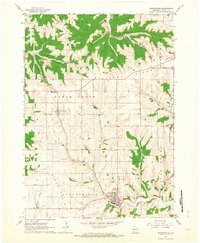 1962 Bloomington1964 Print · USGSGrant County in the early sixties remains a landscape of high ridges and winding creek valleys. Genealogists and local researchers can trace the locations of family plots at Hermitage Cem or Patch Grove Cem and follow the old routes along Military Ridge.2 unique versions available
 - 1962 Map of Bagley, 1964 Print
 1962 Bagley1964 Print · USGSThe confluence of the Wisconsin and Mississippi Rivers comes to life in the early sixties, showing the vital rail-and-river hub of Grant County. Genealogists can trace the rural landscape near Bagley, Brodtville, and family sites like Lumpkin Cem.
 - 1965 Map of La Crosse
 1965 La Crosse1965 Print · USGSThe Driftless Area and the Upper Mississippi valley are captured here during a period of steady mid-century growth. Researchers can trace the rail lines of the Chicago and North Western or locate riverfront sites like Effigy Mounds National Monument and the Camp McCoy Military Reservation.
 - 1967 Map of Prairie Du Chien, 1969 Print
 1967 Prairie Du Chien1969 Print · USGSThe river-and-rail hub of the Upper Mississippi comes alive in this late-sixties study of the Wisconsin-Iowa border. Genealogists can locate family names at Campbell Cem and Hazen Corners Cem or trace old rail lines through Harpers Ferry and Marquette.
 - 1967 Map of Wauzeka, 1970 Print
 1967 Wauzeka1970 Print · USGSCrawford and Grant Counties are captured here in the late sixties as the river valleys and ridge-top farms maintained their traditional layouts. Trace the paths of the Chicago Milwaukee St Paul and Pacific railroad through Wauzeka or locate rural landmarks like St Lawrence Ch and the Kickapoo Indian Caverns.
 - 1976 Map of Dubuque
 1976 Dubuque1976 Print · USGSThe tri-state borderlands of Iowa, Wisconsin, and Illinois come alive during the mid-seventies, showing a region built on river commerce and mining. Genealogists and historians can trace the paths of the Illinois Central railroad or locate heritage sites like the New Melleray Abbey Monastery and Backbone State Park.
 - 1976 Map of La Crosse
 1976 La Crosse1976 Print · USGSThe Driftless Area and Mississippi River valley are captured here in the mid-seventies, showing a landscape of deep coulees and river commerce. Genealogists can trace family footprints from La Crosse to smaller hamlets like Newburg Corners and Witoka.
 - 1983 Map of Bridgeport
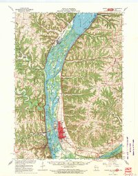
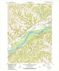
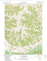 1983 Bridgeport1983 Print · USGSThe bluffs of the Wisconsin River are captured here in the early eighties, showing the ridge-and-valley topography of Crawford County. Genealogists and researchers can locate Bridgeport Cem, the local Townhall, and the Prairie Du Chien Airport.
 - 1983 Map of Wauzeka West
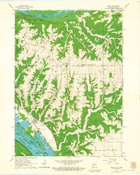
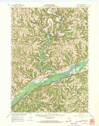
 1983 Wauzeka West1983 Print · USGSThe confluence of the Wisconsin and Kickapoo rivers is mapped here during the early eighties, showing a landscape defined by dramatic ridges and deep hollows. Genealogists and local historians can trace family locations near Wauzeka, Millville, and Gran Grae Cem.
 - 1984 Map of Oelwein, 1985 Print
 1984 Oelwein1985 Print · USGSNortheast Iowa and the Mississippi riverfront appear in detail during the 1980s, showing a land defined by deep river valleys and high ridges. Genealogists and historians can trace the Chicago and North Western rail line and locate rural sites like St Sebald Ch and Quaker Mill Pond.2 unique versions available
 - 1984 Map of Dubuque North, 1985 Print
 1984 Dubuque North1985 Print · USGSThis Tri-State region was a hub of Midwestern mining and river commerce in the mid-eighties. Researchers can trace the legacy of the Lead District through specific sites like Annie Mine or locate early civic centers such as First Capitol State Park.2 unique versions available
 - 1985 Map of Decorah
 1985 Decorah1985 Print · USGSNortheast Iowa and western Wisconsin in the mid-eighties show a landscape of high bluffs and river valleys shaped by the Upper Iowa and Mississippi Rivers. Genealogists and historians can trace the paths of the Chicago Milwaukee St Paul and Pacific railroad or locate the National Cemetery and the ancient earthworks at Effigy Mounds National Monument.2 unique versions available
Showing maps 1-25 of 30
Top cities near Millville
- Prairie du Chien historical maps
- Guttenberg historical maps
- Bridgeport historical maps
- Seneca historical maps
- Wauzeka historical maps
- McGregor historical maps
See more
Frequently asked questions
- What are the different types of historical maps available for Millville?
- What is the oldest map of Millville?
- Where can I purchase historical maps of Millville for my home or office?
- Where can I download high-res historical maps of Millville?
- Are there historical topographic maps available for Millville?
- Is there historical aerial imagery available for Millville?
- Where are historical maps of Millville sourced from?