Old Maps of Green County, Wisconsin
Explore 35 old maps of Green County, spanning from 1889 to today. These high-resolution historic maps reveal how streets, neighborhoods, landmarks, and natural features evolved over time — perfect for genealogy, metal detecting, research, and local history exploration.
What you can do with these maps:
- See how Green County changed over time: Compare historical maps to modern-day views to trace roads, homesites, rail lines & more.
- View detailed metadata: Each map includes creators, publishers, year, scale, and archive source.
- Overlay maps with satellite & LiDAR: Visualize the past alongside modern tools to explore terrain & human change.
- Trusted historical sources: Maps sourced from the USGS, Library of Congress, and other archives.
- Access maps your way: View online, download high-res files, or order prints for personal or research use.
Start exploring old maps of Green County to uncover forgotten places, hidden landmarks, and the deep history beneath your feet.
Green County, WI maps
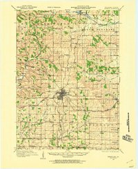
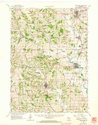
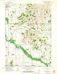
(35)- 1889 Map of Evansville
 1889 Evansville1889 Print · USGSCovers Green County, including Madison, Fitchburg, and other nearby areas
 - 1893 Map of Brodhead
 1893 Brodhead1893 Print · USGSCovers Green County, including Brodhead, Orfordville, and other nearby areas5 unique versions available
 - 1894 Map of Evansville
 1894 Evansville1894 Print · USGSCovers Green County, including Madison, Fitchburg, and other nearby areas2 unique versions available
 - 1906 Map of Evansville
 1906 Evansville1906 Print · USGSCovers Green County, including Madison, Fitchburg, and other nearby areas3 unique versions available
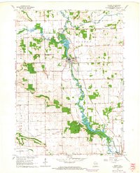
 - 1920 Map of Monroe, 1960 Print
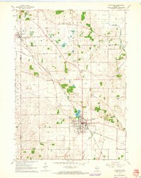
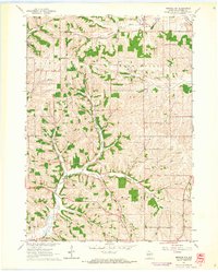
 1920 Monroe1960 Print · USGSCovers Green County, including Monroe, Monticello, and other nearby areas
 - 1922 Map of Monroe
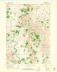
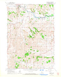
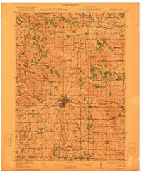 1922 Monroe1922 Print · USGSCovers Green County, including Monroe, Monticello, and other nearby areas
 - 1923 Map of Blanchardville
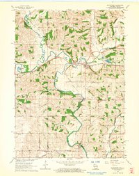
 1923 Blanchardville1923 Print · USGSCovers Green County, including Mount Horeb, Barneveld, and other nearby areas2 unique versions available
 - 1923 Map of New Glarus
 1923 New Glarus1923 Print · USGSCovers Green County, including Madison, Verona, and other nearby areas2 unique versions available
 - 1923 Map of South Wayne
 1923 South Wayne1923 Print · USGSCovers Green County, including Warren, Wiota, and other nearby areas3 unique versions available
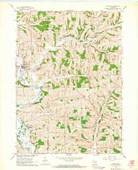
 - 1954 Map of Rockford
 1954 Rockford1954 Print · USGSCovers Green County, including Milwaukee, Madison, and other nearby areas
 - 1955 Map of Rockford
 1955 Rockford1955 Print · USGSCovers Green County, including Milwaukee, Madison, and other nearby areas
 - 1958 Map of Rockford, 1974 Print
 1958 Rockford1974 Print · USGSCovers Green County, including Milwaukee, Madison, and other nearby areas4 unique versions available
 - 1961 Map of Evansville, 1963 Print
 1961 Evansville1963 Print · USGSCovers Green County, including Madison, Fitchburg, and other nearby areas2 unique versions available
 - 1961 Map of Evansville, 1964 Print
 1961 Evansville1964 Print · USGSCovers Green County, including Evansville, Union, and other nearby areas3 unique versions available
 - 1961 Map of Attica, 1964 Print
 1961 Attica1964 Print · USGSCovers Green County, including Exeter, Montrose, and other nearby areas2 unique versions available
 - 1962 Map of Brodhead West, 1964 Print
 1962 Brodhead West1964 Print · USGSCovers Green County, including Brodhead, Oakley, and other nearby areas3 unique versions available
 - 1962 Map of Juda, 1964 Print
 1962 Juda1964 Print · USGSCovers Green County, including Monroe, Clarno, and other nearby areas3 unique versions available
 - 1962 Map of New Glarus, 1964 Print
 1962 New Glarus1964 Print · USGSCovers Green County, including Madison, Verona, and other nearby areas2 unique versions available
 - 1962 Map of Monroe NW, 1964 Print
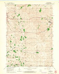
 1962 Monroe NW1964 Print · USGSCovers Green County, including Monroe, Adams, and other nearby areas2 unique versions available
 - 1962 Map of Monticello, 1964 Print
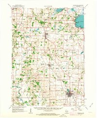
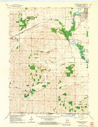
 1962 Monticello1964 Print · USGSCovers Green County, including Monticello, Washington, and other nearby areas3 unique versions available
 - 1962 Map of Blanchardville, 1964 Print
 1962 Blanchardville1964 Print · USGSCovers Green County, including Mount Horeb, Barneveld, and other nearby areas
 - 1962 Map of Browntown, 1964 Print
 1962 Browntown1964 Print · USGSCovers Green County, including Wiota, South Wayne, and other nearby areas2 unique versions available
 - 1962 Map of Brodhead East, 1964 Print
 1962 Brodhead East1964 Print · USGSCovers Green County, including Brodhead, Orfordville, and other nearby areas2 unique versions available
 - 1962 Map of Albany, 1964 Print
 1962 Albany1964 Print · USGSCovers Green County, including Brodhead, Albany, and other nearby areas2 unique versions available
 - 1962 Map of Argyle, 1964 Print
 1962 Argyle1964 Print · USGSCovers Green County, including Wiota, Argyle, and other nearby areas
Showing maps 1-25 of 35
Top cities of Green County
- Monroe historical maps
- Brodhead historical maps
- New Glarus historical maps
- Exeter historical maps
- Monticello historical maps
- Albany historical maps
See more
Frequently asked questions
- What are the different types of historical maps available for Green County?
- What is the oldest map of Green County?
- Where can I purchase historical maps of Green County for my home or office?
- Where can I download high-res historical maps of Green County?
- Are there historical topographic maps available for Green County?
- Is there historical aerial imagery available for Green County?
- Where are historical maps of Green County sourced from?