Old Maps of Estates of Lawsonia, Brooklyn for Genealogy
Trace your family roots with 15 historic maps of Estates of Lawsonia. These high-res maps reveal old neighborhoods, homesites, landmarks, and streets — helping you uncover where your ancestors lived and how the area evolved over time.
- Explore historic neighborhoods: Identify where your relatives may have lived in the 1800s or 1900s.
- Compare maps over time: Trace the changes in streets, buildings, and landmarks for multi-generational research.
- Perfect for genealogy & ancestry research: Used by family historians and researchers to map out lineage and migration.
These maps are an incredible resource for exploring your personal connection to Estates of Lawsonia's past.
Estates of Lawsonia, Brooklyn maps
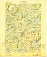
(15)- 1915 Map of Neshkoro
 1915 Neshkoro1915 Print · USGSCovers Estates of Lawsonia, including Princeton, Marquette, and other nearby areas
 - 1916 Map of Ripon
 1916 Ripon1916 Print · USGSCovers Estates of Lawsonia, including Ripon, Berlin, and other nearby areas
 - 1918 Map of Neshkoro
 1918 Neshkoro1918 Print · USGSCovers Estates of Lawsonia, including Princeton, Marquette, and other nearby areas3 unique versions available
 - 1918 Map of Ripon
 1918 Ripon1918 Print · USGSCovers Estates of Lawsonia, including Ripon, Berlin, and other nearby areas
 - 1956 Map of Ripon, 1957 Print
 1956 Ripon1957 Print · USGSCovers Estates of Lawsonia, including Ripon, Berlin, and other nearby areas
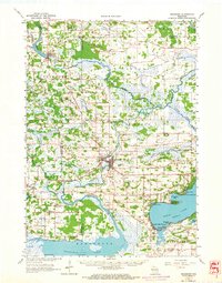
 - 1957 Map of Madison, 1967 Print
 1957 Madison1967 Print · USGSCovers Estates of Lawsonia, including Milwaukee, Madison, and other nearby areas3 unique versions available
 - 1960 Map of Madison
 1960 Madison1960 Print · USGSCovers Estates of Lawsonia, including Milwaukee, Madison, and other nearby areas2 unique versions available
 - 1963 Map of Neshkoro, 1964 Print
 1963 Neshkoro1964 Print · USGSCovers Estates of Lawsonia, including Princeton, Marquette, and other nearby areas2 unique versions available
 - 1980 Map of Fond Du Lac
 1980 Fond Du Lac1980 Print · USGSCovers Estates of Lawsonia, including Oshkosh, Fond du Lac, and other nearby areas
 - 1980 Map of Green Lake, 1981 Print
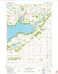 1980 Green Lake1981 Print · USGSCovers Estates of Lawsonia, including Green Lake, City of Green Lake, and other nearby areas
 - 1984 Map of Princeton East
 1984 Princeton East1984 Print · USGSCovers Estates of Lawsonia, including Princeton, Marquette, and other nearby areas
 - 1985 Map of Wisconsin Dells
 1985 Wisconsin Dells1985 Print · USGSCovers Estates of Lawsonia, including Portage, Reedsburg, and other nearby areas
 - 1990 Map of Wisconsin Dells, 1991 Print
 1990 Wisconsin Dells1991 Print · USGSCovers Estates of Lawsonia, including Portage, Reedsburg, and other nearby areas
 - 2022 Map of Green Lake, 2022 Print
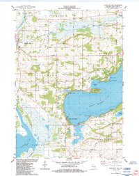
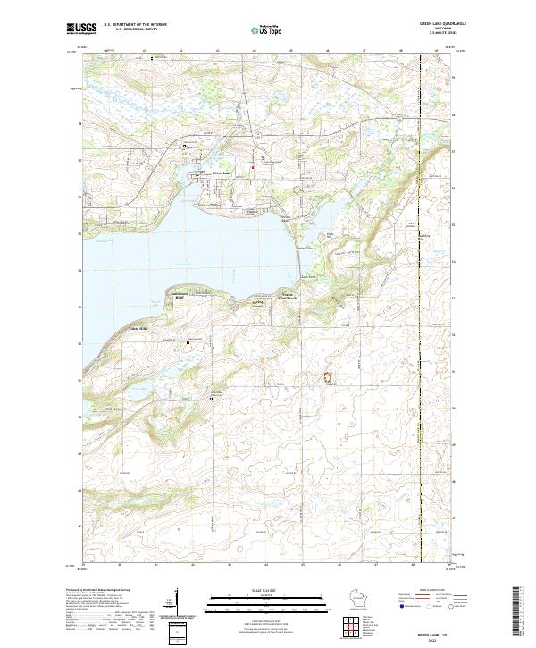 2022 Green Lake2022 Print · USGSCovers Estates of Lawsonia, including Green Lake, City of Green Lake, and other nearby areas
 - 2022 Map of Princeton East, 2022 Print
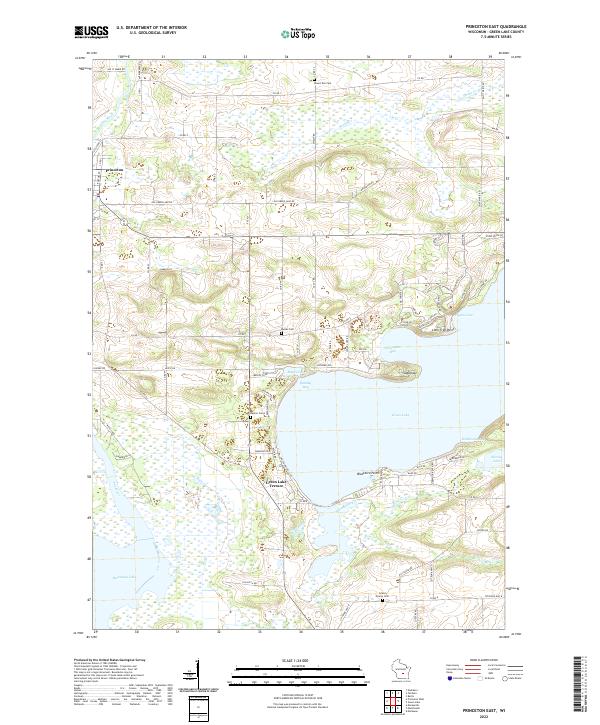 2022 Princeton East2022 Print · USGSCovers Estates of Lawsonia, including Princeton, Marquette, and other nearby areas
End of results
Showing maps 1-15 of 15
Frequently asked questions
- What are the different types of historical maps available for Estates of Lawsonia?
- What is the oldest map of Estates of Lawsonia?
- Where can I purchase historical maps of Estates of Lawsonia for my home or office?
- Where can I download high-res historical maps of Estates of Lawsonia?
- Are there historical topographic maps available for Estates of Lawsonia?
- Is there historical aerial imagery available for Estates of Lawsonia?
- Where are historical maps of Estates of Lawsonia sourced from?