Old Maps of Carter, Mercer
Explore 13 old maps of Carter, spanning from 1940 to today. These high-resolution historic maps reveal how streets, neighborhoods, landmarks, and natural features evolved over time — perfect for genealogy, metal detecting, research, and local history exploration.
What you can do with these maps:
- See how Carter changed over time: Compare historical maps to modern-day views to trace roads, homesites, rail lines & more.
- View detailed metadata: Each map includes creators, publishers, year, scale, and archive source.
- Overlay maps with satellite & LiDAR: Visualize the past alongside modern tools to explore terrain & human change.
- Trusted historical sources: Maps sourced from the USGS, Library of Congress, and other archives.
- Access maps your way: View online, download high-res files, or order prints for personal or research use.
Start exploring old maps of Carter to uncover forgotten places, hidden landmarks, and the deep history beneath your feet.
Carter, Mercer maps
(13)- 1940 Map of Mercer, 1953 Print
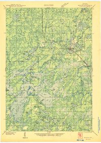
 1940 Mercer1953 Print · USGSIron County’s lake-rich landscape is captured in the early 1940s, showing the early growth of Northwoods tourism and timber management. Researchers can trace the rail corridor of the Chicago and Northwestern, find the rural Springstead Sch, and locate the historic Mercer Fire Tower.
 - 1945 Map of Mercer
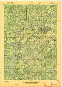
 1945 Mercer1945 Print · USGSIron County in the mid-1940s is defined by its massive flowage systems and transition from rail to highway travel. Genealogists and researchers can trace the rural infrastructure of Mercer via the Springstead Sch, Mercer Fire Tower, and the Chicago and Northwestern tracks.
 - 1947 Map of Mercer
 1947 Mercer1947 Print · USGSIron County’s lake country is captured here during the post-war years as the regional transport network evolved. Researchers can trace family roots through settlements like Mercer and Springstead, or locate landmarks such as the Springstead Sch and the Mercer Fire Tower.
 - 1953 Map of Ashland, 1964 Print
 1953 Ashland1964 Print · USGSNorthern Wisconsin's lakefront and timberlands are seen here in the mid-1950s, showing the intersection of industrial rail lines and vast wilderness. Genealogists and historians can trace the Soo Line through rail towns like Mellen or locate family roots in the Apostle Islands and Bad River Indian Reservation.3 unique versions available
 - 1955 Map of Mercer, 1957 Print
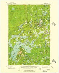 1955 Mercer1957 Print · USGSIron County in the mid-1950s is a landscape of expansive forests and interconnected waterways. Researchers can trace the path of the CHICAGO AND NORTHWESTERN railroad or locate local landmarks like Springstead Sch and Murrays Landing.4 unique versions available
 - 1958 Map of Ashland
 1958 Ashland1958 Print · USGSCoastal Wisconsin and the Michigan borderlands meet here in the late fifties, dominated by the timbered expanses and iron-rich ranges. Genealogists can trace family footprints in settlements like Odanah and Montreal, or locate landmarks such as the Coast Guard Station and Agricultural Experiment Station.
 - 1973 Map of Lake of The Falls, 1976 Print
 1973 Lake of The Falls1976 Print · USGSIron County's lake country in the early seventies shows a landscape shaped by water and the timber-era rail network. Researchers can trace the Chicago and North Western line through Carter or locate the Winter Trail near Moose Lake.
 - 1980 Map of Ironwood
 1980 Ironwood1980 Print · USGSThe Michigan-Wisconsin borderlands appear in the late twentieth century as a landscape defined by iron mining and deep forests. Researchers can trace the rail-and-river economy through the Soo Line and Chicago and North Western tracks connecting Mellen, Glidden, and Hurley.
 - 2010 Map of Lake of the Falls, 2010 Print
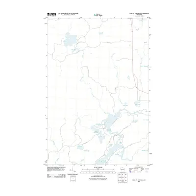 2010 Lake of the Falls2010 Print · USGSCovers Carter, including Mercer, Carey, and other nearby areas
 - 2013 Map of Lake of the Falls, 2013 Print
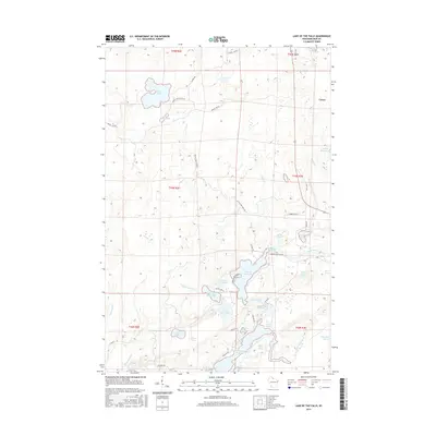
 2013 Lake of the Falls2013 Print · USGSCovers Carter, including Mercer, Carey, and other nearby areas
 - 2015 Map of Lake of the Falls, 2015 Print
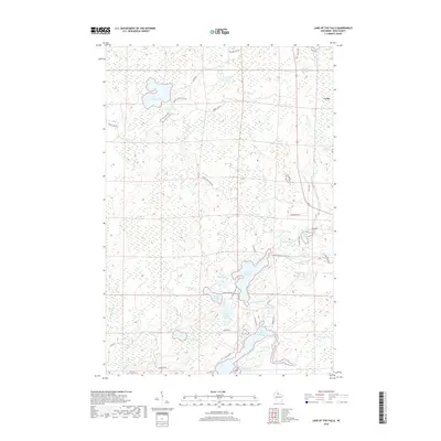
 2015 Lake of the Falls2015 Print · USGSCovers Carter, including Mercer, Carey, and other nearby areas
 - 2018 Map of Lake of the Falls, 2018 Print
 2018 Lake of the Falls2018 Print · USGSCovers Carter, including Mercer, Carey, and other nearby areas
 - 2022 Map of Lake of the Falls, 2022 Print
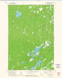
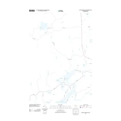
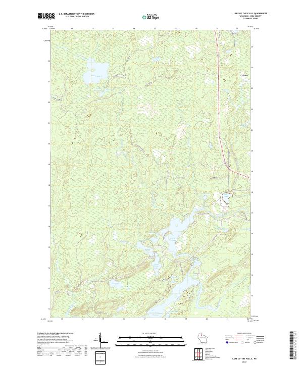 2022 Lake of the Falls2022 Print · USGSIron County’s Northwoods are mapped here in the early twenty-first century, showing the complex river and lake networks of northern Wisconsin. You can trace the Turtle River as it connects Lake of the Falls to the Turtle-Flambeau Flowage and the settlement of Carter.
End of results
Showing maps 1-13 of 13
Top cities near Carter
- Ironwood historical maps
- Lac du Flambeau historical maps
- Mercer historical maps
- Hurley historical maps
- Montreal historical maps
- Manitowish Waters historical maps
See more
Frequently asked questions
- What are the different types of historical maps available for Carter?
- What is the oldest map of Carter?
- Where can I purchase historical maps of Carter for my home or office?
- Where can I download high-res historical maps of Carter?
- Are there historical topographic maps available for Carter?
- Is there historical aerial imagery available for Carter?
- Where are historical maps of Carter sourced from?