1960s Maps of Juneau County, Wisconsin
Explore 14 historic maps of Juneau County from the 1960s. These maps offer a rare glimpse into what life looked like during the 1960s — showing old roads, neighborhoods, homes, and landmarks that have changed or disappeared over time.
Whether you're researching your family's past, planning a metal detecting trip, or studying how Juneau County's landscape evolved across the 1960s, these high-resolution maps are a powerful tool for exploring the history of this region.
- Focus on a specific era: All maps on this page are from the 1960s, giving you a focused view of this time period.
- See what’s changed: Compare century-old streets, trails, and buildings to today's modern landscape using overlays and satellite layers.
- Research with precision: Use these maps for genealogy, historical research, land use analysis, or educational projects.
- View, download, or print: Maps are fully viewable online in high resolution, and can be downloaded or printed for your own records.
Start exploring Juneau County's history through authentic maps from the 1960s. This is your window into the past.
Juneau County, WI maps
(14)- 1960 Map of Madison
 1960 Madison1960 Print · USGSCentral and Southern Wisconsin are captured in the late fifties, showing the region as its rail-and-river network matured. Trace the paths of the Soo Line RR or locate family roots near Lake Mendota and Horicon National Wildlife Refuge.2 unique versions available
 - 1961 Map of La Crosse
 1961 La Crosse1961 Print · USGSThe Driftless Area at the start of the 1960s reveals a complex network of river towns and rail lines along the Mississippi River. Genealogists and historians can trace old settlements like New Amsterdam and Wyattville or locate major landmarks like Camp McCoy Military Reservation and Effigy Mounds National Monument.
 - 1961 Map of Adams, 1963 Print
 1961 Adams1963 Print · USGSCentral Wisconsin at the start of the sixties reveals a landscape shaped by the Castle Rock Flowage and prominent glacial mounds. Researchers can locate vanished rural landmarks like Castle Rock Sch, the Woodside Ranch, and historic country cemeteries.2 unique versions available
 - 1962 Map of Kendall, 1964 Print
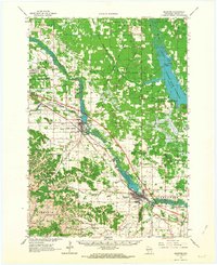
 1962 Kendall1964 Print · USGSMid-century Monroe and Juneau Counties are captured here as military training sites and railroad engineering meet rural valley life. Genealogists and historians can locate family landmarks like Hoffman Corners, the Dorset Ridge Ch, and the high-elevation Sunny Ridge Sch.2 unique versions available
 - 1962 Map of Mauston, 1964 Print
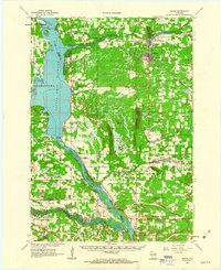
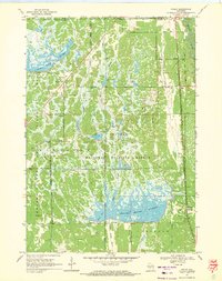
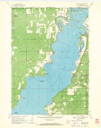
 1962 Mauston1964 Print · USGSJuneau County in the early 1960s is defined by the expansive Castle Rock Flowage and the bustling rail corridors of the Lemonweir River valley. Genealogists and local researchers can locate numerous family landmarks, including St Patricks Cem, Baker Sch, and the grounds of Camp Williams.2 unique versions available
 - 1964 Map of Eau Claire
 1964 Eau Claire1964 Print · USGSWest-central Wisconsin in the mid-1960s was a hub of river-driven industry and expanding rail networks. Researchers can trace historic homesteads near Menomonie, follow the Soo Line RR through Marshfield, or explore the grounds of the Camp McCoy Military Reservation.
 - 1965 Map of La Crosse
 1965 La Crosse1965 Print · USGSThe Driftless Area and the Upper Mississippi valley are captured here during a period of steady mid-century growth. Researchers can trace the rail lines of the Chicago and North Western or locate riverfront sites like Effigy Mounds National Monument and the Camp McCoy Military Reservation.
 - 1966 Map of Hillsboro, 1968 Print
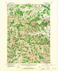
 1966 Hillsboro1968 Print · USGSWisconsin's Driftless Area remains a maze of ridges and coulees in the mid-sixties, centered on the growing town of Hillsboro. Genealogists can locate family roots at the Bohemian Brotherhood Cem, County Corners Sch, or along the Chicago and North Western line.
 - 1967 Map of Arkdale, 1969 Print
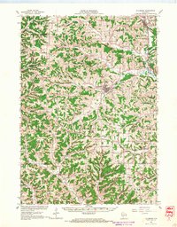
 1967 Arkdale1969 Print · USGSAdams County in the late sixties reveals a landscape transformed by the Wisconsin River reservoirs. Genealogists can locate several local burial grounds including Monroe Center Cem and East Arkdale Cem, or trace the rural road network near Arkdale.3 unique versions available
 - 1969 Map of New Miner, 1971 Print
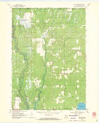 1969 New Miner1971 Print · USGSJuneau County was a landscape of specialized land use in the late sixties, from military ranges to wildlife conservation. Researchers can locate the New Miner settlement, several rural burial grounds like Novotny Cem, and the tracks of the M St P & P railroad.2 unique versions available
 - 1969 Map of Cutler, 1971 Print
 1969 Cutler1971 Print · USGSJuneau County was a landscape of vast managed wetlands and timbered ridges in the late sixties. Genealogists and researchers can trace the Chicago and North Western corridor through Cutler or locate the Wildlife Headquarters near the Rynearson Pool No 2.3 unique versions available
 - 1969 Map of Necedah, 1971 Print
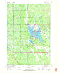
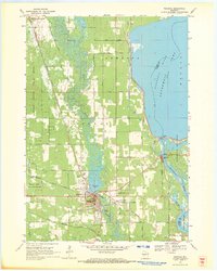 1969 Necedah1971 Print · USGSThe village of Necedah sits at the intersection of rail and river during the late sixties, flanked by massive wildlife refuges and the Wisconsin River. Researchers can locate the Queen of the Holy Rosary Shrine, the Rockview Sch, and the high ground of Necedah Bluff.
 - 1969 Map of Finley, 1971 Print
 1969 Finley1971 Print · USGSJuneau County’s wetland interior is documented here in the late sixties, showcasing the vast water management systems of the Necedah National Wildlife Refuge. Researchers can trace the rail corridor of the Chicago Milwaukee St Paul and Pacific and locate local landmarks like Finley and Meadow Valley Cem.
 - 1969 Map of Arkdale NW, 1971 Print
 1969 Arkdale NW1971 Print · USGSThe shorelines of the Wisconsin River define the local landscape during the late sixties, where recreation and military activity exist side-by-side. Trace old landmarks like Cranberry Rock Lookout Tower, the settlement at New Rome, and the expansive National Guard Bombing and Gunnery Range.3 unique versions available
End of results
Showing maps 1-14 of 14
Top cities of Juneau County
- Mauston historical maps
- New Lisbon historical maps
- Lemonweir historical maps
- Elroy historical maps
- Lyndon historical maps
- Necedah historical maps
See more
Frequently asked questions
- What are the different types of historical maps available for Juneau County?
- What is the oldest map of Juneau County?
- Where can I purchase historical maps of Juneau County for my home or office?
- Where can I download high-res historical maps of Juneau County?
- Are there historical topographic maps available for Juneau County?
- Is there historical aerial imagery available for Juneau County?
- Where are historical maps of Juneau County sourced from?