2000s (21st Century) Maps of Juneau County, Wisconsin
Explore 22 historic maps of Juneau County from the 2000s (21st Century). These maps offer a rare glimpse into what life looked like during the 2000s — showing old roads, neighborhoods, homes, and landmarks that have changed or disappeared over time.
Whether you're researching your family's past, planning a metal detecting trip, or studying how Juneau County's landscape evolved across the 2000s, these high-resolution maps are a powerful tool for exploring the history of this region.
- Focus on a specific era: All maps on this page are from the 2000s, giving you a focused view of this time period.
- See what’s changed: Compare century-old streets, trails, and buildings to today's modern landscape using overlays and satellite layers.
- Research with precision: Use these maps for genealogy, historical research, land use analysis, or educational projects.
- View, download, or print: Maps are fully viewable online in high resolution, and can be downloaded or printed for your own records.
Start exploring Juneau County's history through authentic maps from the 2000s. This is your window into the past.
Juneau County, WI maps
(22)- 2022 Map of Potato Hill, 2022 Print
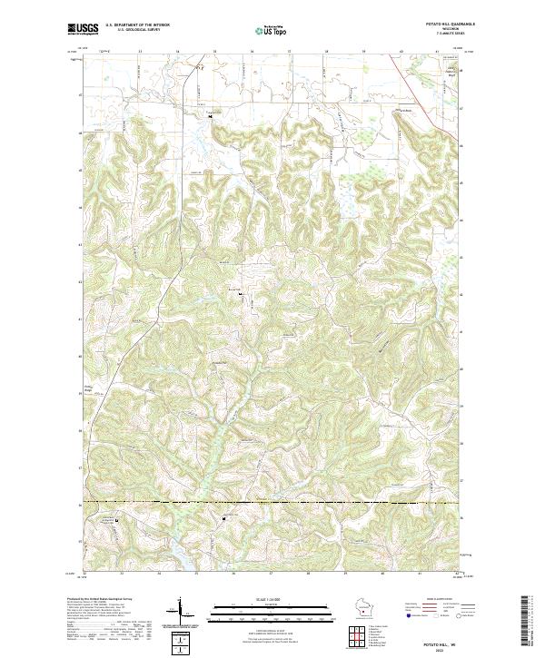 2022 Potato Hill2022 Print · USGSJuneau County's ridgelands are captured here in the early 2020s, showcasing a landscape of narrow valleys and high bluffs. Genealogists can locate several burial sites including Evergreen Cem and Big Creek Cem, or trace landmarks like Potato Hill and Sheep Pasture Bluff.
 - 2022 Map of Mauston, 2022 Print
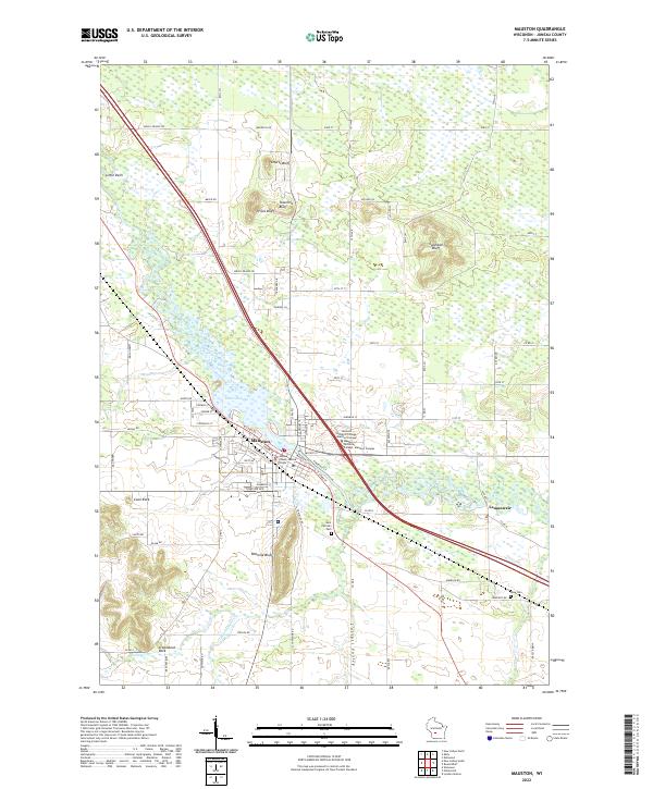 2022 Mauston2022 Print · USGSMauston and the surrounding river bluffs are captured here in the early 2020s, showing a landscape defined by the Lemonweir River. Researchers can locate family sites at Saint Patrick's Cem or trace the geography of unique landmarks like Steamboat Rock and Onemile Bluff.
 - 2022 Map of Mather, 2022 Print
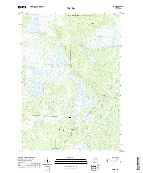 2022 Mather2022 Print · USGSThe rural marshlands at the junction of four Wisconsin counties come into focus in this contemporary survey. Genealogists and local historians can locate Oak Grove Cem and Pine Grove Cem or trace the vast Beaver Flowage and Norway Ridge.
 - 2022 Map of Lyndon Station, 2022 Print
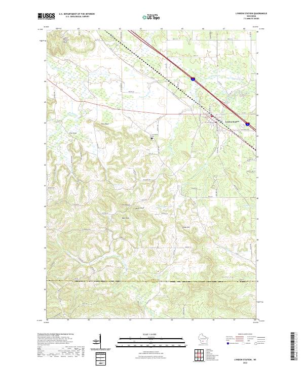 2022 Lyndon Station2022 Print · USGSLyndon Station and the surrounding Juneau County bluffs are captured in this contemporary survey of the Wisconsin landscape. Researchers can locate the Saint Marys Cem or trace the drainage of Sevenmile Cr beneath Sheep Pasture Bluff.
 - 2022 Map of Shennington, 2022 Print
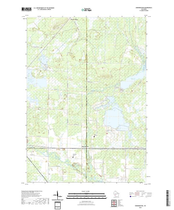 2022 Shennington2022 Print · USGSCentral Wisconsin at the Monroe and Juneau county line reveals a landscape shaped by the Lemonweir River and extensive drainage projects. Researchers can trace local roots at Shennington and Wyeville or locate the Saint Peters Lutheran Cem.
 - 2022 Map of Cutler, 2022 Print
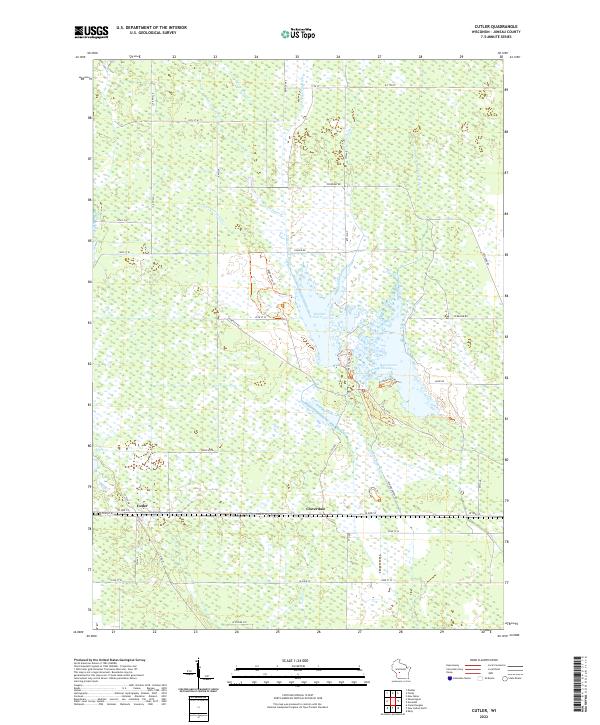 2022 Cutler2022 Print · USGSJuneau County's wetland interior is showcased here in the early twenty-first century, revealing a landscape defined by complex drainage and conservation. Researchers can trace local water management through the Spencer-Robinson Ditch and find the small settlements of Cutler and Cloverdale.
 - 2022 Map of Necedah, 2022 Print
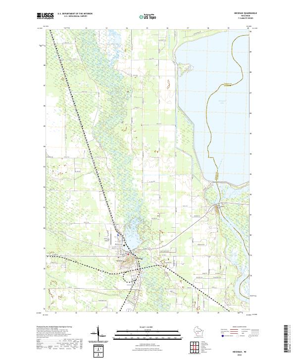 2022 Necedah2022 Print · USGSNecedah and the surrounding river lowlands are shown here in the early twenty-first century as the landscape transitions toward the massive Petenwell flowage. Researchers can locate Bayview Cemetery, the Necedah Airport, and prominent landmarks like Necedah Bluff.
 - 2022 Map of Easton, 2022 Print
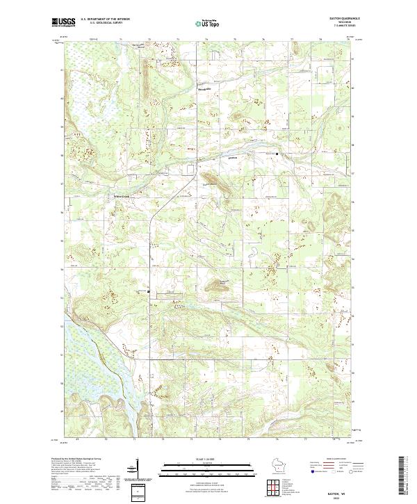 2022 Easton2022 Print · USGSAdams County land south of Adams is captured here in the early 2020s, defined by the winding Wisconsin River and local bluffs. Researchers can locate family sites near Easton Cem or trace the drainage of Grays Marsh and Campbell Creek.
 - 2022 Map of Finley, 2022 Print
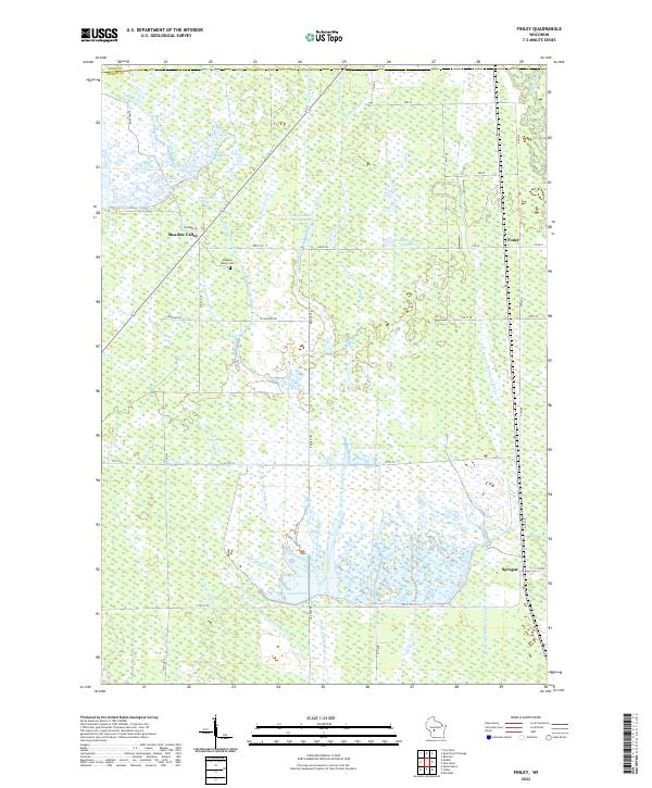 2022 Finley2022 Print · USGSThe marshlands of Juneau County are depicted here in the early twenty-first century, showing a landscape shaped by a intricate network of drainage laterals. Researchers can locate the Meadow Valley Cem and trace the waterways of Goose Pool and Finley.
 - 2022 Map of New Miner, 2022 Print
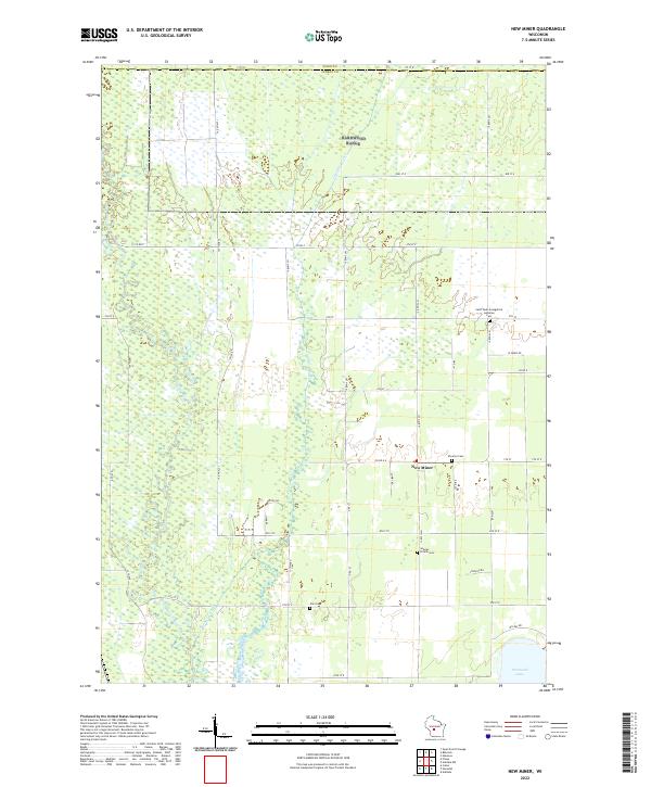 2022 New Miner2022 Print · USGSJuneau County’s wetland interior is documented here in the early twenty-first century, centered on the small community of New Miner. Researchers can locate several rural burial sites, including Searles Prairie Cemetery, and trace the shoreline of Petenwell Lake.
 - 2022 Map of Round Bluff, 2022 Print
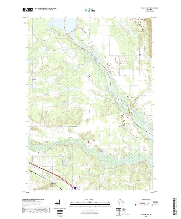 2022 Round Bluff2022 Print · USGSThe river systems of Juneau and Adams counties converge here in the early twenty-first century. Researchers can locate family sites near Saint Michaels Cem or trace the shoreline from Castle Rock Lake down the Wisconsin River.
 - 2022 Map of Dellwood, 2022 Print
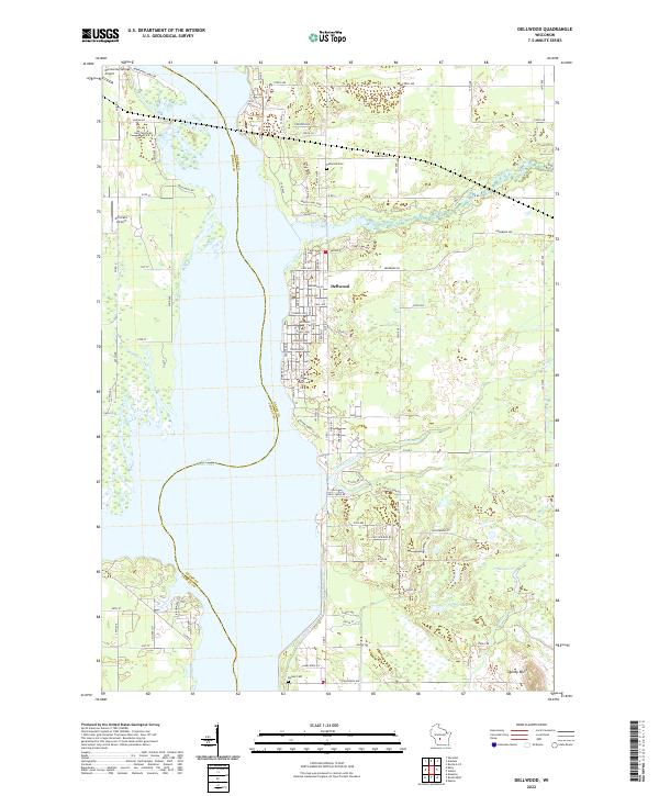 2022 Dellwood2022 Print · USGSDellwood and the eastern shores of Castle Rock Lake are documented here in the early 2020s, showing a mix of lakeside residential growth and traditional marshy lowlands. Genealogists and local historians can locate Dellwood Cem, Quincy Bluff, and the small airfields of Murmuring Springs and Accurate.
 - 2022 Map of Wisconsin Dells North, 2022 Print
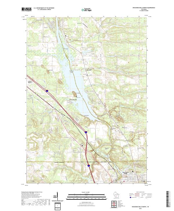 2022 Wisconsin Dells North2022 Print · USGSThe northern Dells and the junction of four Wisconsin counties come into focus in this recent survey. Local historians can trace the Union Pacific RR through Lyndon Station or locate family sites at Plainville Cem and Indian Baptist Cem along the Wisconsin River.
 - 2022 Map of Arkdale, 2022 Print
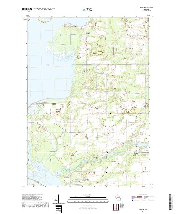 2022 Arkdale2022 Print · USGSThe eastern shores of Petenwell Lake and Castle Rock Lake are shown here in the 2020s. Researchers can trace rural lineages at Strongs Prairie Cem or follow the waters of Big Roche a Cri Creek through Arkdale and Monroe Center.
 - 2022 Map of Arkdale NW, 2022 Print
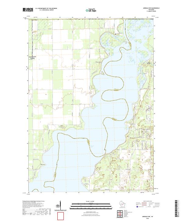 2022 Arkdale NW2022 Print · USGSThe sprawling waters of Petenwell Lake define this region along the Juneau and Adams county line in the early twenty-first century. Researchers can trace the development of New Rome and locate landmarks like Greenwood Cem and Halls Point.
 - 2022 Map of Kendall East, 2022 Print
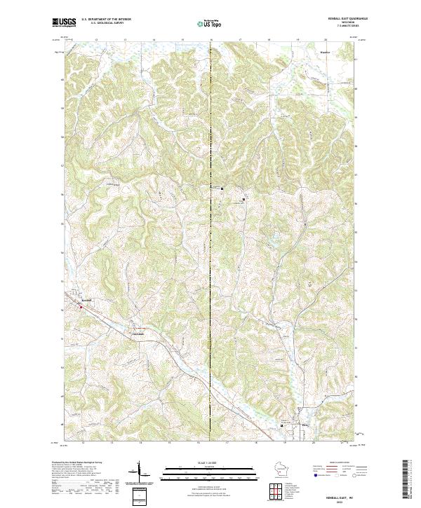 2022 Kendall East2022 Print · USGSThe Baraboo River valley in Monroe and Juneau Counties is captured here in recent years, showing the area's transition from rail to recreation. Genealogists can trace family connections at Fountain Lutheran Cemetery or locate old homesteads near Glendale and Clifton Ridge.
 - 2022 Map of New Lisbon South, 2022 Print
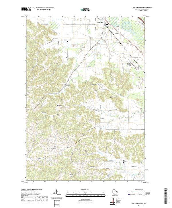 2022 New Lisbon South2022 Print · USGSSouth of New Lisbon in the early 2020s, this landscape reveals a dense network of rural cemeteries and ridge-top settlements. Genealogists can locate family sites like Pleasant Acres Cem or trace the winding waters of Webster Cr and Brewer Cr.
 - 2022 Map of Hillsboro, 2022 Print
 2022 Hillsboro2022 Print · USGSThe valleys and bluffs of Vernon and Juneau counties are captured here in the early twenty-first century. Genealogists and hikers can trace sites like Mount Vernon Cem and the Hillsboro State Trl through Hillsboro and Union Center.
 - 2022 Map of Wonewoc, 2022 Print
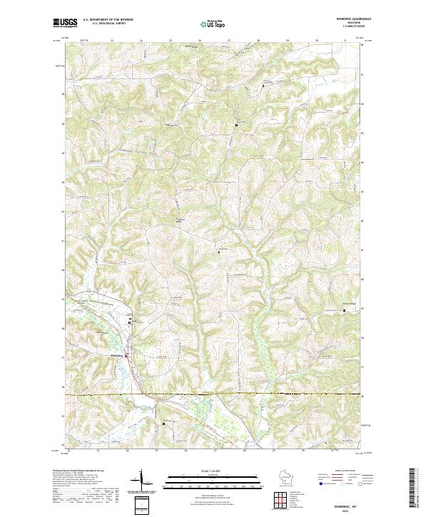 2022 Wonewoc2022 Print · USGSThe village of Wonewoc and the winding Baraboo River define this rural landscape during the early 2020s. Researchers can locate numerous family-named landmarks and burial sites including Hochmuth Cem, Raese Cem, and the prominent Castle Rocks.
 - 2022 Map of Kelly, 2022 Print
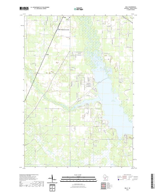 2022 Kelly2022 Print · USGSCentral Wisconsin's wetlands and waterways are in clear focus in this recent survey near the village of Necedah. Researchers can trace the banks of Castle Rock Lake and locate family landmarks like Saint Francis of Assisi Cem and the rural settlement of Kelly.
 - 2022 Map of New Lisbon North, 2022 Print
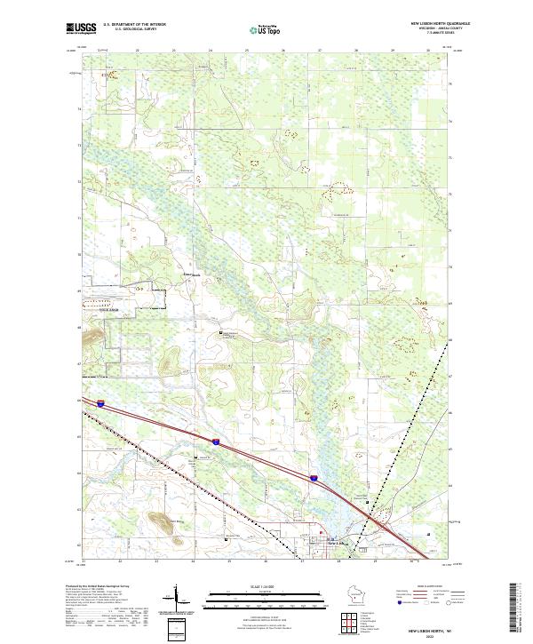 2022 New Lisbon North2022 Print · USGSCentral Wisconsin at the dawn of the 2020s shows a landscape deeply tied to the winding Lemonweir River. Researchers can trace family history through sites like Brewster Cem, Town of Orange Cem, and the prominent Twin Bluffs.
 - 2022 Map of Camp Douglas, 2022 Print
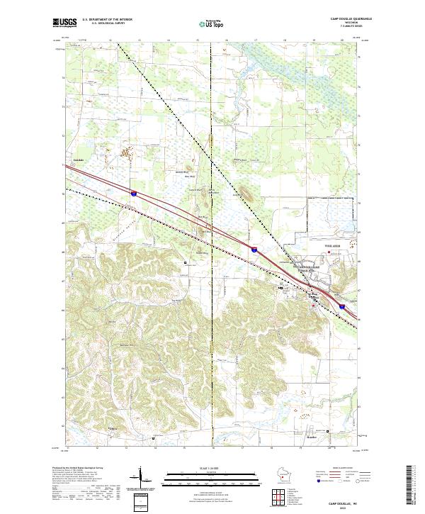 2022 Camp Douglas2022 Print · USGSThe Juneau County landscape at the start of the 2020s shows a unique topography of isolated sandstone bluffs and winding valley floors. Researchers can trace the proximity of local settlements like Hustler and Oakdale to landmarks such as Mill Bluff, Round Bluff, and Devils Monument.
End of results
Showing maps 1-22 of 22
Top cities of Juneau County
- Mauston historical maps
- New Lisbon historical maps
- Lemonweir historical maps
- Elroy historical maps
- Lyndon historical maps
- Necedah historical maps
See more
Frequently asked questions
- What are the different types of historical maps available for Juneau County?
- What is the oldest map of Juneau County?
- Where can I purchase historical maps of Juneau County for my home or office?
- Where can I download high-res historical maps of Juneau County?
- Are there historical topographic maps available for Juneau County?
- Is there historical aerial imagery available for Juneau County?
- Where are historical maps of Juneau County sourced from?