Old Maps of Southview Shores, Armenia for Hiking & Exploration
Hike through history with 11 historic maps of Southview Shores. Explore old trails, ghost towns, and forgotten backroads — perfect for outdoor adventurers and local explorers.
- Rediscover forgotten places: Map out old mining camps, roads, and footpaths that no longer exist on modern maps.
- Layer with modern tools: Combine with LiDAR or satellite views to plan hikes through historical terrain.
- Made for exploration: Popular among hikers, overlanders, and local history lovers.
Use these maps to find adventure and explore the hidden past of Southview Shores.
Southview Shores, Armenia maps
(11)- 1953 Map of Eau Claire, 1965 Print
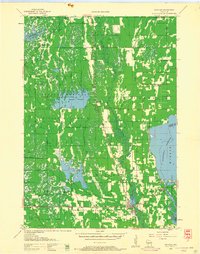
 1953 Eau Claire1965 Print · USGSWest-central Wisconsin in the mid-fifties shows a landscape of river-valley industry and vast wildlife refuges during the transition from rails to modern highways. Genealogists and historians can trace the rail corridors of the Chicago and North Western or locate family-named landmarks like Decorah Mound and Chippewa Island.4 unique versions available
 - 1958 Map of Eau Claire
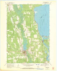
 1958 Eau Claire1958 Print · USGSWestern Wisconsin in the late fifties shows a landscape of growing regional hubs and massive wildlife refuges. Trace the rail lines of the Chicago and North Western between Eau Claire and Marshfield, or explore the terrain around Iron Mound and Lake Wissota.
 - 1958 Map of Necedah, 1960 Print
 1958 Necedah1960 Print · USGSJuneau County in the late fifties shows a landscape shaped by massive water projects and conservation efforts. Genealogists and hikers can trace old country roads to find the Rockview Sch, Zion Cem, and the tracks of the Chicago and North Western.3 unique versions available
 - 1964 Map of Eau Claire
 1964 Eau Claire1964 Print · USGSWest-central Wisconsin in the mid-1960s was a hub of river-driven industry and expanding rail networks. Researchers can trace historic homesteads near Menomonie, follow the Soo Line RR through Marshfield, or explore the grounds of the Camp McCoy Military Reservation.
 - 1969 Map of Necedah, 1971 Print
 1969 Necedah1971 Print · USGSThe village of Necedah sits at the intersection of rail and river during the late sixties, flanked by massive wildlife refuges and the Wisconsin River. Researchers can locate the Queen of the Holy Rosary Shrine, the Rockview Sch, and the high ground of Necedah Bluff.
 - 1985 Map of Black River Falls
 1985 Black River Falls1985 Print · USGSCentral Wisconsin in the mid-1980s is defined by its sprawling wildlife refuges and the winding Black River corridor. Genealogists and researchers can trace rural settlements like Millston and Warrens or locate historical sites such as the Iron Mine and the grounds of Fort McCoy.2 unique versions available
 - 2010 Map of Necedah, 2010 Print
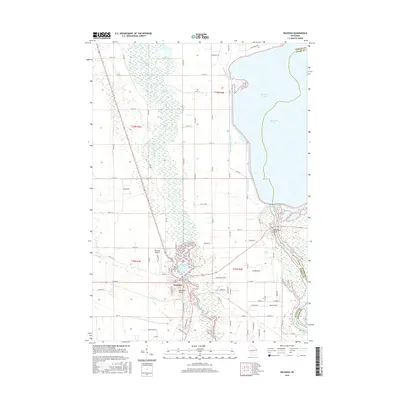
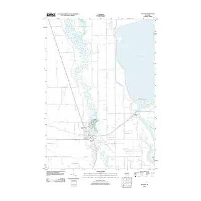 2010 Necedah2010 Print · USGSCovers Southview Shores, including Strongs Prairie, Necedah, and other nearby areas
 - 2013 Map of Necedah, 2013 Print
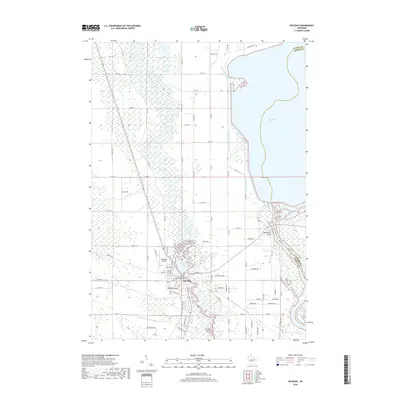
 2013 Necedah2013 Print · USGSCovers Southview Shores, including Strongs Prairie, Necedah, and other nearby areas
 - 2015 Map of Necedah, 2015 Print
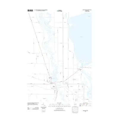
 2015 Necedah2015 Print · USGSCovers Southview Shores, including Strongs Prairie, Necedah, and other nearby areas
 - 2018 Map of Necedah, 2018 Print
 2018 Necedah2018 Print · USGSCovers Southview Shores, including Strongs Prairie, Necedah, and other nearby areas
 - 2022 Map of Necedah, 2022 Print
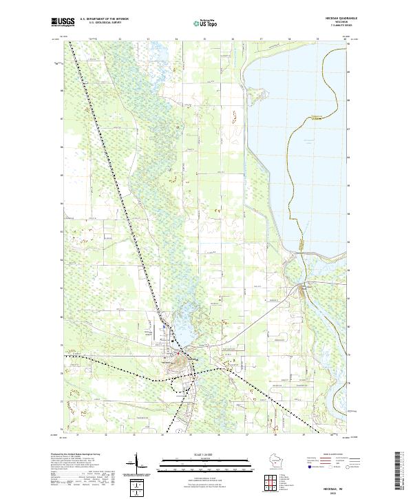 2022 Necedah2022 Print · USGSNecedah and the surrounding river lowlands are shown here in the early twenty-first century as the landscape transitions toward the massive Petenwell flowage. Researchers can locate Bayview Cemetery, the Necedah Airport, and prominent landmarks like Necedah Bluff.
End of results
Showing maps 1-11 of 11
Frequently asked questions
- What are the different types of historical maps available for Southview Shores?
- What is the oldest map of Southview Shores?
- Where can I purchase historical maps of Southview Shores for my home or office?
- Where can I download high-res historical maps of Southview Shores?
- Are there historical topographic maps available for Southview Shores?
- Is there historical aerial imagery available for Southview Shores?
- Where are historical maps of Southview Shores sourced from?