1980s Maps of Necedah, Wisconsin
Explore 3 historic maps of Necedah from the 1980s. These maps offer a rare glimpse into what life looked like during the 1980s — showing old roads, neighborhoods, homes, and landmarks that have changed or disappeared over time.
Whether you're researching your family's past, planning a metal detecting trip, or studying how Necedah's landscape evolved across the 1980s, these high-resolution maps are a powerful tool for exploring the history of this region.
- Focus on a specific era: All maps on this page are from the 1980s, giving you a focused view of this time period.
- See what’s changed: Compare century-old streets, trails, and buildings to today's modern landscape using overlays and satellite layers.
- Research with precision: Use these maps for genealogy, historical research, land use analysis, or educational projects.
- View, download, or print: Maps are fully viewable online in high resolution, and can be downloaded or printed for your own records.
Start exploring Necedah's history through authentic maps from the 1980s. This is your window into the past.
Necedah, WI maps
(3)- 1983 Map of Kelly, 1984 Print
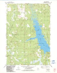 1983 Kelly1984 Print · USGSJuneau County's eastern lakefront and rail corridors are captured in the early eighties as Castle Rock Lake borders rising parklands. Genealogists and local historians can trace the Danish Cem, locate the Townhall, or follow the path of the Chicago and North Western railroad.
 - 1985 Map of Black River Falls
 1985 Black River Falls1985 Print · USGSCentral Wisconsin in the mid-1980s is defined by its sprawling wildlife refuges and the winding Black River corridor. Genealogists and researchers can trace rural settlements like Millston and Warrens or locate historical sites such as the Iron Mine and the grounds of Fort McCoy.2 unique versions available
 - 1985 Map of Sparta
 1985 Sparta1985 Print · USGSWestern Wisconsin in the 1980s shows the unique ridge-and-valley terrain of the Driftless Area during a period of transition for its rails and rural hubs. Trace the historic rail tunnels of the Elroy-Sparta State Trail and find local landmarks like St Marys Ch and Castle Rock Lake.2 unique versions available
End of results
Showing maps 1-3 of 3
Top cities near Necedah
- Mauston historical maps
- New Lisbon historical maps
- Lemonweir historical maps
- Easton historical maps
- Strongs Prairie historical maps
- Big Flats historical maps
See more
Frequently asked questions
- What are the different types of historical maps available for Necedah?
- What is the oldest map of Necedah?
- Where can I purchase historical maps of Necedah for my home or office?
- Where can I download high-res historical maps of Necedah?
- Are there historical topographic maps available for Necedah?
- Is there historical aerial imagery available for Necedah?
- Where are historical maps of Necedah sourced from?