1960s Maps of Randall, Wisconsin
Explore 8 historic maps of Randall from the 1960s. These maps offer a rare glimpse into what life looked like during the 1960s — showing old roads, neighborhoods, homes, and landmarks that have changed or disappeared over time.
Whether you're researching your family's past, planning a metal detecting trip, or studying how Randall's landscape evolved across the 1960s, these high-resolution maps are a powerful tool for exploring the history of this region.
- Focus on a specific era: All maps on this page are from the 1960s, giving you a focused view of this time period.
- See what’s changed: Compare century-old streets, trails, and buildings to today's modern landscape using overlays and satellite layers.
- Research with precision: Use these maps for genealogy, historical research, land use analysis, or educational projects.
- View, download, or print: Maps are fully viewable online in high resolution, and can be downloaded or printed for your own records.
Start exploring Randall's history through authentic maps from the 1960s. This is your window into the past.
Randall, WI maps
(8)- 1960 Map of Silver Lake, 1962 Print
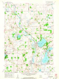 1960 Silver Lake1962 Print · USGSSouthern Wisconsin at the start of the sixties reveals a landscape of quiet glacial lakes and evolving military footprints. Genealogists and local historians can trace the foundations of Silver Lake and New Munster or explore the massive Richard Bong Air Force Base (Abandoned).3 unique versions available
 - 1960 Map of Fox Lake, 1962 Print
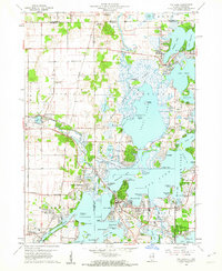 1960 Fox Lake1962 Print · USGSThe Chain O’Lakes region in the early sixties was a bustling landscape of resort life and growing residential pockets. Trace the layout of settlements like Lotus Woods, locate local landmarks like Wilmot Hills Raceway, and find family-named cemeteries such as Orvis Cem.3 unique versions available
 - 1960 Map of Silver Lake, 1962 Print
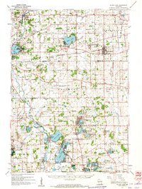 1960 Silver Lake1962 Print · USGSKenosha County in the early sixties is captured here as a landscape of rural schoolhouses and emerging mid-century recreation. Trace the footprint of the Richard Bong Air Force Base (Abandoned) or locate local landmarks like the Great Lakes Dragway and Wilmot Hills Raceway.3 unique versions available
 - 1960 Map of Genoa City, 1962 Print
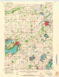
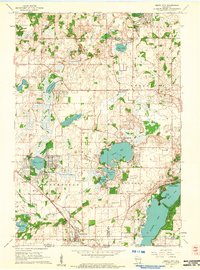 1960 Genoa City1962 Print · USGSGenoa City and its surrounding lake country are captured in detail during the early sixties, showing the transition from rural farmland to residential lakeside communities. Genealogists can trace family roots through numerous sites like Hillside Cemetery, Wheatland Center School, and the St Theresa Church.2 unique versions available
 - 1960 Map of Lake Geneva, 1963 Print
 1960 Lake Geneva1963 Print · USGSIn the early 1960s, the Lake Geneva region was a thriving network of rail-connected towns and lakeside retreats. Genealogists can trace family footprints at Oak Hill Cem, Hickory Grove Cem, and crossroads like Slades Corners.
 - 1960 Map of Grayslake, 1965 Print
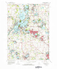 1960 Grayslake1965 Print · USGSLake County's glacial landscape is captured here in the early sixties, showing the rise of commuter suburbs among the region's famous waterways. Researchers can locate dozens of country landmarks like Wray-Imeson Cem, Allendale Farm Sch, and Antioch Airport.
 - 1963 Map of Rockford
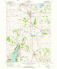
 1963 Rockford1963 Print · USGSThe mid-century industrial corridor along the Rock River is shown here during a period of rapid post-war growth. Researchers can trace the extensive rail lines of the Chicago and North Western or locate local landmarks like the Rockford Ordnance Depot and Holy Hill.
 - 1963 Map of Richmond, 1964 Print
 1963 Richmond1964 Print · USGSThe Illinois-Wisconsin borderlands come alive in the early sixties, showing the growth of Wonder Lake alongside established rail towns. Genealogists can trace family names at St Josephs Cem and Carr-Harrison Cem or locate the old Harrison Sch.3 unique versions available
End of results
Showing maps 1-8 of 8
Top cities near Randall
- Mundelein historical maps
- Round Lake Beach historical maps
- McHenry historical maps
- Woodstock historical maps
- Libertyville historical maps
- Grayslake historical maps
See more
Top neighborhoods of Randall
Frequently asked questions
- What are the different types of historical maps available for Randall?
- What is the oldest map of Randall?
- Where can I purchase historical maps of Randall for my home or office?
- Where can I download high-res historical maps of Randall?
- Are there historical topographic maps available for Randall?
- Is there historical aerial imagery available for Randall?
- Where are historical maps of Randall sourced from?