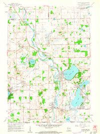
1960 Map of Silver Lake
USGS Topo · Published 1962About this map
The Fox River carves a winding path through the heart of this Kenosha County landscape, defining the boundaries of agricultural life and early recreational development. In the northeast corner, the sprawling footprint of the Richard Bong Air Force Base (Abandoned) stands as a massive disruption to the traditional section lines, representing a significant Cold War era land use shift before its conversion. Around the waters of Silver Lake and Camp Lake, the map reveals a dense network of lakeside streets and cottages, contrasting with the rural expanses of Wheatland and Salem.
Find a feature on this map
40 named features on this map. Tap any name to fly to it.
Don’t see what you’re looking for? This feature index may not catch every label — zoom into the map to look around manually.
Map Details
Editions of this 1960 Silver Lake Map
3 editions found
Other maps of this area

1893 · Silver Lake
USGS Topo · 1:62,500

1893 · Geneva
USGS Topo · 1:62,500

1904 · Lake Geneva
USGS Topo · 1:62,500

1906 · Silver Lake
USGS Topo · 1:62,500

1906 · Lake Geneva
USGS Topo · 1:62,500

1920 · Grays Lake
USGS Topo · 1:62,500

1923 · Grays Lake
USGS Topo · 1:62,500

1926 · Mc Henry
USGS Topo · 1:62,500

1944 · McHenry
USGS Topo · 1:62,500

1954 · Rockford
USGS Topo · 1:250,000