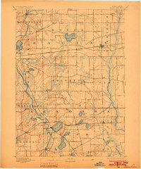
1906 Map of Silver Lake
USGS Topo · Published 1906About this map
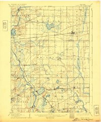
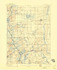
Silver Lake serves as a central landmark in this agricultural and hydrologic study of Kenosha and Racine counties. The early 20th-century landscape is defined by its glaciated terrain, where numerous water bodies like Eagle Lake, Paddock Lake, and Camp Lake are interspersed among emerging rail hubs. The Chicago Milwaukee and St. Paul Railroad bisects the northern half of the region, anchoring settlements like Kansasville and Union Grove, while the Wisconsin Central Railroad follows the path of the Fox River through Wheatland. This survey reveals the dense network of rural roads connecting small hamlets such as Paris and Brighton before the expansion of modern highways. The drainage patterns of the Des Plaines River and the varied wetlands reflect a period when local land use was still intimately tied to the natural contours and seasonal changes of the watershed.
Find a feature on this map
47 named features on this map. Tap any name to fly to it.
Don’t see what you’re looking for? This feature index may not catch every label — zoom into the map to look around manually.
Map Details
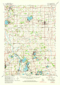
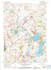
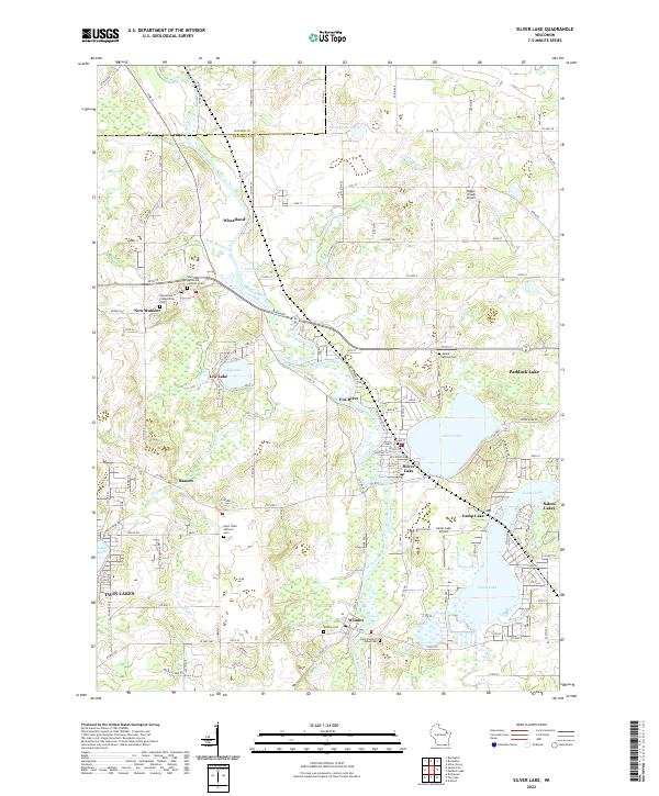
Editions of this 1906 Silver Lake Map
3 editions found
Historical Maps of Salem Lakes Through Time
5 maps found