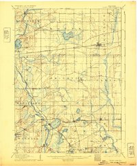
1906 Map of Silver Lake
USGS Topo · Published 1932About this map
The Fox River snakes through the western edge of this landscape, a region defined at the turn of the century by its glacial lake basins and two major rail corridors. The Chicago Milwaukee and St. Paul Railroad cuts across the northern section, connecting rural hubs like Kansasville and Union Grove. To the south, the Chicago and Northwestern Railroad serves a cluster of water-focused communities, including Silver Lake, Salem, and Bristol.
Find a feature on this map
48 named features on this map. Tap any name to fly to it.
Don’t see what you’re looking for? This feature index may not catch every label — zoom into the map to look around manually.
Map Details
Editions of this 1906 Silver Lake Map
3 editions found

Other maps of this area

1891 · Bayview
USGS Topo · 1:62,500

1891 · Muskego
USGS Topo · 1:62,500

1892 · Racine
USGS Topo · 1:62,500

1892 · Eagle
USGS Topo · 1:62,500

1893 · Silver Lake
USGS Topo · 1:62,500

1893 · Geneva
USGS Topo · 1:62,500

1894 · Eagle
USGS Topo · 1:62,500

1897 · Eagle
USGS Topo · 1:62,500

1901 · Bayview
USGS Topo · 1:62,500

1901 · Muskego
USGS Topo · 1:62,500