1954 Map of Rockford
USGS Topo · Published 1954About this map
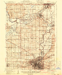
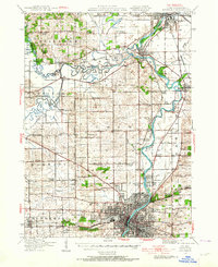
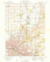
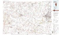
The Rock River valley serves as the primary corridor for settlement and industry across north-central Illinois and southern Wisconsin in the mid-1950s. At the heart of the region, Rockford and Beloit appear as established manufacturing hubs, their growth mirrored by the dense network of lines from the Chicago and North Western RR and the Illinois Central RR that link small agricultural centers like Brodhead and Fort Atkinson. The landscape transitions from the flat expanse of Big Foot Prairie to the glacier-carved lakes of the east, where Lake Geneva and Lake Koshkonong define the recreation and drainage patterns of the area.
Find a feature on this map
340 named features on this map. Tap any name to fly to it.
Don’t see what you’re looking for? This feature index may not catch every label — zoom into the map to look around manually.
Map Details
Editions of this 1954 Rockford Map
This is the sole edition of this map. No revisions or reprints were ever made.
Historical Maps of Milwaukee Through Time
8 maps found