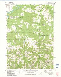
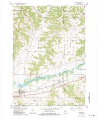
1900s (20th Century) Maps of Burns, Wisconsin
Explore 24 historic maps of Burns from the 1900s (20th Century). These maps offer a rare glimpse into what life looked like during the 1900s — showing old roads, neighborhoods, homes, and landmarks that have changed or disappeared over time.
Whether you're researching your family's past, planning a metal detecting trip, or studying how Burns's landscape evolved across the 1900s, these high-resolution maps are a powerful tool for exploring the history of this region.
- Focus on a specific era: All maps on this page are from the 1900s, giving you a focused view of this time period.
- See what’s changed: Compare century-old streets, trails, and buildings to today's modern landscape using overlays and satellite layers.
- Research with precision: Use these maps for genealogy, historical research, land use analysis, or educational projects.
- View, download, or print: Maps are fully viewable online in high resolution, and can be downloaded or printed for your own records.
Start exploring Burns's history through authentic maps from the 1900s. This is your window into the past.
Burns, WI maps
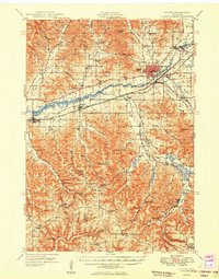
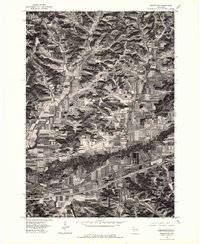
(24)- 1909 Map of Sparta
 1909 Sparta1909 Print · USGSCovers Burns, including Sparta, Sparta, and other nearby areas3 unique versions available
 - 1927 Map of La Crosse, 1960 Print
 1927 La Crosse1960 Print · USGSCovers Burns, including La Crosse, Onalaska, and other nearby areas
 - 1928 Map of Melrose
 1928 Melrose1928 Print · USGSCovers Burns, including Sparta, Brockway, and other nearby areas
 - 1930 Map of La Crosse
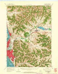
 1930 La Crosse1930 Print · USGSCovers Burns, including La Crosse, Onalaska, and other nearby areas3 unique versions available
 - 1947 Map of Sparta, 1972 Print
 1947 Sparta1972 Print · USGSCovers Burns, including Sparta, Sparta, and other nearby areas
 - 1949 Map of Sparta
 1949 Sparta1949 Print · USGSCovers Burns, including Sparta, Sparta, and other nearby areas
 - 1949 Map of Melrose
 1949 Melrose1949 Print · USGSCovers Burns, including Sparta, Brockway, and other nearby areas
 - 1953 Map of Eau Claire, 1965 Print
 1953 Eau Claire1965 Print · USGSCovers Burns, including Eau Claire, Winona, and other nearby areas4 unique versions available
 - 1958 Map of Eau Claire
 1958 Eau Claire1958 Print · USGSCovers Burns, including Eau Claire, Winona, and other nearby areas
 - 1958 Map of La Crosse, 1979 Print
 1958 La Crosse1979 Print · USGSCovers Burns, including La Crosse, Winona, and other nearby areas2 unique versions available
 - 1961 Map of La Crosse
 1961 La Crosse1961 Print · USGSCovers Burns, including La Crosse, Winona, and other nearby areas
 - 1963 Map of West Salem, 1964 Print
 1963 West Salem1964 Print · USGSCovers Burns, including West Salem, Bangor, and other nearby areas2 unique versions available
 - 1963 Map of La Crosse, 1965 Print
 1963 La Crosse1965 Print · USGSCovers Burns, including La Crosse, Onalaska, and other nearby areas3 unique versions available
 - 1964 Map of Eau Claire
 1964 Eau Claire1964 Print · USGSCovers Burns, including Eau Claire, Winona, and other nearby areas
 - 1965 Map of La Crosse
 1965 La Crosse1965 Print · USGSCovers Burns, including La Crosse, Winona, and other nearby areas
 - 1976 Map of La Crosse
 1976 La Crosse1976 Print · USGSCovers Burns, including La Crosse, Winona, and other nearby areas
 - 1976 Map of Sparta NW, 1978 Print
 1976 Sparta NW1978 Print · USGSCovers Burns, including Sparta, Bangor, and other nearby areas2 unique versions available
 - 1983 Map of Four Corners, 1984 Print
 1983 Four Corners1984 Print · USGSCovers Burns, including Sparta, Melrose, and other nearby areas
 - 1983 Map of Bangor, 1984 Print
 1983 Bangor1984 Print · USGSCovers Burns, including Sparta, Bangor, and other nearby areas
 - 1984 Map of La Crosse, 1985 Print
 1984 La Crosse1985 Print · USGSCovers Burns, including La Crosse, Winona, and other nearby areas
 - 1985 Map of Black River Falls
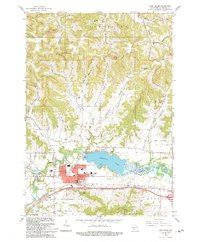
 1985 Black River Falls1985 Print · USGSCovers Burns, including Sparta, Tomah, and other nearby areas2 unique versions available
 - 1985 Map of Sparta
 1985 Sparta1985 Print · USGSCovers Burns, including Reedsburg, Sparta, and other nearby areas2 unique versions available
 - 1990 Map of La Crosse, 1991 Print
 1990 La Crosse1991 Print · USGSCovers Burns, including La Crosse, Winona, and other nearby areas
 - 1993 Map of West Salem
 1993 West Salem1993 Print · USGSCovers Burns, including West Salem, Bangor, and other nearby areas
End of results
Showing maps 1-24 of 24
Top cities near Burns
- La Crosse historical maps
- Onalaska historical maps
- Sparta historical maps
- Sparta historical maps
- West Salem historical maps
- Shelby historical maps
See more
Frequently asked questions
- What are the different types of historical maps available for Burns?
- What is the oldest map of Burns?
- Where can I purchase historical maps of Burns for my home or office?
- Where can I download high-res historical maps of Burns?
- Are there historical topographic maps available for Burns?
- Is there historical aerial imagery available for Burns?
- Where are historical maps of Burns sourced from?