2000s (21st Century) Maps of Washington, Wisconsin
Explore 4 historic maps of Washington from the 2000s (21st Century). These maps offer a rare glimpse into what life looked like during the 2000s — showing old roads, neighborhoods, homes, and landmarks that have changed or disappeared over time.
Whether you're researching your family's past, planning a metal detecting trip, or studying how Washington's landscape evolved across the 2000s, these high-resolution maps are a powerful tool for exploring the history of this region.
- Focus on a specific era: All maps on this page are from the 2000s, giving you a focused view of this time period.
- See what’s changed: Compare century-old streets, trails, and buildings to today's modern landscape using overlays and satellite layers.
- Research with precision: Use these maps for genealogy, historical research, land use analysis, or educational projects.
- View, download, or print: Maps are fully viewable online in high resolution, and can be downloaded or printed for your own records.
Start exploring Washington's history through authentic maps from the 2000s. This is your window into the past.
Washington, WI maps
(4)- 2022 Map of Saint Joseph, 2022 Print
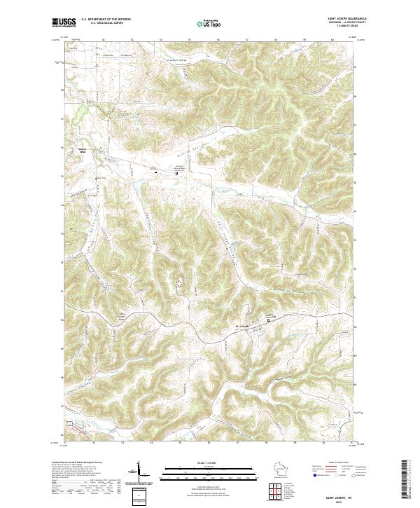 2022 Saint Joseph2022 Print · USGSLa Crosse County's ridge-and-coulee landscape is shown here in the 2020s, centered on the community of St. Joseph. Researchers can trace local heritage through landmarks like Barre Cem, Barre Mills, and the Old Saint Johns Lutheran Church Cem.
 - 2022 Map of Coon Valley, 2022 Print
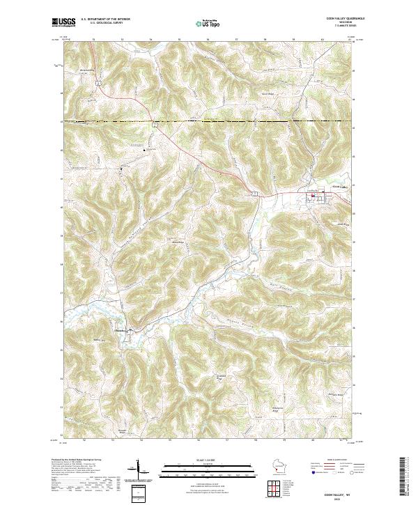 2022 Coon Valley2022 Print · USGSWisconsin's coulee country comes into focus in this recent survey of the ridges and valleys between Coon Valley and Chaseburg. Trace local family landmarks and rural infrastructure, from Hellwig Cemetery to the heights of Gronvold Ridge and Bunker Hill.
 - 2022 Map of Middle Ridge, 2022 Print
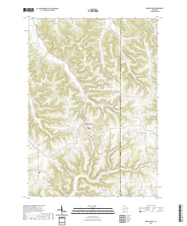 2022 Middle Ridge2022 Print · USGSThe high ridge country of western Wisconsin is mapped here in the early 2020s, showing a landscape of deep valleys and family-named coulees. Genealogists can locate Saint Peter's Cem and North Ridge Cem or trace ancestral lands in Bohemian Valley.
 - 2022 Map of Esofea, 2022 Print
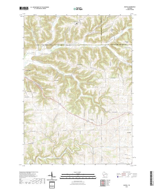 2022 Esofea2022 Print · USGSVernon County ridge and valley country is meticulously documented here as it appeared in the early 2020s. Local researchers can trace family landmarks and rural settlements from Urbanek Family Cem to the outskirts of Westby and Coon Valley.
End of results
Showing maps 1-4 of 4
Top cities near Washington
- La Crosse historical maps
- Onalaska historical maps
- Sparta historical maps
- Sparta historical maps
- West Salem historical maps
- Shelby historical maps
See more
Top neighborhoods of Washington
Frequently asked questions
- What are the different types of historical maps available for Washington?
- What is the oldest map of Washington?
- Where can I purchase historical maps of Washington for my home or office?
- Where can I download high-res historical maps of Washington?
- Are there historical topographic maps available for Washington?
- Is there historical aerial imagery available for Washington?
- Where are historical maps of Washington sourced from?