1900s (20th Century) Maps of Day, Wisconsin
Explore 17 historic maps of Day from the 1900s (20th Century). These maps offer a rare glimpse into what life looked like during the 1900s — showing old roads, neighborhoods, homes, and landmarks that have changed or disappeared over time.
Whether you're researching your family's past, planning a metal detecting trip, or studying how Day's landscape evolved across the 1900s, these high-resolution maps are a powerful tool for exploring the history of this region.
- Focus on a specific era: All maps on this page are from the 1900s, giving you a focused view of this time period.
- See what’s changed: Compare century-old streets, trails, and buildings to today's modern landscape using overlays and satellite layers.
- Research with precision: Use these maps for genealogy, historical research, land use analysis, or educational projects.
- View, download, or print: Maps are fully viewable online in high resolution, and can be downloaded or printed for your own records.
Start exploring Day's history through authentic maps from the 1900s. This is your window into the past.
Day, WI maps
(17)- 1902 Map of Marathon, 1938 Print
 1902 Marathon1938 Print · USGSMarathon County is captured here at the height of the timber era, when a dense network of logging railroads and new settlements defined the central Wisconsin woods. Genealogists and historians can trace early town sites like Athens, Rib Falls, and the specialized Connors Logging R. R.
 - 1953 Map of Marathon, 1955 Print
 1953 Marathon1955 Print · USGSMarathon County's agricultural and river heartland is documented here in the early fifties, centering on the villages of Marathon and Edgar. Local historians can trace a dense network of country schools and churches like Rib Falls Ch and the St Anthony Friary.
 - 1953 Map of Stratford, 1955 Print
 1953 Stratford1955 Print · USGSMarathon County in the early fifties is captured here as a landscape of small dairy farms and rail-connected villages. Genealogists and historians can trace numerous rural landmarks, from Milan and Stratford to family-named schools like Hillcrest Sch and Wescott Sch.
 - 1953 Map of Eau Claire, 1965 Print
 1953 Eau Claire1965 Print · USGSWest-central Wisconsin in the mid-fifties shows a landscape of river-valley industry and vast wildlife refuges during the transition from rails to modern highways. Genealogists and historians can trace the rail corridors of the Chicago and North Western or locate family-named landmarks like Decorah Mound and Chippewa Island.4 unique versions available
 - 1954 Map of Marshfield, 1956 Print
 1954 Marshfield1956 Print · USGSMarshfield and the surrounding Wood County dairy lands are captured here in the mid-fifties as the city evolved into a major regional medical and rail hub. Genealogists can locate family landmarks like St Peters Ch, Trinity Cem, and dozens of rural schoolhouses including Golden Glow Sch.2 unique versions available
 - 1955 Map of Green Bay, 1968 Print
 1955 Green Bay1968 Print · USGSCentral and Eastern Wisconsin are captured here in the mid-fifties, showing the industrial growth of the Fox Valley and Wisconsin River corridors. Genealogists and historians can trace rail lines like the Green Bay and Western through settlements like Weyauwega, Clintonville, and Pulaski.2 unique versions available
 - 1956 Map of Milladore, 1958 Print
 1956 Milladore1958 Print · USGSIn the mid-fifties, this section of Wood County was a busy crossroads for the Soo Line and Milwaukee Road railroads. Genealogists can trace a lost network of rural education through sites like Steppingstone Sch, Lone Elm Sch, and the Runkle Sch.
 - 1958 Map of Eau Claire
 1958 Eau Claire1958 Print · USGSWestern Wisconsin in the late fifties shows a landscape of growing regional hubs and massive wildlife refuges. Trace the rail lines of the Chicago and North Western between Eau Claire and Marshfield, or explore the terrain around Iron Mound and Lake Wissota.
 - 1963 Map of Marathon, 1964 Print
 1963 Marathon1964 Print · USGSMarathon County in the early sixties is a landscape of established dairy farms and developing recreation areas. Researchers can trace the rail-side growth of Edgar and Marathon City or locate rural landmarks like Daisy Dell Sch and Sacred Heart Ch Cem.
 - 1963 Map of Stratford, 1964 Print
 1963 Stratford1964 Print · USGSMarathon County's rural heartland is captured here in the early sixties, showing the vital intersection of rail and river commerce. Genealogists and historians can trace family locations near Stratford, March Rapids, and several country schools like Strupp Sch.
 - 1964 Map of Eau Claire
 1964 Eau Claire1964 Print · USGSWest-central Wisconsin in the mid-1960s was a hub of river-driven industry and expanding rail networks. Researchers can trace historic homesteads near Menomonie, follow the Soo Line RR through Marshfield, or explore the grounds of the Camp McCoy Military Reservation.
 - 1970 Map of Honey Island, 1972 Print
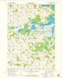 1970 Honey Island1972 Print · USGSThe Marathon and Wood County borderlands appear here in the early 1970s, showcasing the extensive flowage systems of the George W Mead State Wildlife Management Area. Genealogists and local historians can trace family locations near Rangeline, Townhall, and the Cem Grace Ch.
 - 1979 Map of Hewitt, 1980 Print
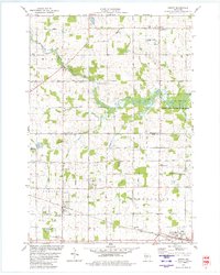 1979 Hewitt1980 Print · USGSThe Wood and Marathon County border country is captured here in the late seventies, showing the traditional rail-and-road layout of central Wisconsin. Family historians can locate numerous rural burial grounds like St Michaels Cem and Auburndale Cem, or trace the winding Little Eau Pleine River.
 - 1981 Map of Marathon SW, 1982 Print
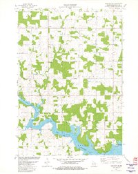 1981 Marathon SW1982 Print · USGSMarathon County in the early eighties centers on the expansive waters of the Big Eau Pleine Reservoir and the rural townships of Wien and Cassel. Researchers can trace old property lines and rural landmarks like Rocky Run, a localized Quarry, and the C & N W railroad line.
 - 1981 Map of Stratford, 1982 Print
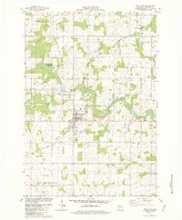 1981 Stratford1982 Print · USGSMarathon County's river-fed dairy lands are captured here in the early eighties, centered on the village of Stratford. Researchers can trace local roots through sites like St Pauls Ch, Zion Cem, and the rail lines of the Chicago and North Western.
 - 1984 Map of Marshfield, 1985 Print
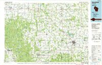 1984 Marshfield1985 Print · USGSCentral Wisconsin's dairy heartland comes into focus during the mid-eighties as a busy network of rail and farm towns. Researchers can trace the path of the Soo Line, identify the grounds of McMillan State Wildlife Area, and locate smaller settlements like Spokeville and Tioga.2 unique versions available
 - 1984 Map of Wausau, 1990 Print
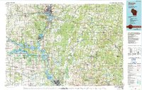 1984 Wausau1990 Print · USGSMarathon and Portage counties come into focus during the mid-eighties as industrial river towns and sprawling conservation areas define the Central Wisconsin landscape. Researchers can trace the rail corridors of the Soo Line or locate rural landmarks like Rib Mountain State Park and St Marys Cem.
End of results
Showing maps 1-17 of 17
Top cities near Day
- Marshfield historical maps
- McMillan historical maps
- Stratford historical maps
- Marathon City historical maps
- Edgar historical maps
- Sherry historical maps
See more
Top neighborhoods of Day
Frequently asked questions
- What are the different types of historical maps available for Day?
- What is the oldest map of Day?
- Where can I purchase historical maps of Day for my home or office?
- Where can I download high-res historical maps of Day?
- Are there historical topographic maps available for Day?
- Is there historical aerial imagery available for Day?
- Where are historical maps of Day sourced from?